
Map of 1,068 lots situate[d] in the Seventeenth Ward of the city of Brooklyn: J.V. Meserole, city surveyor [1889]
Map No. B P-[1889].Fl c.2;B P-[1889].Fl
Cadastral map covering area north from Van Pelt Ave. to Calyer St. and east from Humboldt St. to Morse St. (modern-day Greenpoint). Shows property (including block numbers, lot numbers, and dimensions). Oriented with north to the right. “February 1889.” Includes location map. BHS has 2 copies: c. 1 stamped in red ink and annotated in gray pencil.
Map area shown
Genre
Cadastral mapsRelation
Full catalog recordSize
64 × 77 cmDownload
Low Resolution Image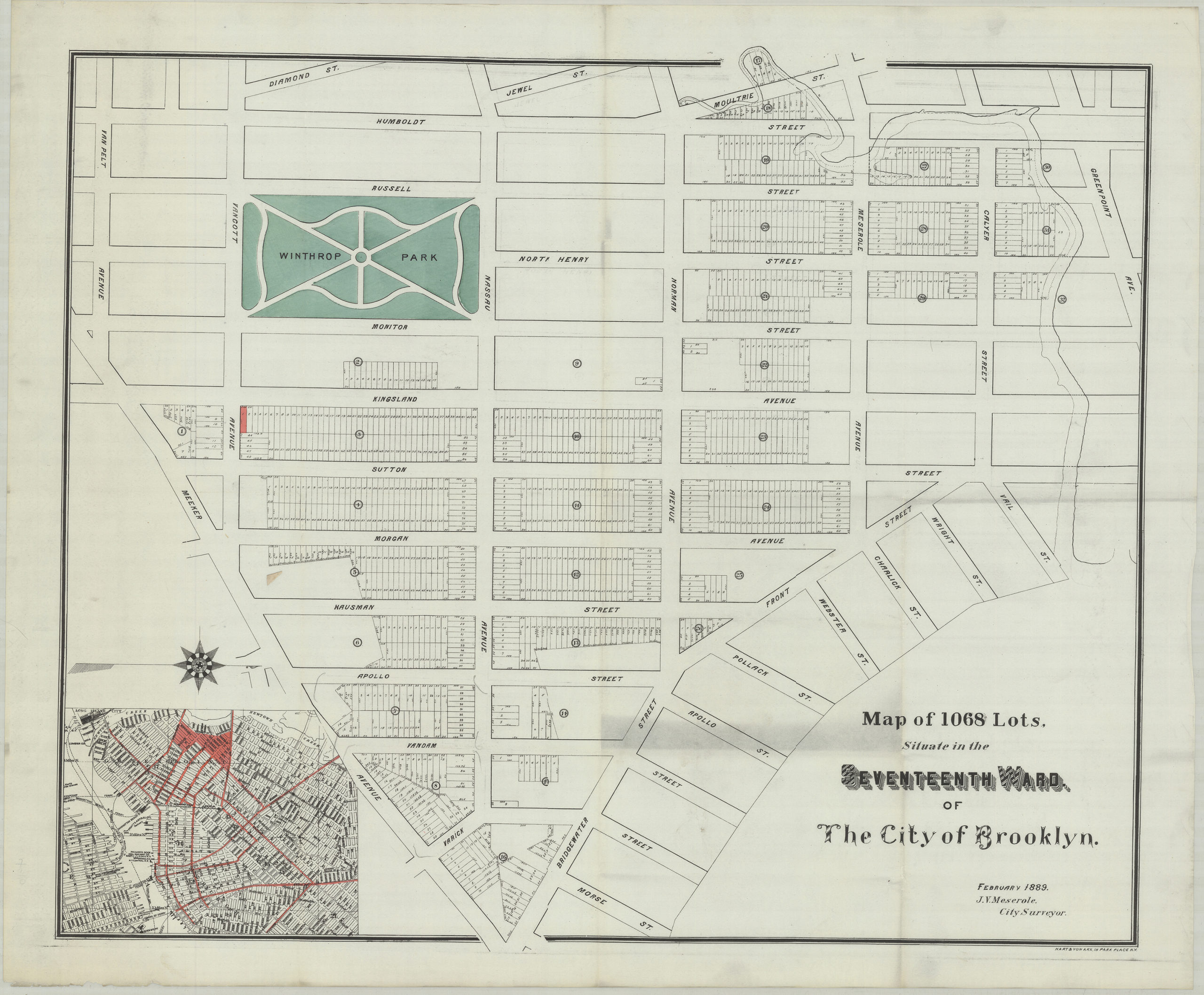
Creator
Meserole, J. V.,Publisher
Brooklyn Historical SocietyCitation
Map of 1,068 lots situate[d] in the Seventeenth Ward of the city of Brooklyn: J.V. Meserole, city surveyor; [1889], Map Collection, B P-[1889].Fl c.2;B P-[1889].Fl; Brooklyn Historical Society.Scale
Scale not givenLoading zoom image... 