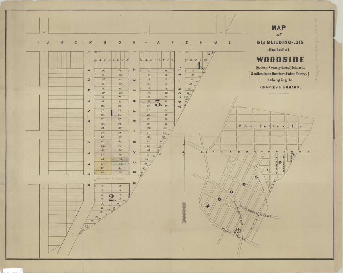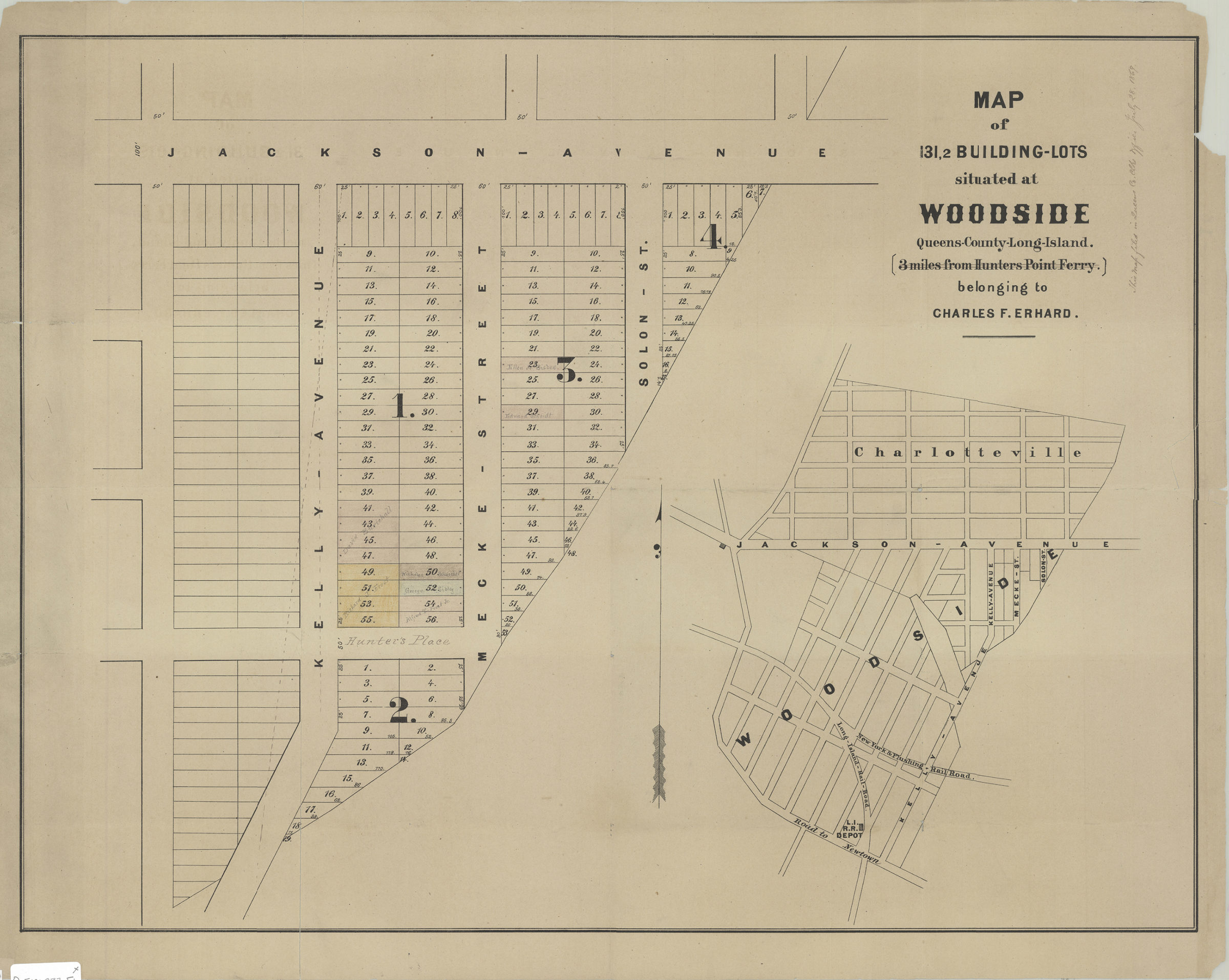
Map of 131, 2 building lots situated at Woodside, Queens County, Long Island, 3 miles from Hunters Point Ferry, belonging to Charles F. Erhard [1869]
Map No. Q-[1869?].Fl
Cadastral map. Shows property (including lot numbers), and names of landowners. Title devised by cataloger. Date of publication conjectured from annotation on BHS copy. Annotated on BHS copy: This map filed in Queens Co. Clks. Office July 28, 1869. Map irregularly shaped. Includes location map.
Map area shown
Genre
Cadastral mapsRelation
Full catalog recordSize
41 × 43 cm, 49 × 62 cmDownload
Low Resolution Image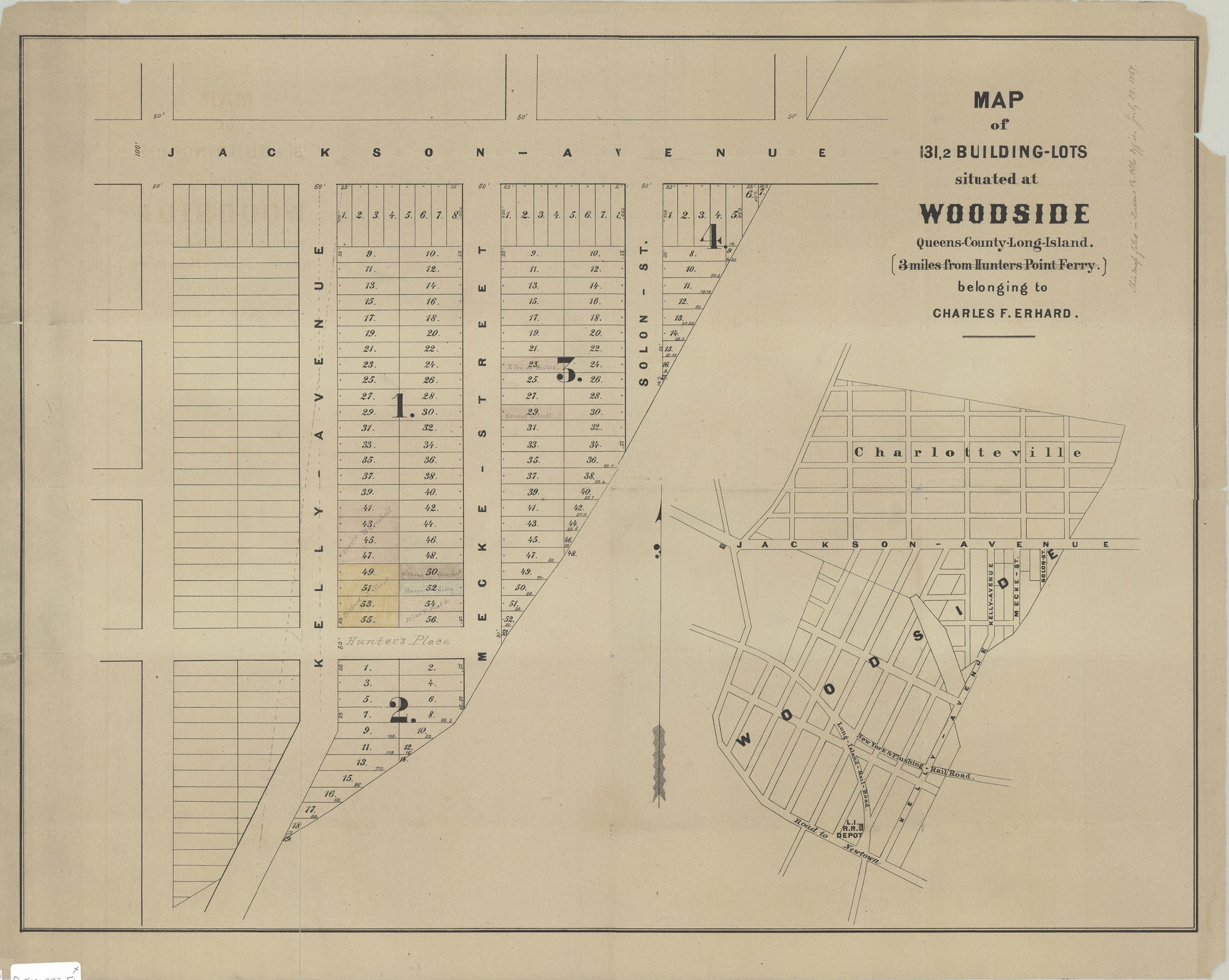
Creator
Publisher
Brooklyn Historical SocietyCitation
Map of 131, 2 building lots situated at Woodside, Queens County, Long Island, 3 miles from Hunters Point Ferry, belonging to Charles F. Erhard; [1869], Map Collection, Q-[1869?].Fl; Brooklyn Historical Society.Scale
Scale not givenLoading zoom image...