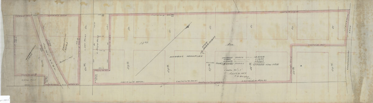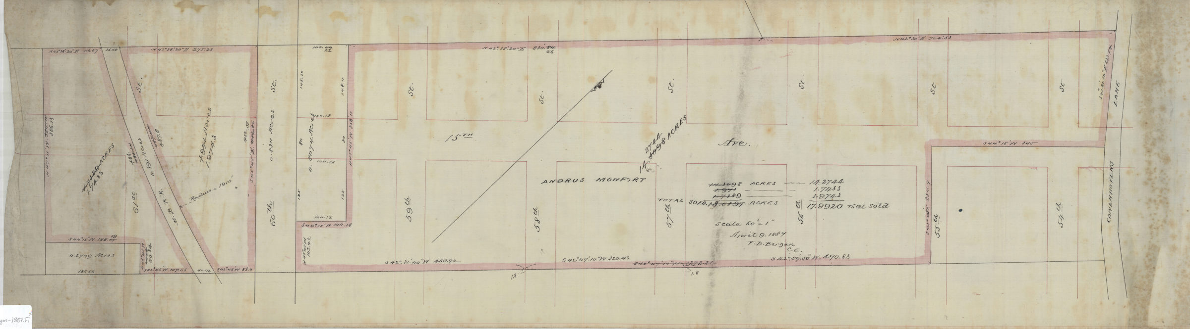
[Map of 15th Ave. between 54th St. and 61st St.]: V.B. Bergen, C.E. April 9, 1887
Map No. Bergen-1887.Fl
Cadastral map covering area in modern-day Borough Park. Shows property (including dimensions and acreages), and names of landowners. Title devised by cataloger. Oriented with north to the upper right. Includes notes and calculations.
Map area shown
Relation
Full catalog recordSize
28 × 101 cmDownload
Low Resolution Image
Creator
Bergen, Van Brunt,Publisher
Brooklyn Historical SocietyCitation
[Map of 15th Ave. between 54th St. and 61st St.]: V.B. Bergen, C.E.; April 9, 1887, Map Collection, Bergen-1887.Fl; Brooklyn Historical Society.Scale
Scale [1:720] 1 in to 60Loading zoom image...