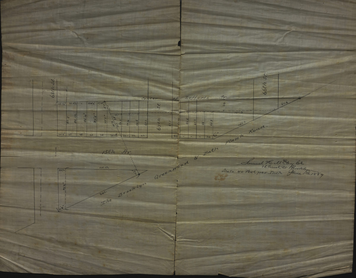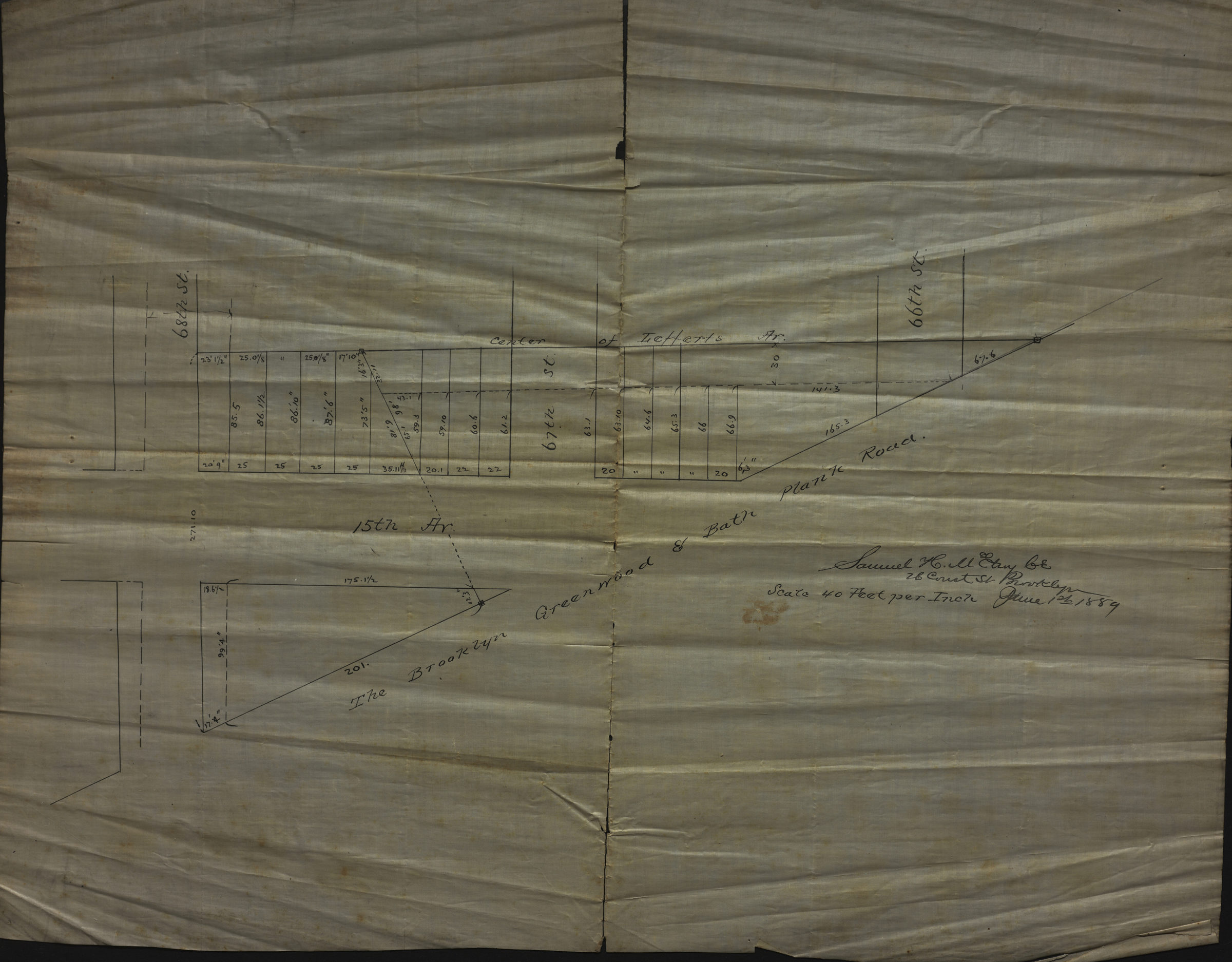
[Map of 15th Ave. between 68th St. and 66th St.]: Samuel H. McElroy June 1, 1889
Map No. B P-1889.Fl
Cadastral map covering area in modern-day Bensonhurst. Shows property (including lots and dimensions). Title devised by cataloger. Oriented with north to the upper right.
Map area shown
Relation
Full catalog recordSize
44 × 56 cmDownload
Low Resolution Image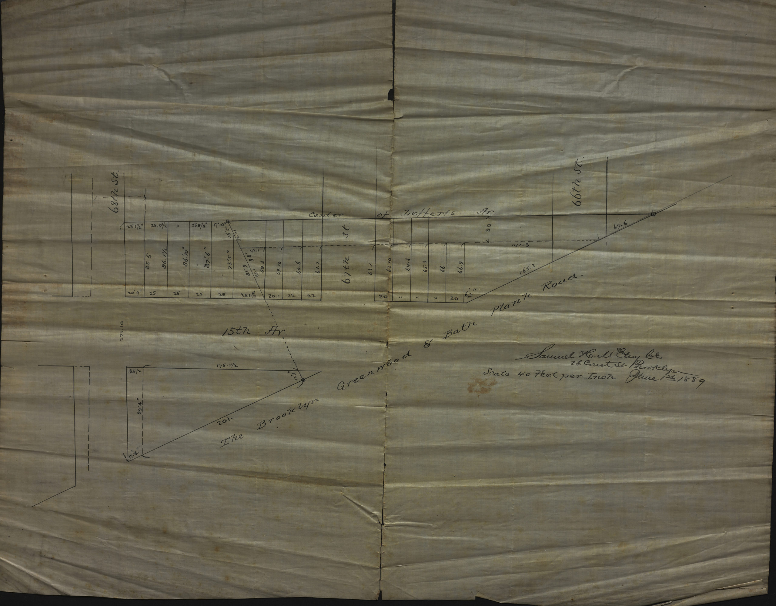
Creator
McElroy, Samuel,Publisher
Brooklyn Historical SocietyCitation
[Map of 15th Ave. between 68th St. and 66th St.]: Samuel H. McElroy; June 1, 1889, Map Collection, B P-1889.Fl; Brooklyn Historical Society.Scale
Scale [1:480] 1 in to 40Loading zoom image...