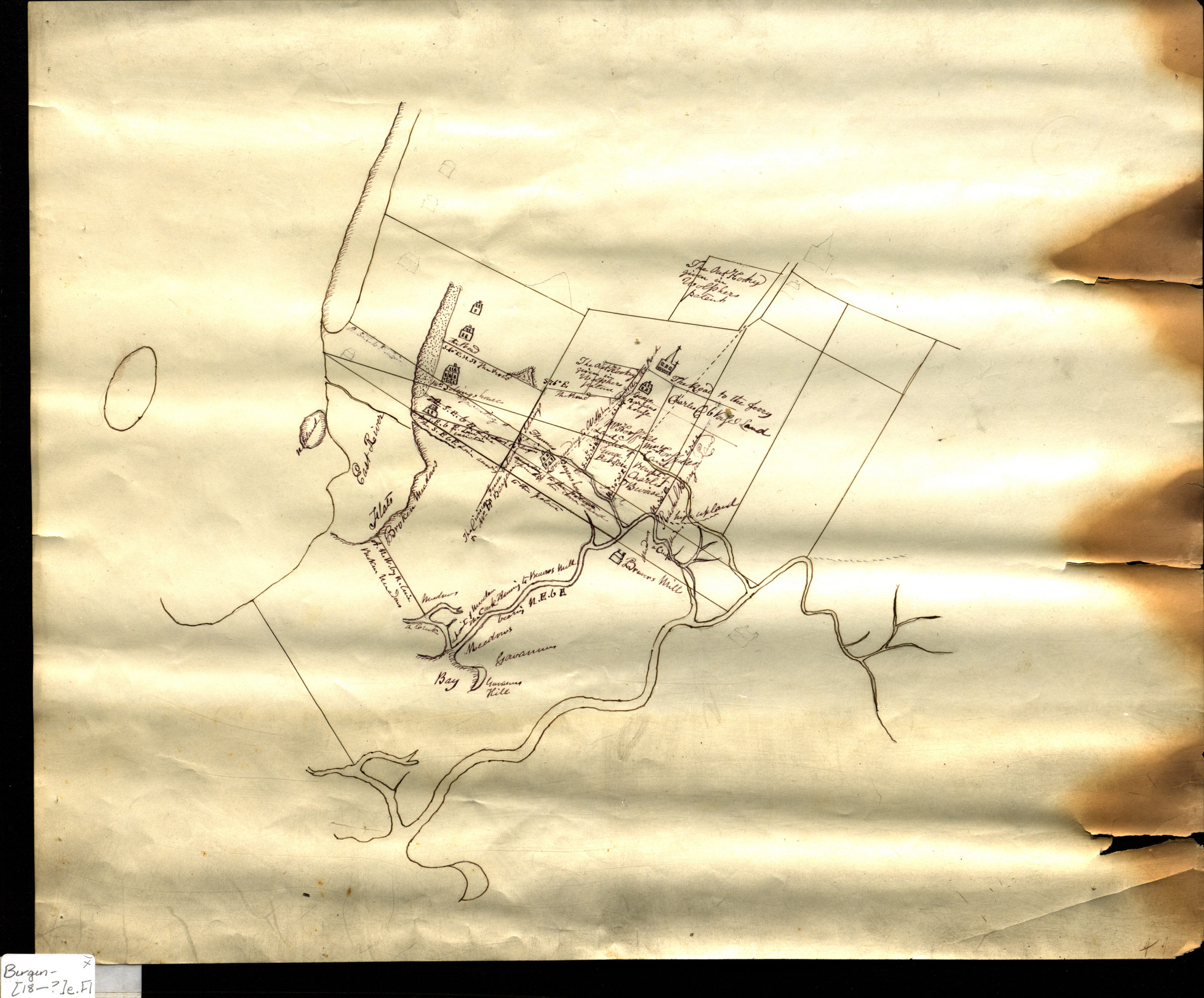
[Map of 17th century Brooklyn] [18??]
Map No. Bergen-[18--?]e.Fl
Cadastral map. Shows houses, churches, names of landowners, and landscape features. Relief shown pictorially. Title devised by cataloger. Responsibility inferred from similarities between map and following item: Bergen, Teunis G., 1806-1881. Copy of an ancient map in possession of a descendant of the Hannes or Han Bergen : whose house is located thereon / made by T. G. Bergen. [N.Y.? : Henry McCloskey?, 1864] (N.Y. : Lith. by G. Hayward).
Map area shown
Relation
Full catalog recordSize
36 × 44 cmDownload
Low Resolution Image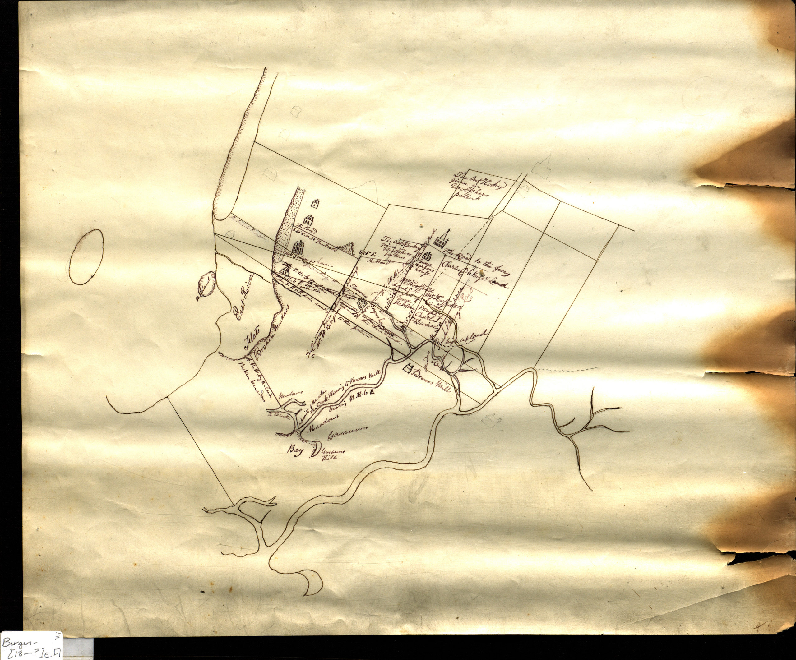
Creator
Bergen, Teunis G.,Publisher
Brooklyn Historical SocietyCitation
[Map of 17th century Brooklyn]; [18??], Map Collection, Bergen-[18--?]e.Fl; Brooklyn Historical Society.Scale
Scale not givenLoading zoom image... 