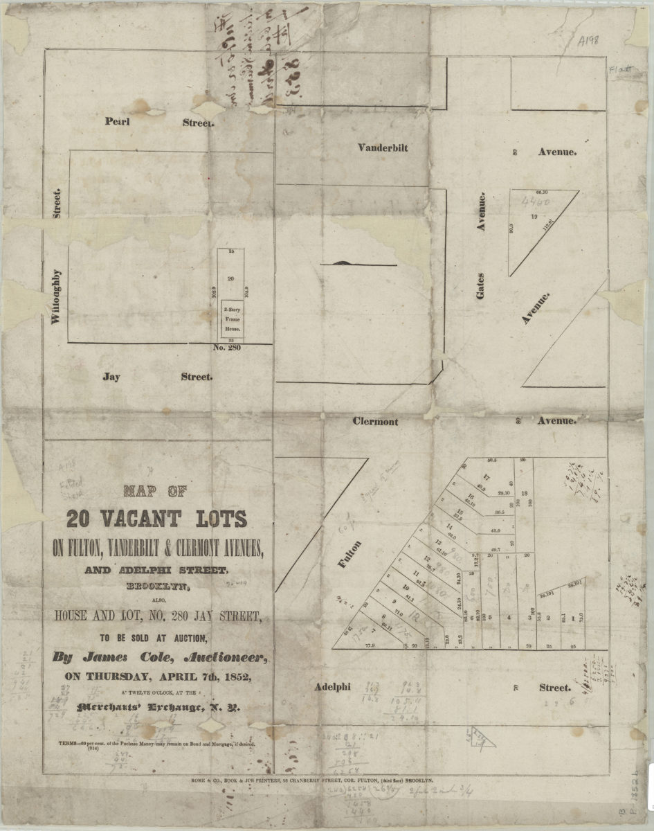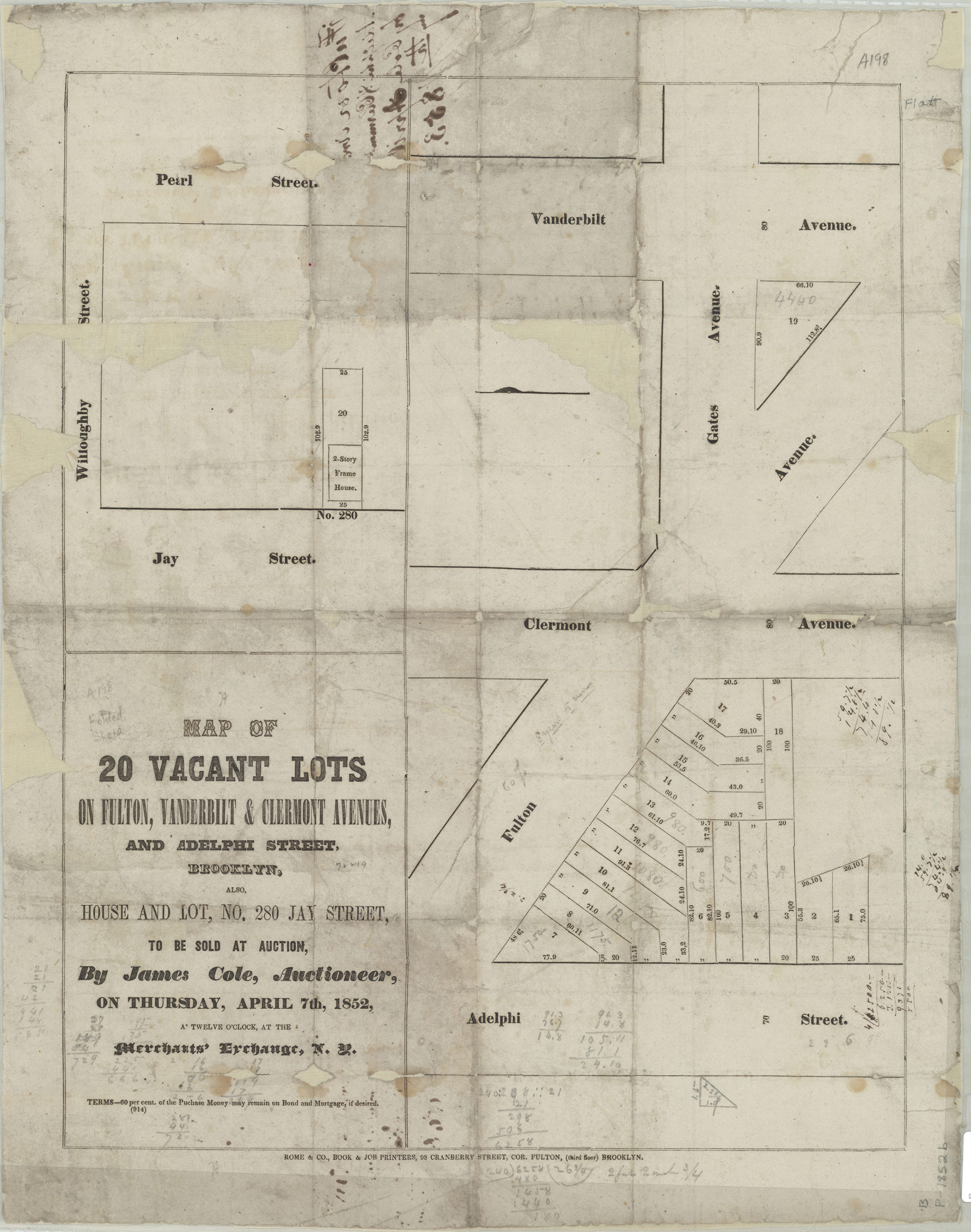
Map of 20 vacant lots on Fulton, Vanderbilt, & Clermont Avenues, and Adelphi Street, Brooklyn, also, house and lot, no. 280 Jay Street, to be sold at auction by James Cole, auctioneer, on Thursday, April 7th, 1852 [1852]
Map No. B P-[1852]b.Fl
Cadastral maps covering modern-day Fort Greene and Downtown Brooklyn. Maps show property (including lot numbers and dimensions). Individual titles devised by cataloger. Oriented with north to the left. Includes note. [Map of intersections of Fulton Ave. with Adelphi St. and Vanderbilt Ave.]. [Map of intersections of Willoughby St. with Jay St. and Pearl St.]. BHS copy annotated in ink and gray pencil.
Subjects
Places
Map area shown
Genre
Cadastral mapsRelation
Full catalog recordSize
54 × 25 cmDownload
Low Resolution Image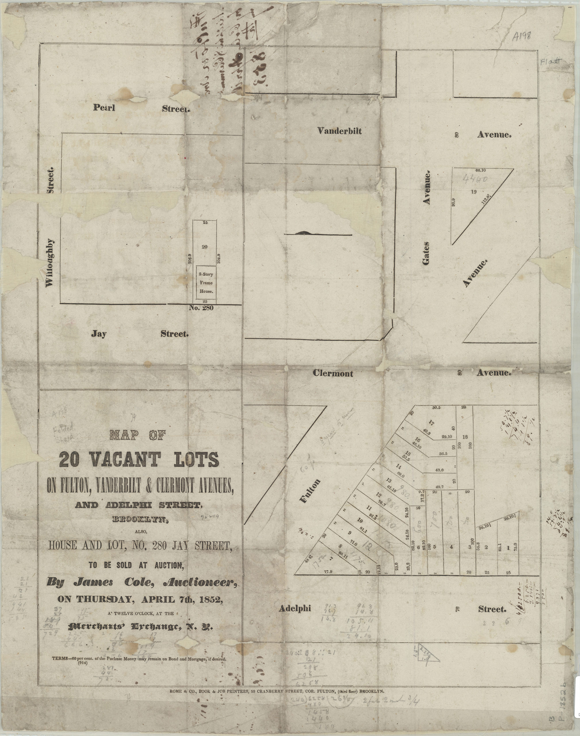
Creator
Rome & Co. (Brooklyn, New York, N.Y.),Publisher
Brooklyn Historical SocietyCitation
Map of 20 vacant lots on Fulton, Vanderbilt, & Clermont Avenues, and Adelphi Street, Brooklyn, also, house and lot, no. 280 Jay Street, to be sold at auction by James Cole, auctioneer, on Thursday, April 7th, 1852; [1852], Map Collection, B P-[1852]b.Fl; Brooklyn Historical Society.Scale
Scale not givenLoading zoom image...