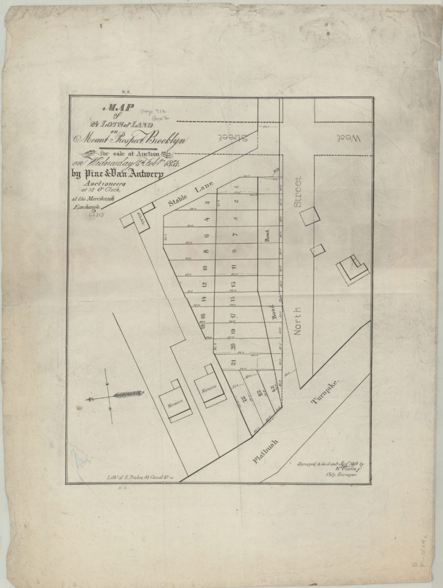
Map of 24 lots of land on Mount Prospect, Brooklyn, for sale at auction on Wednesday, 5th Feby., 1834, by Pine & Van Antwerp, auctioneers, at 12 o’clock, at the Merchants Exchange: surveyed & laid out Jany. 1834 by R. Graves Jr., city surveyor 1834
Map No. B P-[1834]a.Fl
Cadastral map covering area near the intersection of North St. and Flatbush Turnpike (modern-day Prospect Heights). Shows property (including lot numbers, dimensions, and buildings) and proposed streets. Oriented with north to the left.
Map area shown
Genre
Cadastral mapsRelation
Full catalog recordSize
37 × 29 cmDownload
Low Resolution Image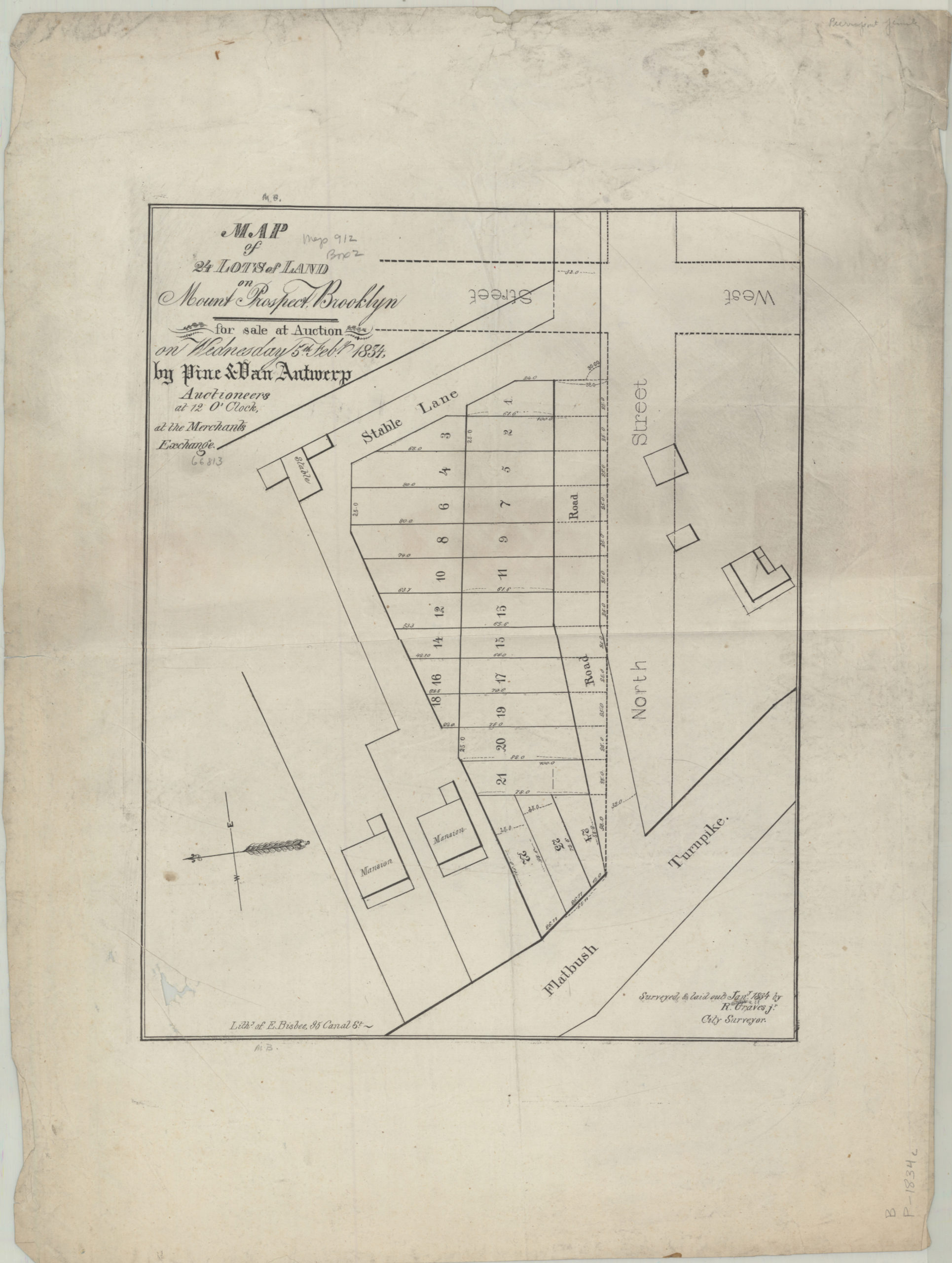
Creator
Graves, Rosewell,Publisher
Brooklyn Historical SocietyCitation
Map of 24 lots of land on Mount Prospect, Brooklyn, for sale at auction on Wednesday, 5th Feby., 1834, by Pine & Van Antwerp, auctioneers, at 12 o’clock, at the Merchants Exchange: surveyed & laid out Jany. 1834 by R. Graves Jr., city surveyor; 1834, Map Collection, B P-[1834]a.Fl; Brooklyn Historical Society.Scale
Scale not givenLoading zoom image...