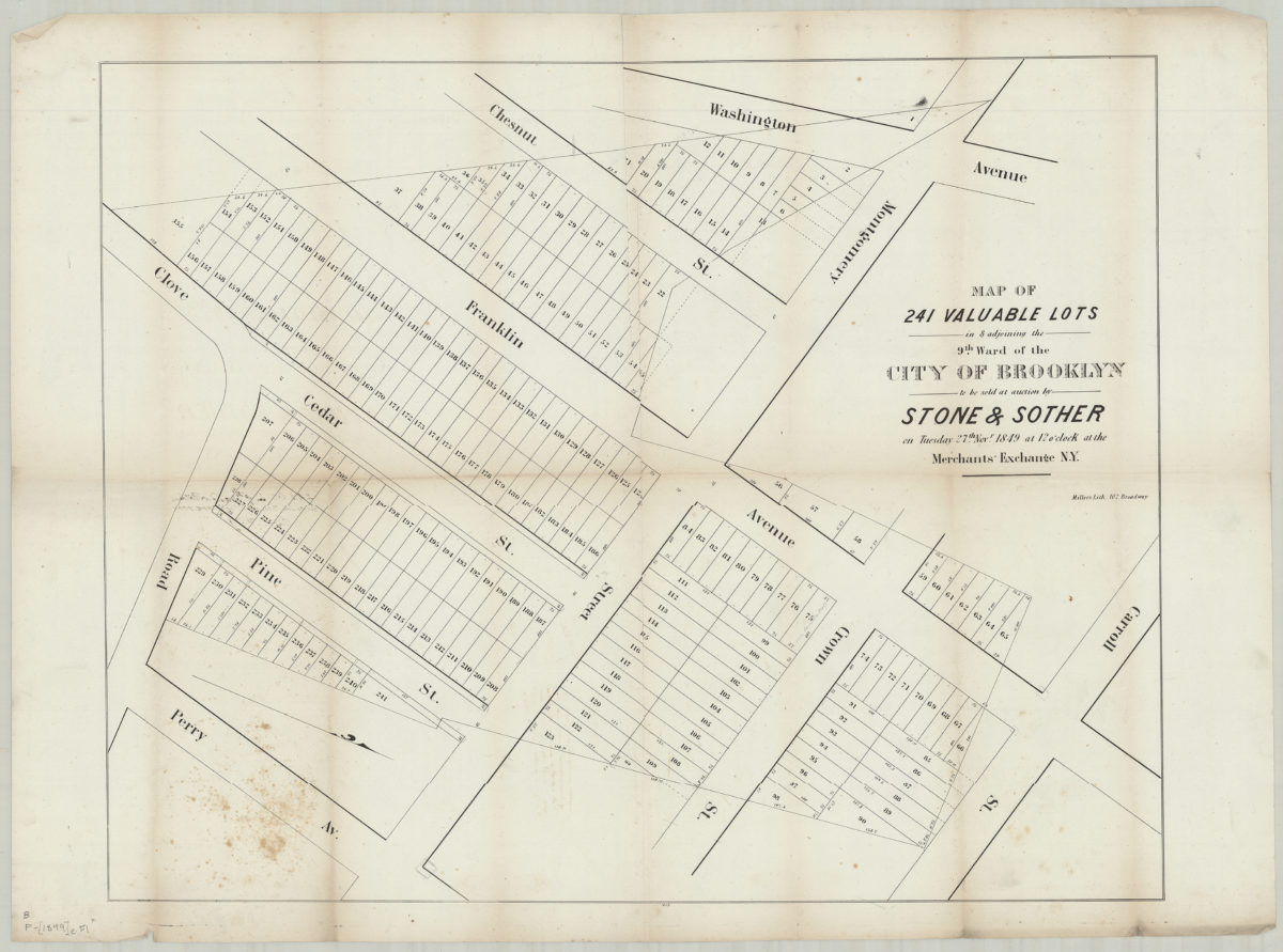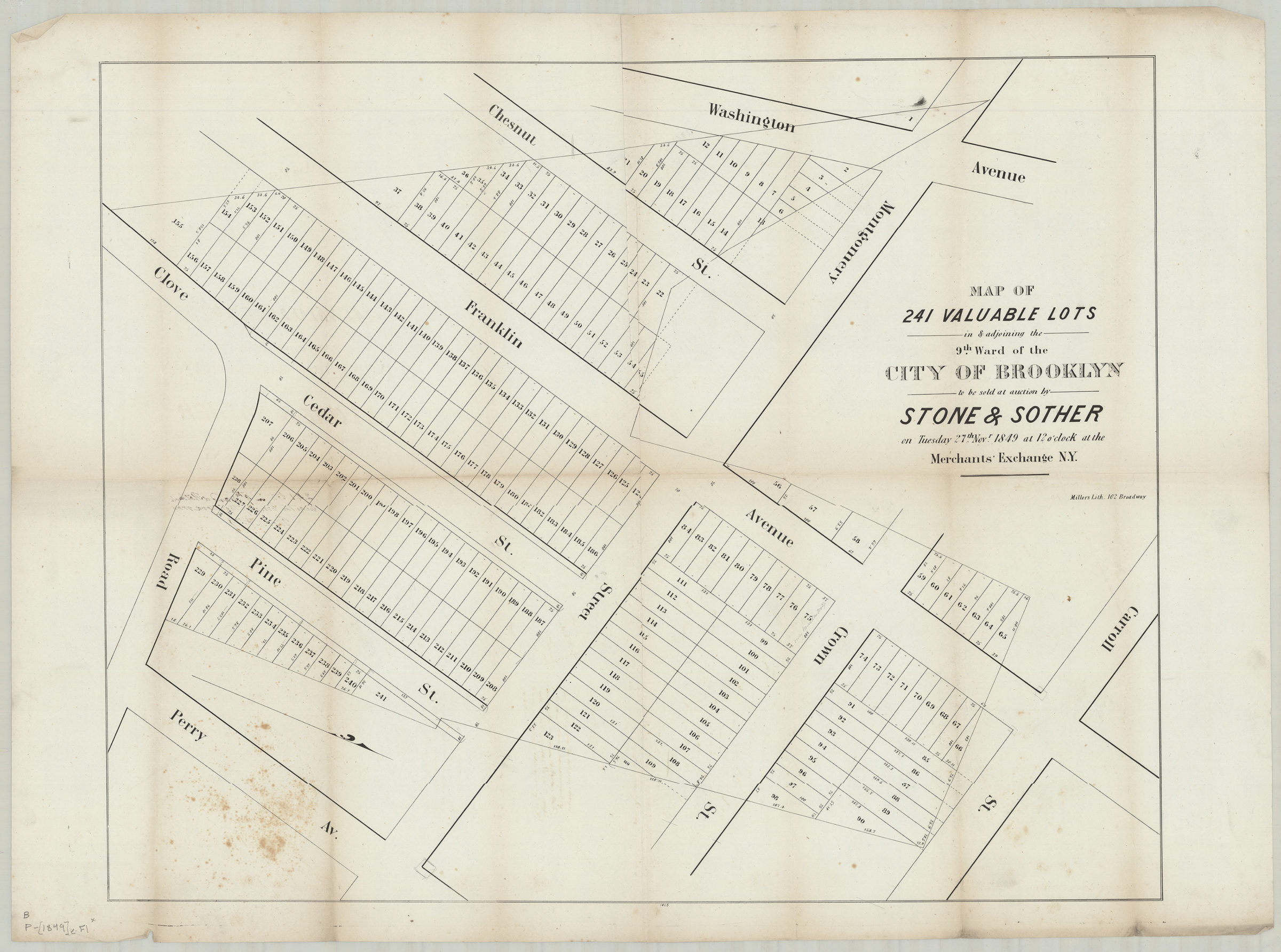
Map of 241 valuable lots in & adjoining the 9th Ward of the city of Brooklyn, to be sold at auction by Stone & Sother on Tuesday, 27th Novr., 1849, at 12 o’clock at the Merchants’ Exchange, N.Y. 1849
Map No. B P-[1849]e.Fl
Cadastral map covering area north from Clove Rd. to Carroll St. and east from Washington Ave. to Perry Ave. (modern-day Crown Heights). Shows property (including lot numbers and dimensions). Oriented with north to the lower right. “1465”–Lower center margin.
Map area shown
Genre
Cadastral mapsRelation
Full catalog recordSize
54 × 68 cmDownload
Low Resolution Image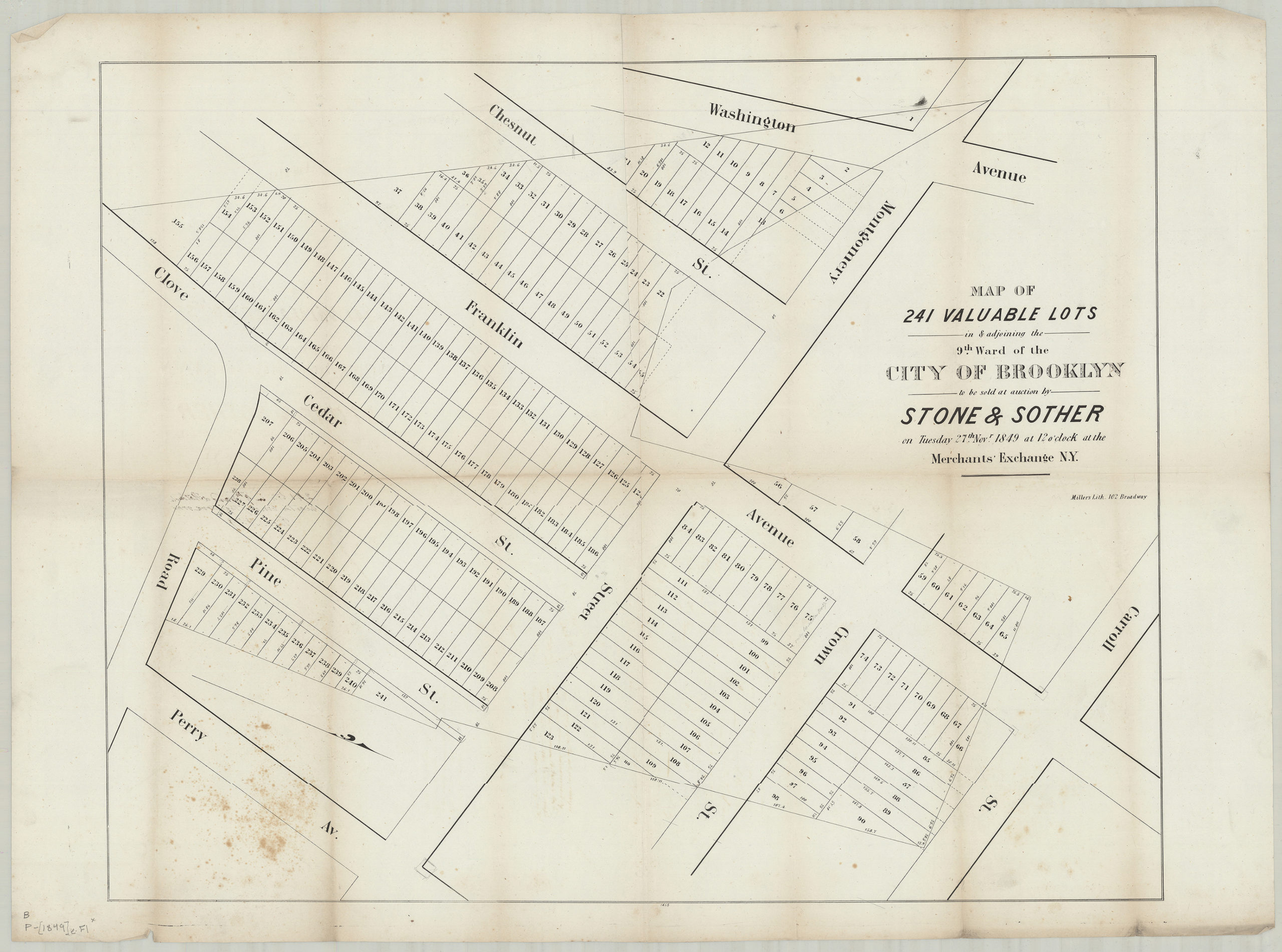
Creator
Miller & Co.,Publisher
Brooklyn Historical SocietyCitation
Map of 241 valuable lots in & adjoining the 9th Ward of the city of Brooklyn, to be sold at auction by Stone & Sother on Tuesday, 27th Novr., 1849, at 12 o’clock at the Merchants’ Exchange, N.Y.; 1849, Map Collection, B P-[1849]e.Fl; Brooklyn Historical Society.Scale
Scale not givenLoading zoom image...