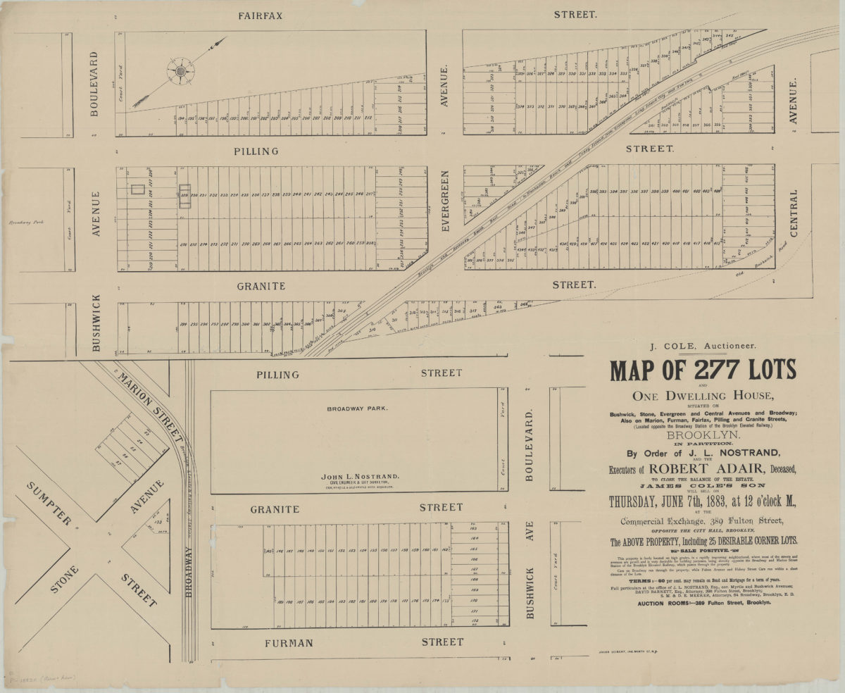
Map of 277 lots and one dwelling house, situated on Bushwick, Stone, Evergreen and Central Avenues and Broadway, also on Marion, Furman, Fairfax, Pilling and Granite Streets (located opposite the Broadway Station of the Brooklyn Elevated Railway) [1883]
Map No. B P-1883.Fl.Folio
Cadastral map covering area northeast from Sumpter St. to Central Ave. and northwest from Furman St. to Fairfax St. (modern-day Bushwick and Bedford-Stuyvesant). Shows property (including lot numbers, dimensions, and buildings), Old Bushwick Road, and elevated railroads. Surveyed by J.L. Nostrand? Oriented with north to the upper right. Composed of 2 segments. BHS has 2 copies.
Subjects
Places
Map area shown
Genre
Cadastral mapsRelation
Full catalog recordSize
85 × 102 cmDownload
Low Resolution Image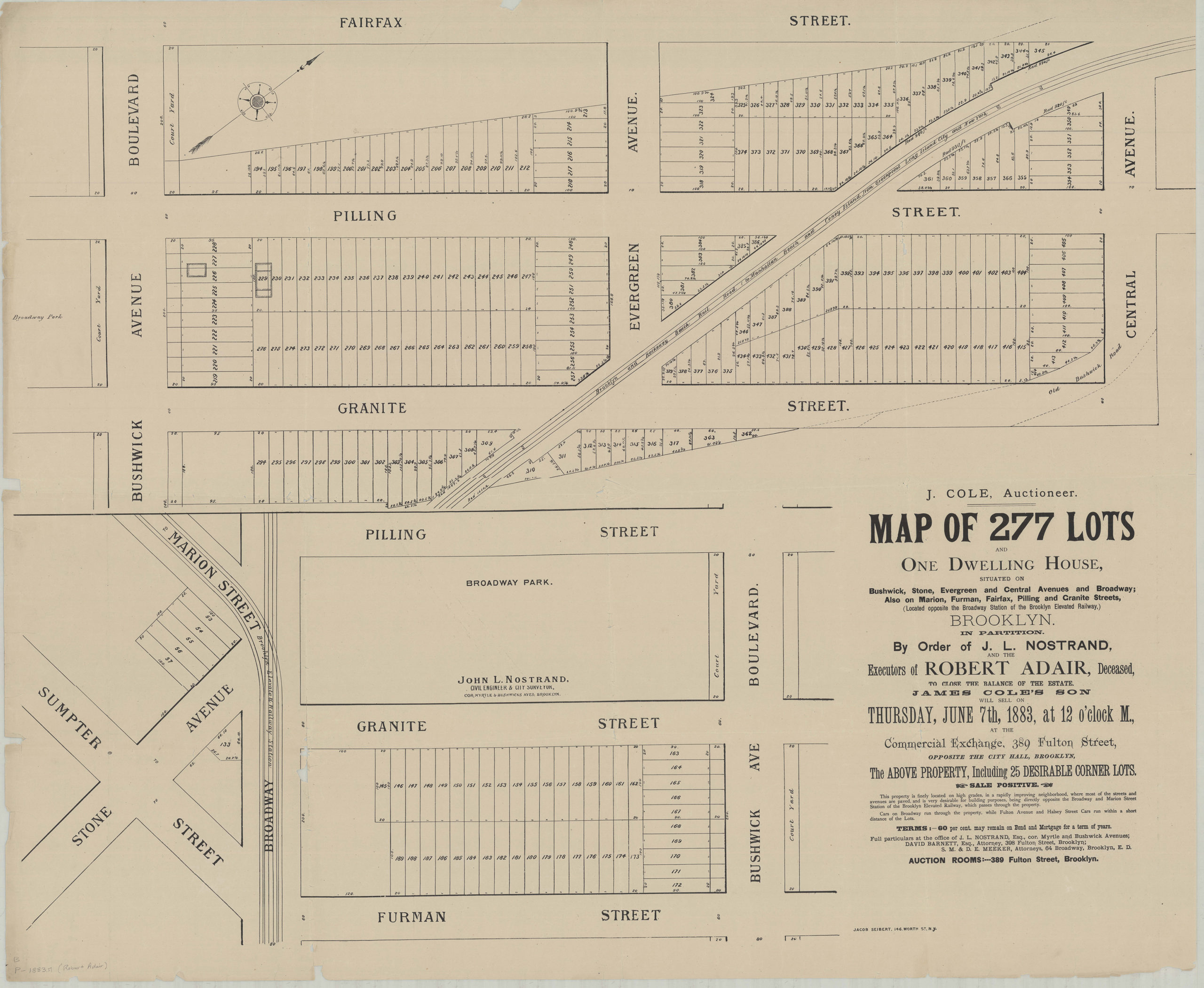
Creator
Nostrand, J. L.,Publisher
Brooklyn Historical SocietyCitation
Map of 277 lots and one dwelling house, situated on Bushwick, Stone, Evergreen and Central Avenues and Broadway, also on Marion, Furman, Fairfax, Pilling and Granite Streets (located opposite the Broadway Station of the Brooklyn Elevated Railway); [1883], Map Collection, B P-1883.Fl.Folio; Brooklyn Historical Society.Scale
Scale not givenLoading zoom image...