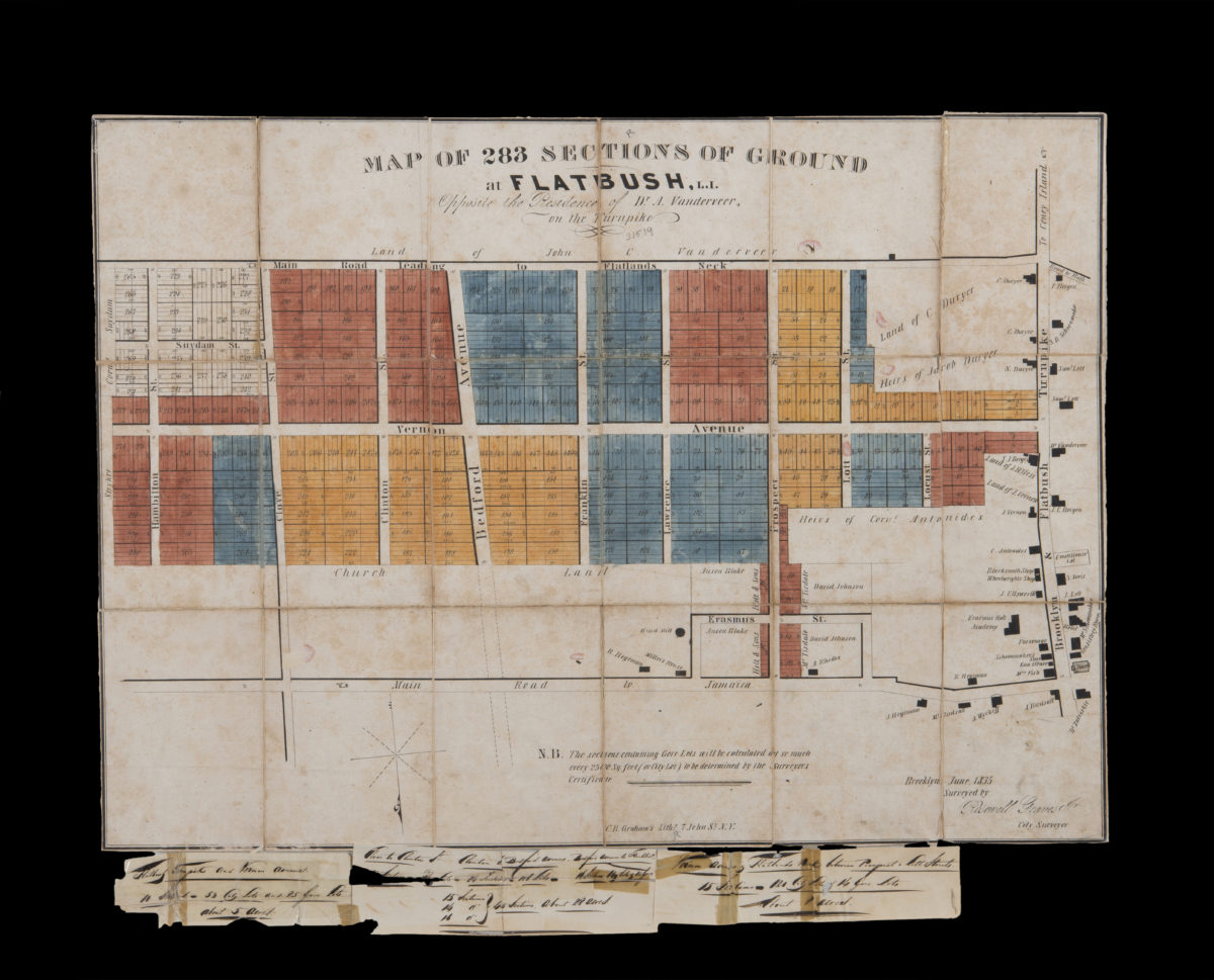
Map of 283 sections of ground at Flatbush, L.I., opposite the residence of Dr. A Vanderveer, on the Turnpike: surveyed by Rosewell Graves, Jr., city surveyor, Brooklyn, June, 1835 [1835]
Map No. B P-[1835]a.Fl
Cadastral map covering area bounded by the Road to Flatlands Neck, the Road to Jamaica, Hamilton Ave., and the Brooklyn & Flatbush Turnpike (modern-day Bedford-Stuyvesant). Shows property (including lot numbers, dimensions, and buildings), and names of landowners. Oriented with north to the bottom. Includes text. Accompanied by manuscript notes.
Subjects
Places
Map area shown
Genre
Cadastral mapsRelation
Full catalog recordSize
48 × 66 cmDownload
Low Resolution Image
Creator
Graves, Rosewell,Publisher
Brooklyn Historical SocietyCitation
Map of 283 sections of ground at Flatbush, L.I., opposite the residence of Dr. A Vanderveer, on the Turnpike: surveyed by Rosewell Graves, Jr., city surveyor, Brooklyn, June, 1835; [1835], Map Collection, B P-[1835]a.Fl; Brooklyn Historical Society.Scale
Scale not givenLoading zoom image...