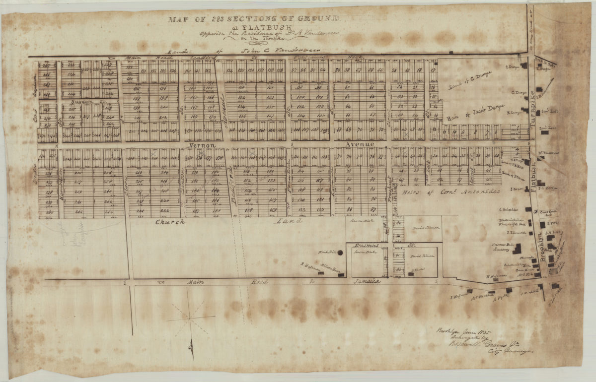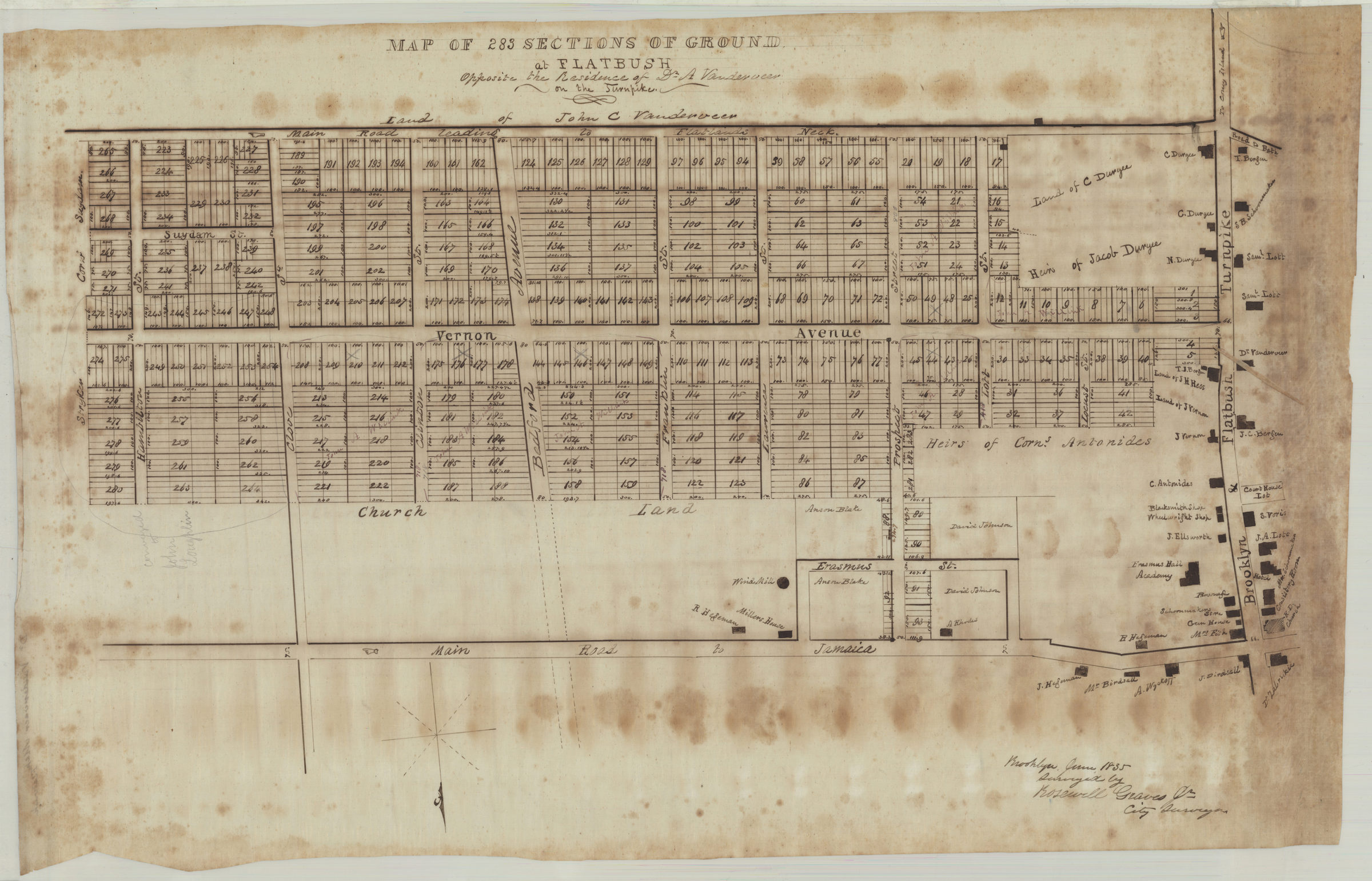
Map of 283 sections of ground at Flatbush opposite the residence of Dr. A. Vanderveer on the Turnpike: surveyed by Rosewell Graves Jr., city surveyor June 1835
Map No. B P-1835a.Fl
Cadastral map covering area bounded by Hamilton St., the Main Road to Flatlands Neck, the Brooklyn & Flatbush Turnpike, and the Main Road to Jamaica (modern-day Erasmus, Flatbush, and East Flatbush). Shows property (including lot numbers, buildings, and dimensions), businesses, the Erasmus Hall Academy, and names of landowners. Oriented with north to the bottom.
Subjects
Places
Map area shown
Relation
Full catalog recordSize
45 × 71 cmDownload
Low Resolution Image
Creator
Graves, Rosewell,Publisher
Brooklyn Historical SocietyCitation
Map of 283 sections of ground at Flatbush opposite the residence of Dr. A. Vanderveer on the Turnpike: surveyed by Rosewell Graves Jr., city surveyor; June 1835, Map Collection, B P-1835a.Fl; Brooklyn Historical Society.Scale
Scale not givenLoading zoom image...