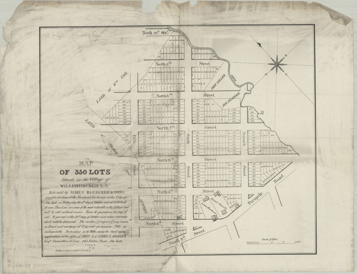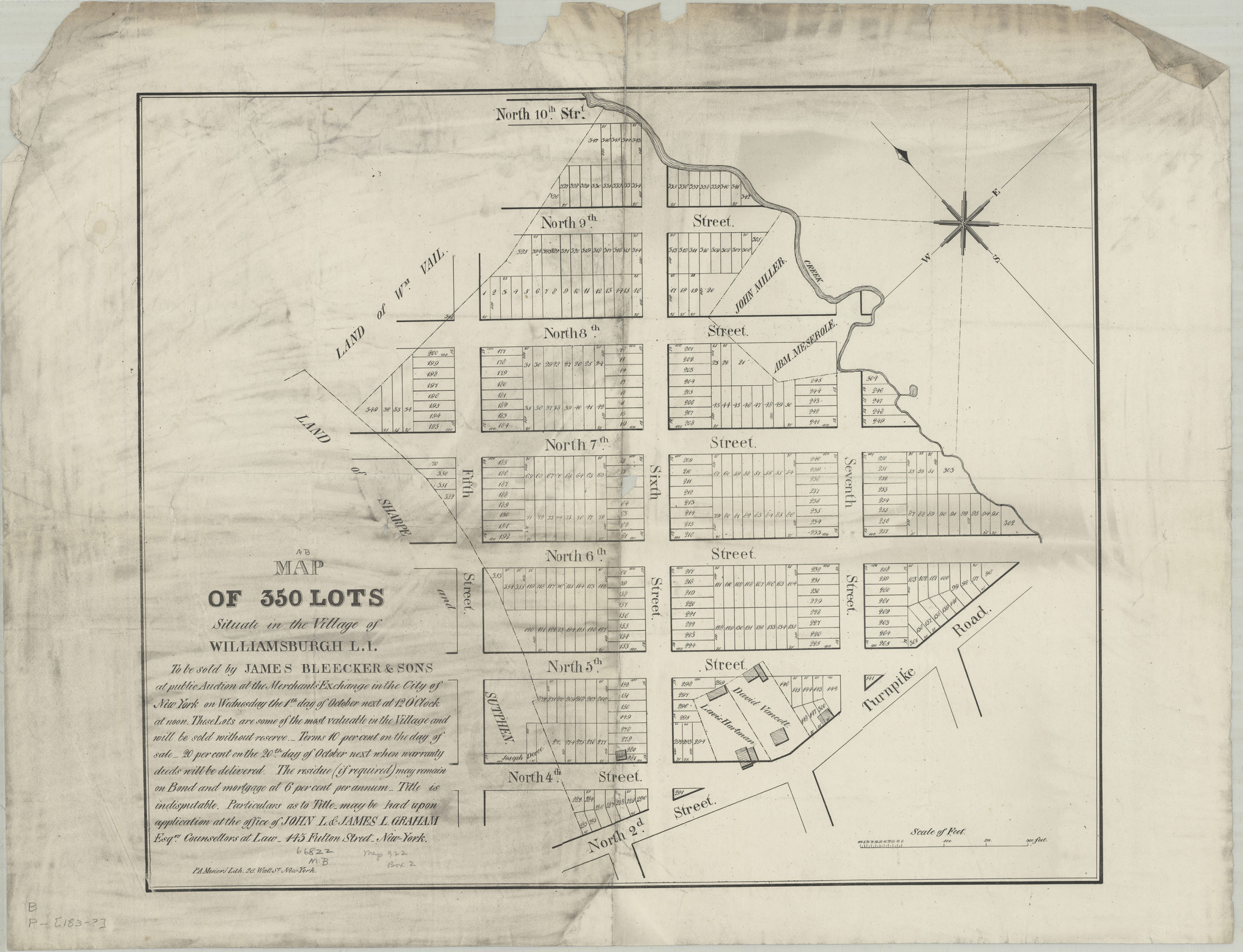
Map of 350 lots situate[d] in the village of Williamsburgh, L.I. [183?]
Map No. B P-[183-?].Fl
Cadastral map covering area northeast from N. 2nd St. to N. 10th St. between approximately 5th St. and 7th St. Shows property (including lot numbers, dimensions, and buildings), names of landowners, and a creek. Oriented with north to the upper left. Includes text.
Map area shown
Genre
Cadastral mapsRelation
Full catalog recordSize
47 × 57 cmDownload
Low Resolution Image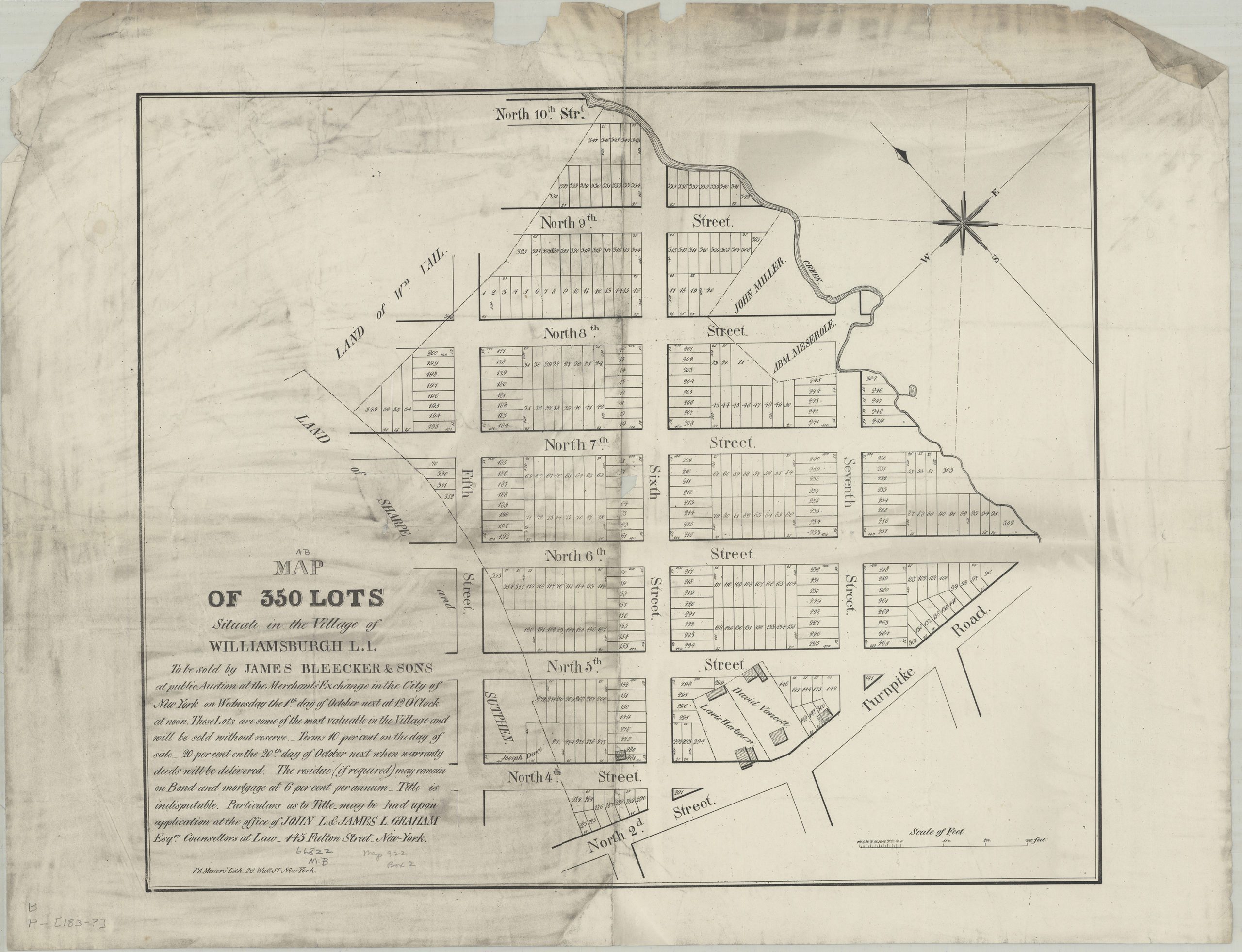
Creator
Mesier, Peter A.,Publisher
Brooklyn Historical SocietyCitation
Map of 350 lots situate[d] in the village of Williamsburgh, L.I.; [183?], Map Collection, B P-[183-?].Fl; Brooklyn Historical Society.Scale
Scale [ca. 1:1,226]Loading zoom image...