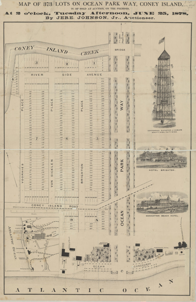
Map of 373 lots on Ocean Park Way, Coney Island, to be sold at auction, on the premises, at 2 o’clock, Tuesday afternoon, June 25, 1878, by Jere. Johnson, Jr., auctioneer [1878]
Map No. B P-[1878].Fl
Cadastral map covering Coney Island west from Ocean Park Way to Voorhies Place and north from the Atlantic Coast to Coney Island Creek. Shows property (including lot numbers and dimensions), hotels, railroads, bridges, shelters, distances from the waterfront, and distances to Prospect Park. Trees and bushes shown pictorially. Oriented with north to the upper left. Includes titled ill. and coverage map. Titled ill.: Centennial Elevator at cables 300 ft. high, 70 ft. wide — Hotel Brighton — Manhattan Beach Hotel.
Map area shown
Genre
Cadastral mapsRelation
Full catalog recordSize
90 × 62 cmDownload
Low Resolution Image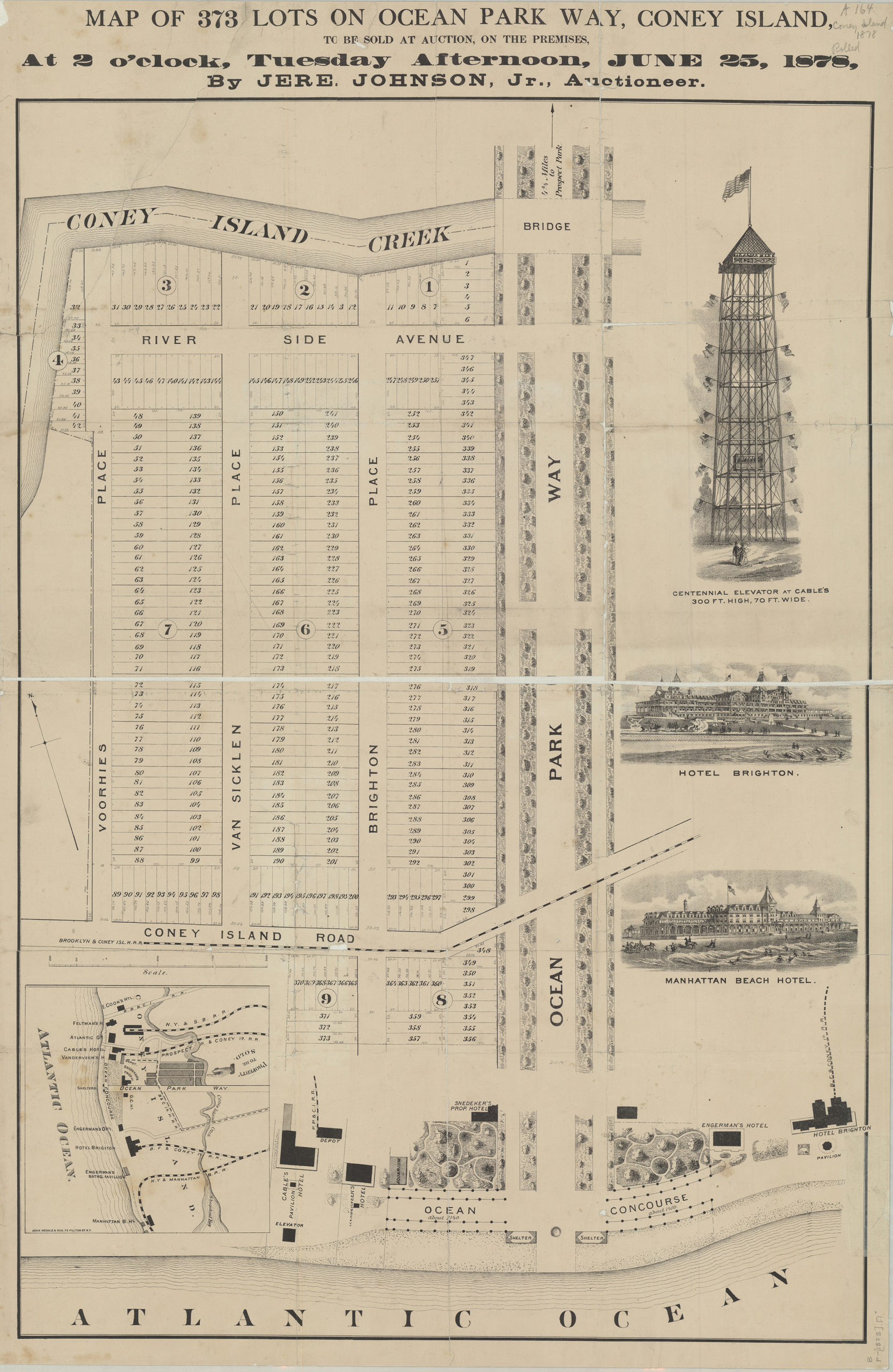
Creator
John Medole & Son,Publisher
Brooklyn Historical SocietyCitation
Map of 373 lots on Ocean Park Way, Coney Island, to be sold at auction, on the premises, at 2 o’clock, Tuesday afternoon, June 25, 1878, by Jere. Johnson, Jr., auctioneer; [1878], Map Collection, B P-[1878].Fl; Brooklyn Historical Society.Scale
Scale not givenLoading zoom image...