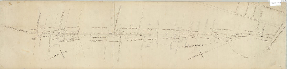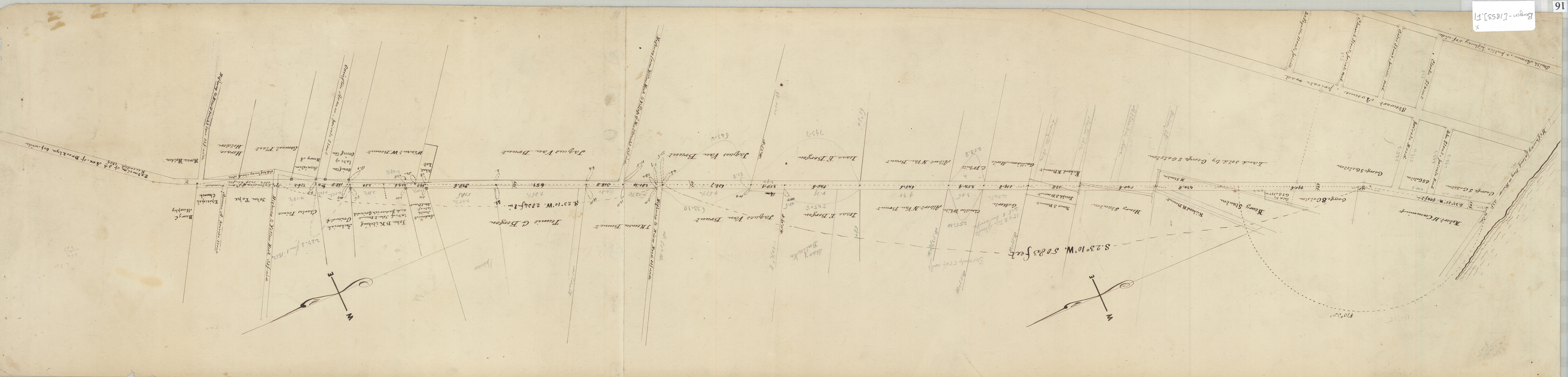
Map of 3d Ave. of Brooklyn, as extended to Fort Hamilton, New Utrecht, by order of commissioners in 1853 [1853]
Map No. Bergen-[1853].Fl
Cadastral survey map covering 3rd Ave. from New York Bay to approximately Ovington Ave. (modern-day Bay Ridge and Fort Hamilton). Shows property and names of landowners. Verso title. Likely attributed to T.G. Bergen, based on handwriting on piece. Oriented with north to the upper right.
Subjects
Places
Map area shown
Relation
Full catalog recordSize
23 × 96 cmDownload
Low Resolution ImageCreator
Bergen, Teunis G., Bergen, Teunis G.,Publisher
Brooklyn Historical Society, Brooklyn Historical SocietyCitation
Map of 3d Ave. of Brooklyn, as extended to Fort Hamilton, New Utrecht, by order of commissioners in 1853; [1853], Map Collection, Bergen-[1853].Fl; Brooklyn Historical Society.Scale
Scale not givenLoading zoom image...