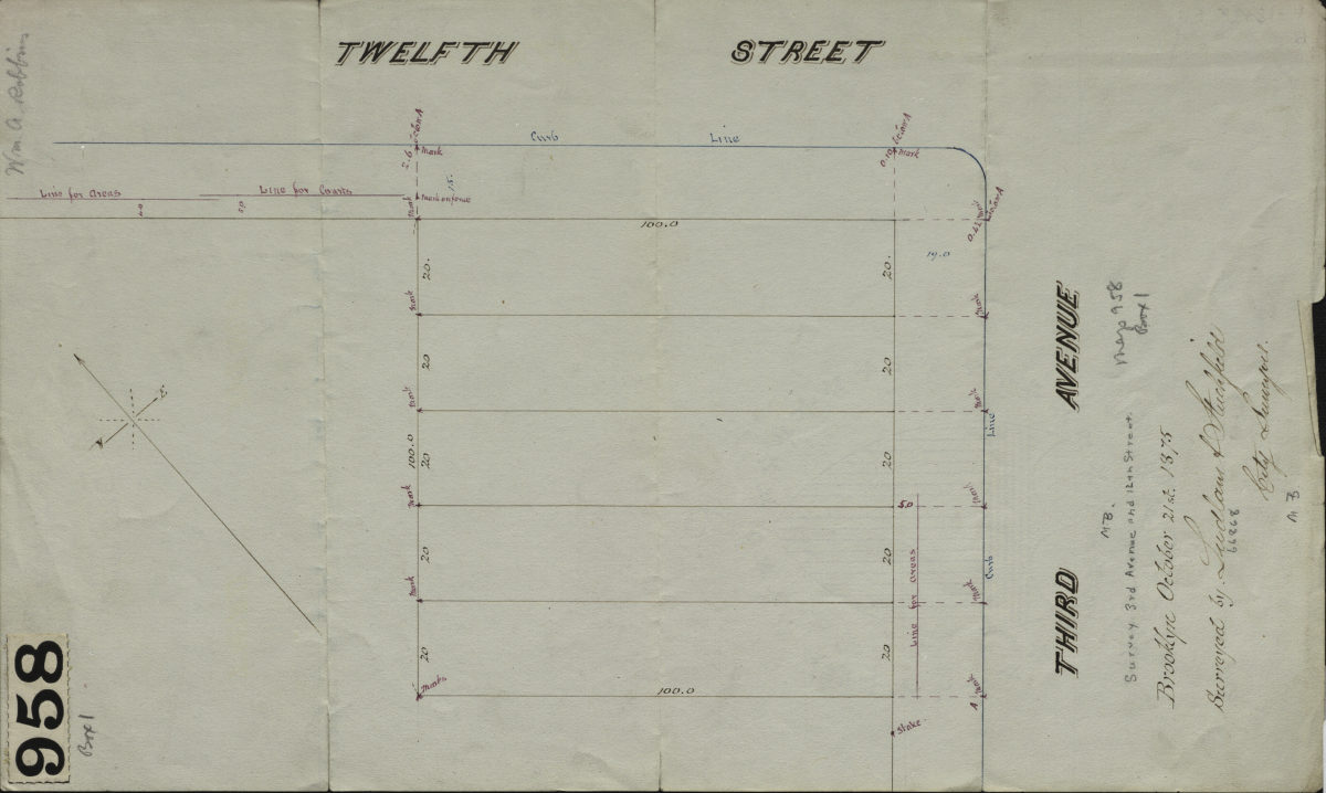
[Map of 3rd Ave. and 12th St.]: surveyed by Ludlam & Stuchfield, city surveyors October 21, 1875
Map No. B A-1875a.Fl
Survey map covering area in modern-day Gowanus. Title devised by cataloger. Oriented with north to the upper right. Watermarked.
Map area shown
Genre
Manuscript mapsRelation
Full catalog recordSize
36 × 22 cmDownload
Low Resolution Image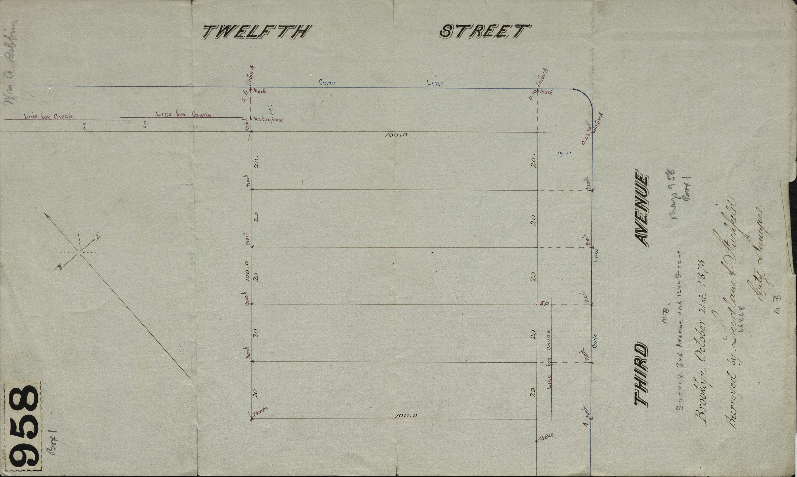
Creator
Ludlam, Silas,Publisher
Brooklyn Historical SocietyCitation
[Map of 3rd Ave. and 12th St.]: surveyed by Ludlam & Stuchfield, city surveyors; October 21, 1875, Map Collection, B A-1875a.Fl; Brooklyn Historical Society.Scale
Scale not givenLoading zoom image...