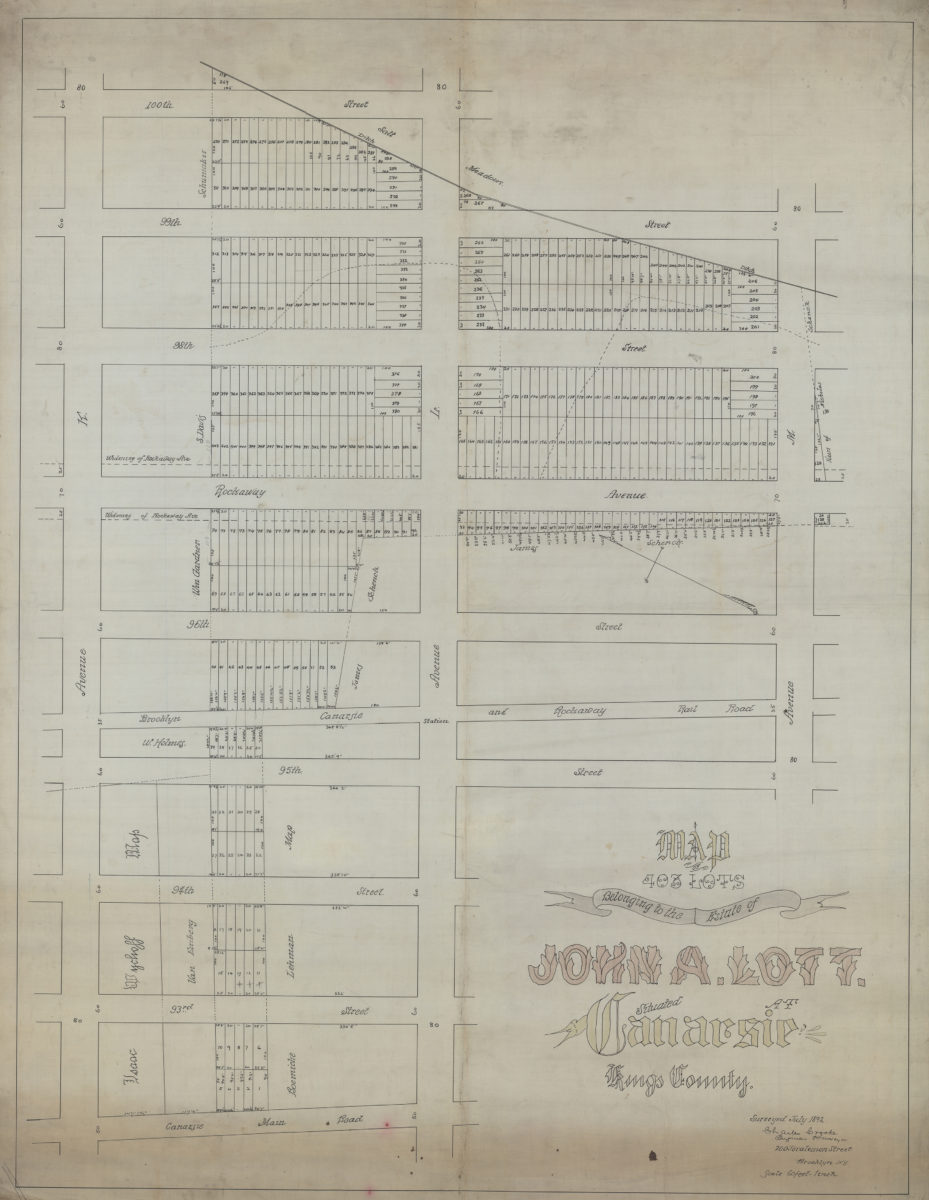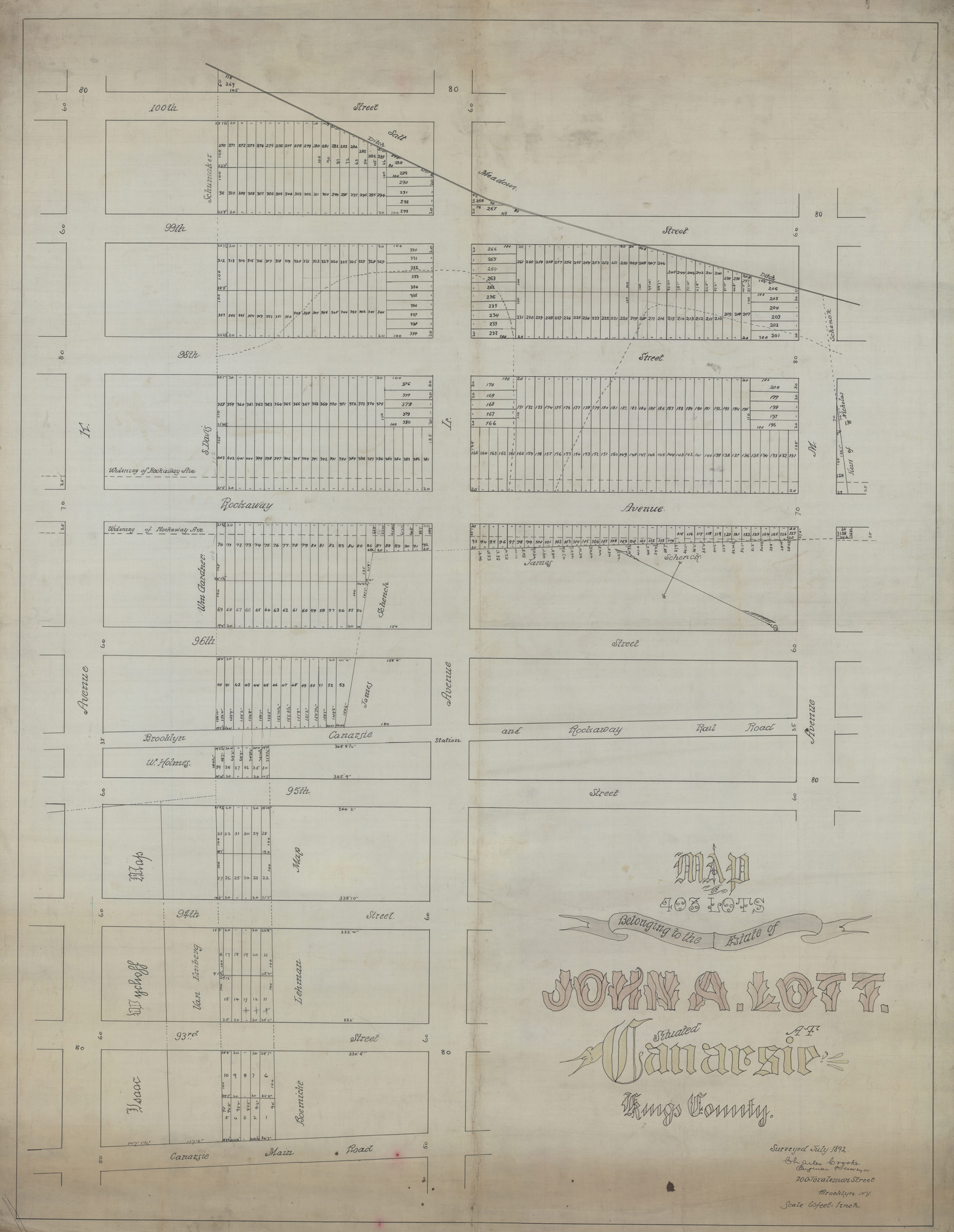
Map of 403 lots belonging to the estate of John A. Lott, situated at Canarsie, Kings County: surveyed … [by] Charles Crooke, engineer & surveyor July 1892
Map No. B P-1892.Fl.O
Cadastral map covering area bounded by Ave. K, the Canarsie Main Rd., Ave. M, and 100th St. Shows property (including lot numbers and dimensions), and names of landowners. Oriented with north to the upper left.
Map area shown
Relation
Full catalog recordSize
108 × 83 cmDownload
Low Resolution Image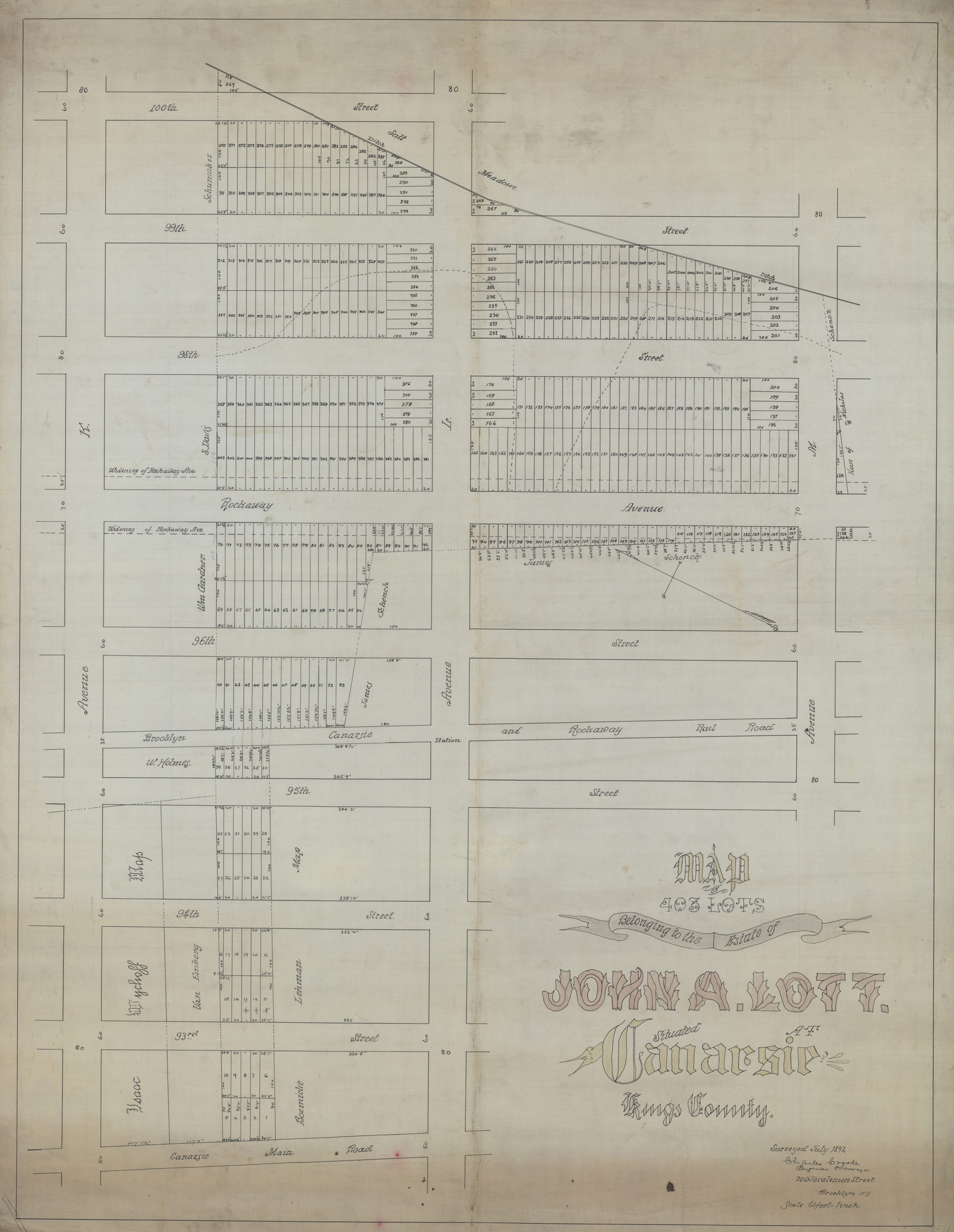
Creator
Crooke, Charles, Crooke, Charles,Publisher
Brooklyn Historical Society, Brooklyn Historical SocietyCitation
Map of 403 lots belonging to the estate of John A. Lott, situated at Canarsie, Kings County: surveyed … [by] Charles Crooke, engineer & surveyor; July 1892, Map Collection, B P-1892.Fl.O; Brooklyn Historical Society.Scale
Scale [1:720] 1 in to 60Loading zoom image...