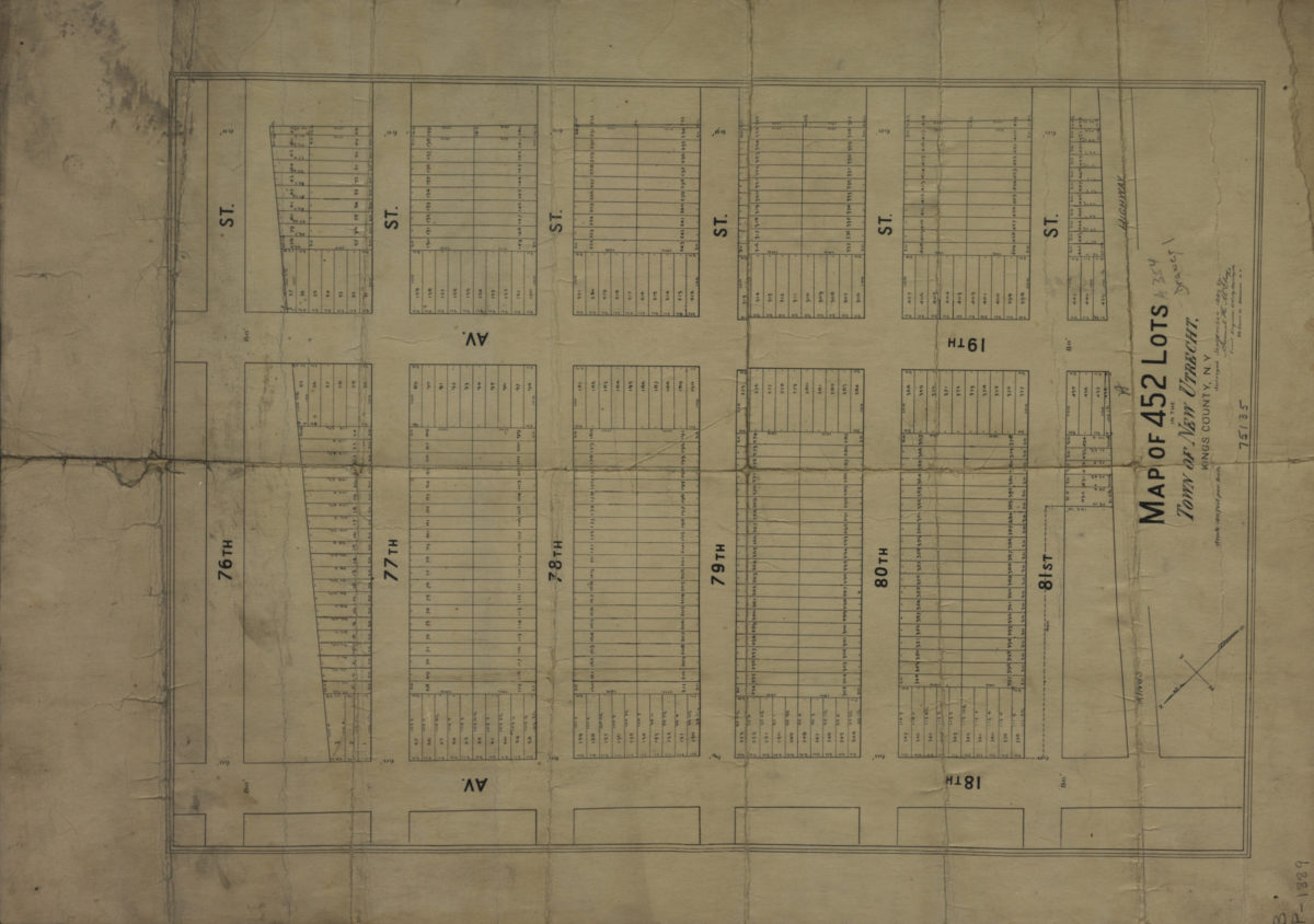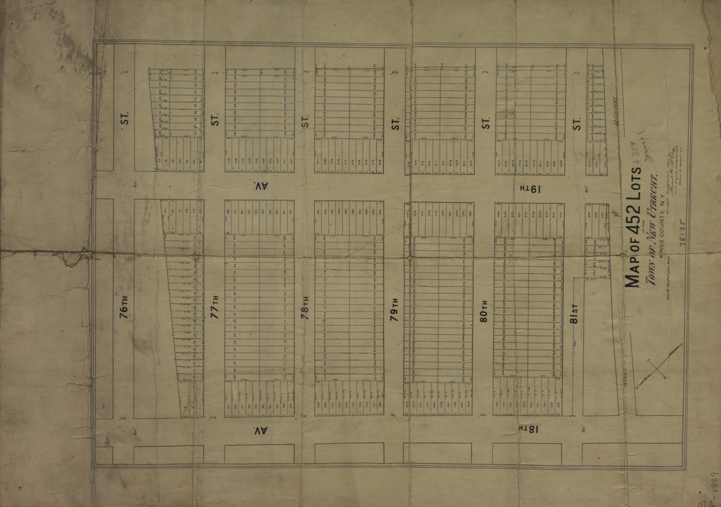
Map of 452 lots in the town of New Utrecht, Kings County, N.Y.: surveyed September 1889 by Samuel H. McElroy, civil engineer & city surveyor [1889]
Map No. B P-[1889?].Fl
Cadastral map covering area bounded by 76th St., 18th Ave., and 81st St. Shows property (including lot numbers and dimensions). Oriented with north to the upper left.
Map area shown
Genre
Cadastral mapsRelation
Full catalog recordSize
35 × 25 cmDownload
Low Resolution Image
Creator
McElroy, Samuel,Publisher
Brooklyn Historical SocietyCitation
Map of 452 lots in the town of New Utrecht, Kings County, N.Y.: surveyed September 1889 by Samuel H. McElroy, civil engineer & city surveyor; [1889], Map Collection, B P-[1889?].Fl; Brooklyn Historical Society.Scale
Scale [ca. 1:480]Loading zoom image...