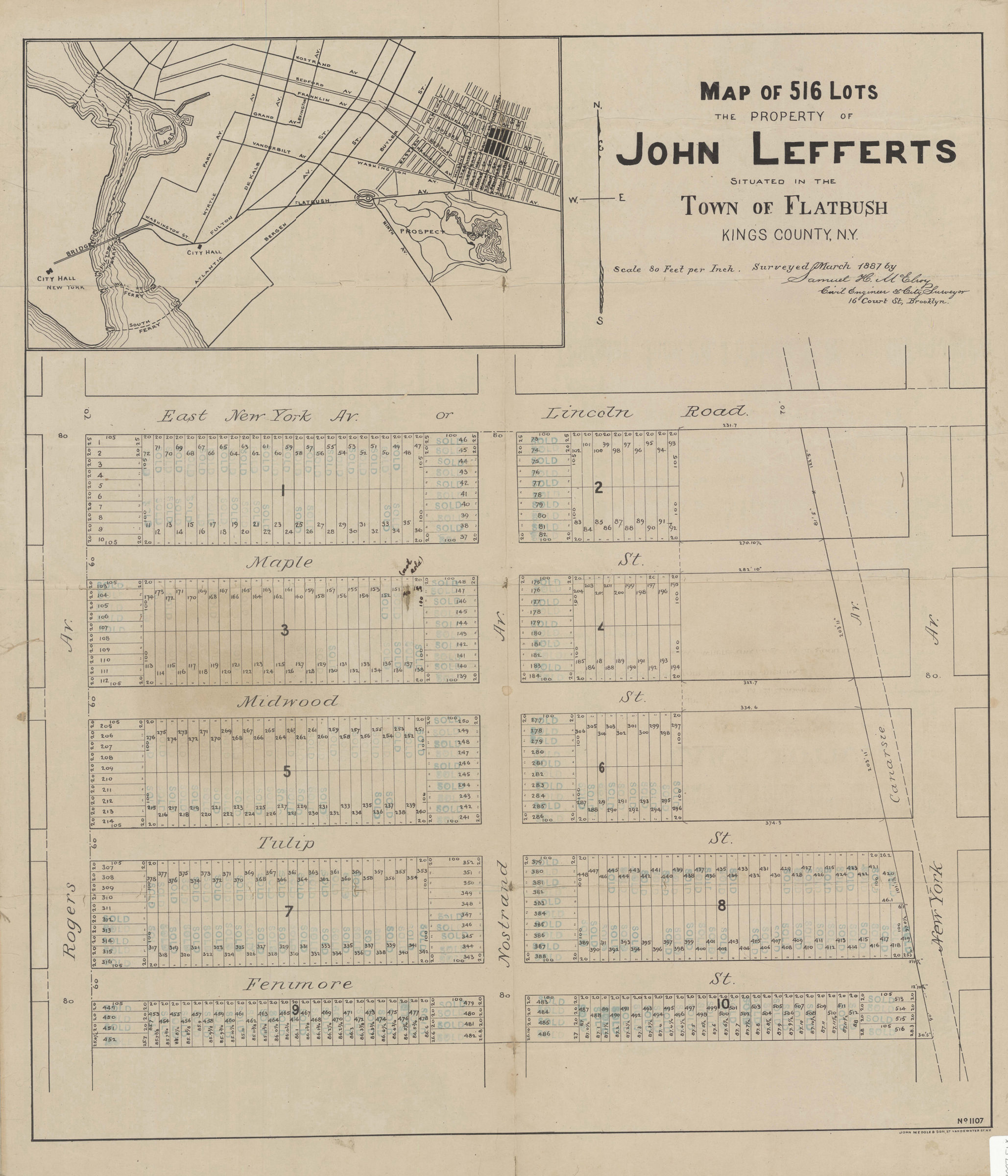
Map of 516 lots, property of John Lefferts situated in the Town of Flatbush, Kings County, N.Y.: surveyed March 1887 by Samuel H. McElroy, civil engineer & city surveyer, 16 Court Street, Brooklyn 1887
Map No. B C-1887.Fl
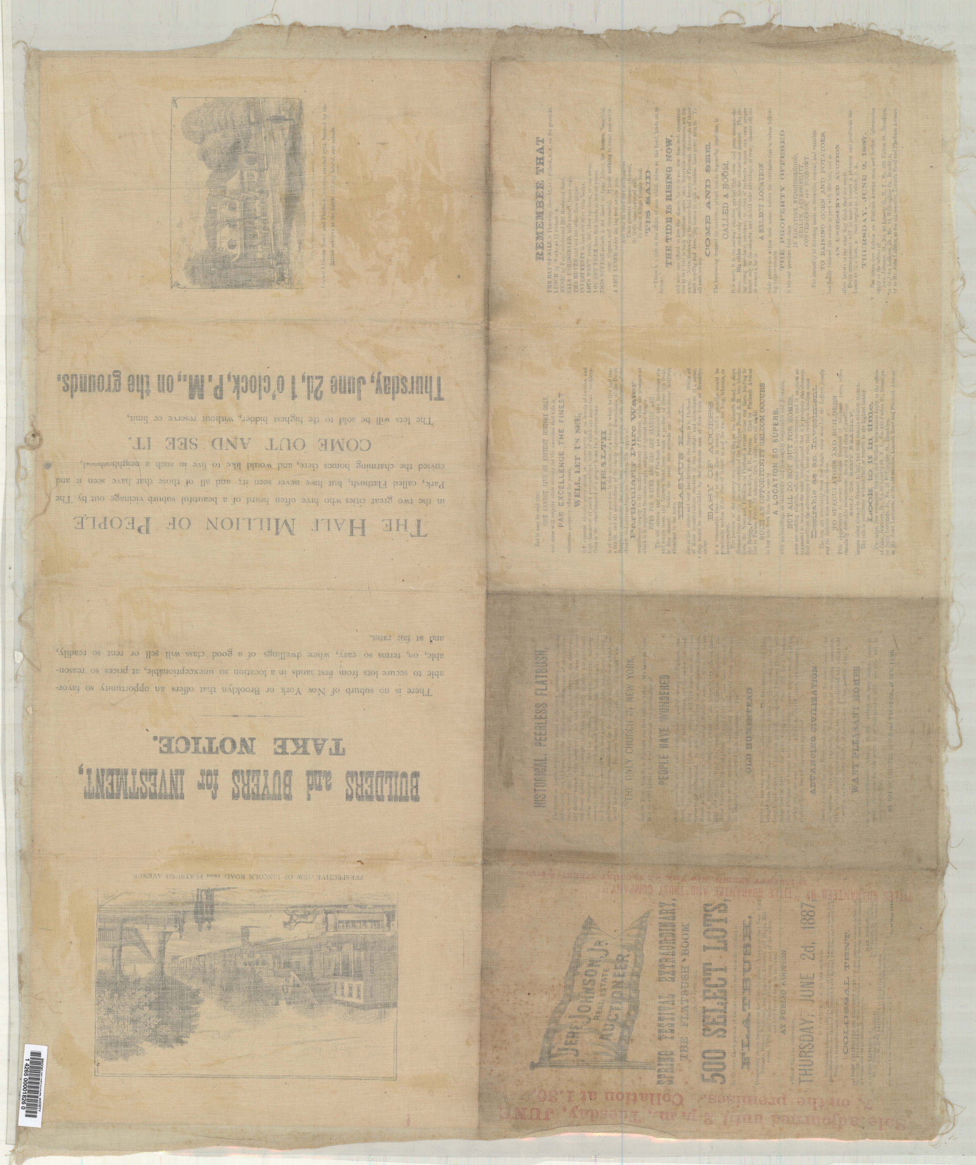
Cadastral map covering area bounded by East New York Avenue or Lincoln Road, Canarsie Avenue, Fenimore Street, and Rogers Avenue in modern-day Prospect-Lefferts Gardens. Shows property (including lot numbers and dimensions). Includes ancillary location map showing Flatbush, portions of Brooklyn, and lower Manhattan. On lower right: “No. 1107.” On verso: text and illustration. BHS copy mounted on linen and stamped to show individual sold lots.
Subjects
Places
Map area shown
Genre
Cadastral mapsRelation
Full catalog recordSize
70 × 60 cmDownload
Low Resolution Image
Creator
McElroy, Samuel H.,Publisher
Brooklyn Historical SocietyCitation
Map of 516 lots, property of John Lefferts situated in the Town of Flatbush, Kings County, N.Y.: surveyed March 1887 by Samuel H. McElroy, civil engineer & city surveyer, 16 Court Street, Brooklyn; 1887, Map Collection, B C-1887.Fl; Brooklyn Historical Society.Scale
[Scale 1:960] 1 in to 80Loading zoom image... 