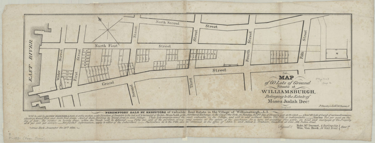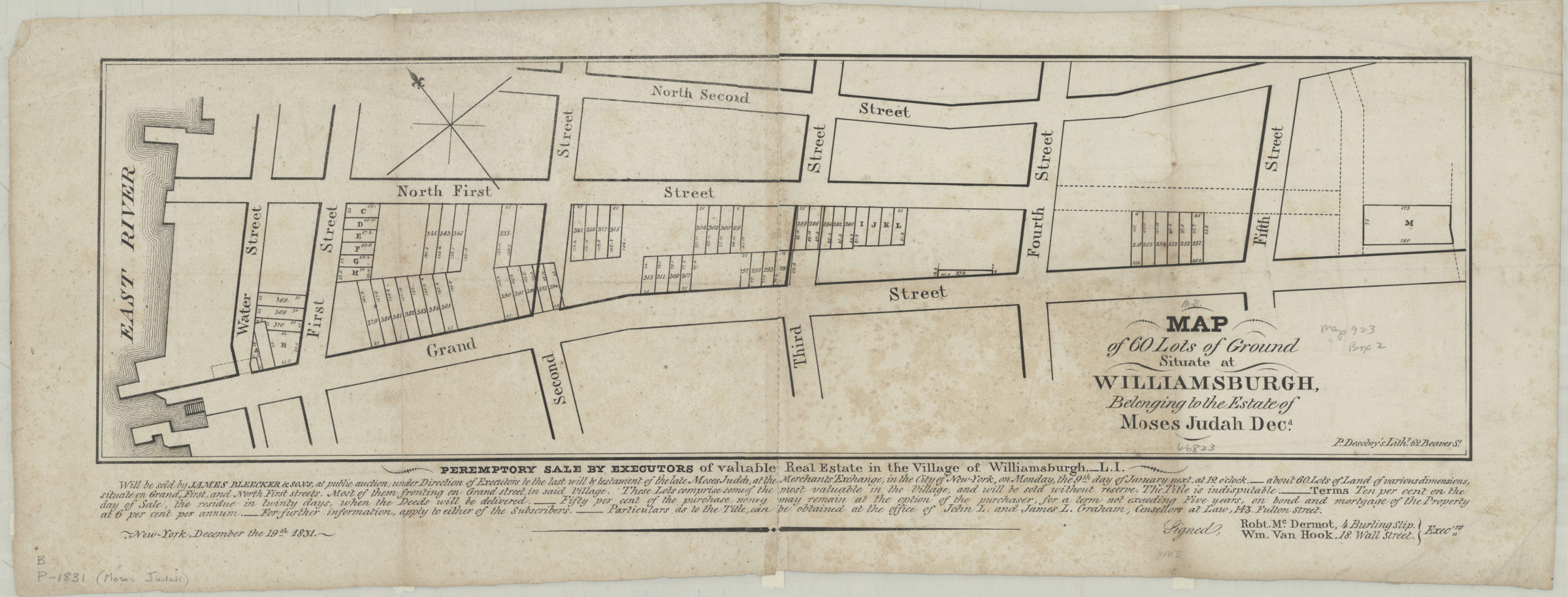
Map of 60 lots of ground situate[d] at Williamsburgh, belonging to the estate of Moses Judah, decd 1831
Map No. B P-[1831].Fl
Cadastral map covering area north from Grand St. to N. 2nd St., and west from 5th St. to the East River. Shows property (including lot numbers and dimensions). Oriented with north to the upper left. Includes text. Keyed to index no index present.
Map area shown
Genre
Cadastral mapsRelation
Full catalog recordSize
18 × 62 cmDownload
Low Resolution Image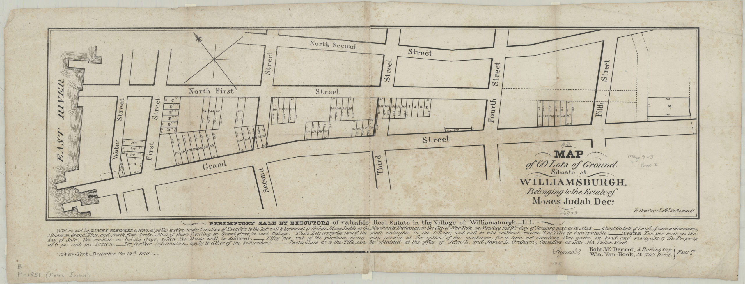
Creator
Desobry, Prosper,Publisher
Brooklyn Historical SocietyCitation
Map of 60 lots of ground situate[d] at Williamsburgh, belonging to the estate of Moses Judah, decd; 1831, Map Collection, B P-[1831].Fl; Brooklyn Historical Society.Scale
Scale not givenLoading zoom image...