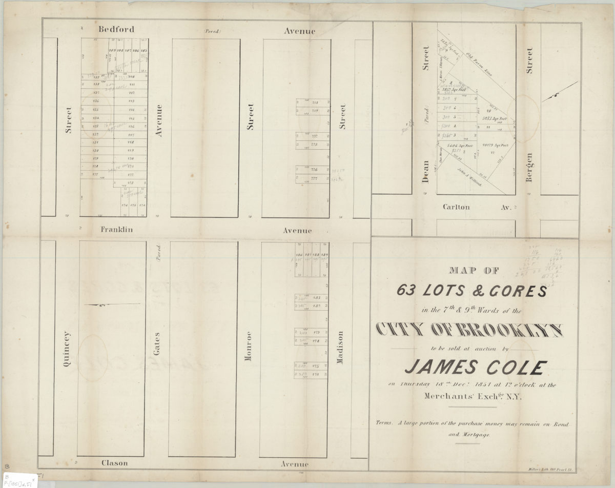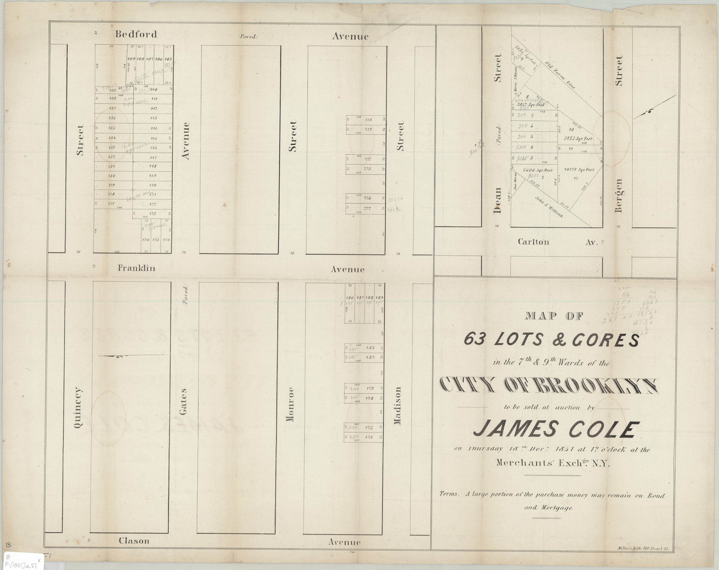
Map of 63 lots & gores in the 7th & 9th Wards of the city of Brooklyn, to be sold at auction by James Cole on Thursday, 18th Decr., 1851, at 12 o’clock, at the Merchants’ Exchge., N.Y. 1851
Map No. B P-[1851]d.Fl
Cadastral maps covering modern-day Bedford-Stuyvesant and Prospect Heights. Maps show property (including lot numbers and dimensions). Individual titles devised by cataloger. Orientations differ. Includes note. “1940”–Lower center margin. [Map of area bounded by Quincey St., Bedford Ave., Madison St., and Clason Ave.]. [Map of the intersections of Carlton Ave. with Dean St. and Bergen St.]. BHS copy annotated in gray pencil.
Subjects
Places
Map area shown
Genre
Cadastral mapsRelation
Full catalog recordSize
34 × 46 cmDownload
Low Resolution Image
Creator
Miller & Co.,Publisher
Brooklyn Historical SocietyCitation
Map of 63 lots & gores in the 7th & 9th Wards of the city of Brooklyn, to be sold at auction by James Cole on Thursday, 18th Decr., 1851, at 12 o’clock, at the Merchants’ Exchge., N.Y.; 1851, Map Collection, B P-[1851]d.Fl; Brooklyn Historical Society.Scale
Scale not givenLoading zoom image...