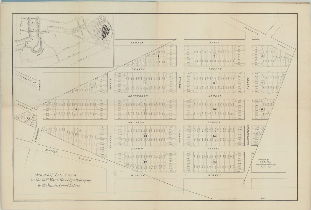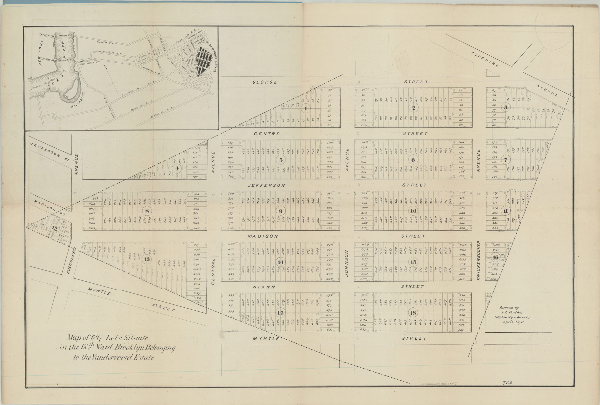
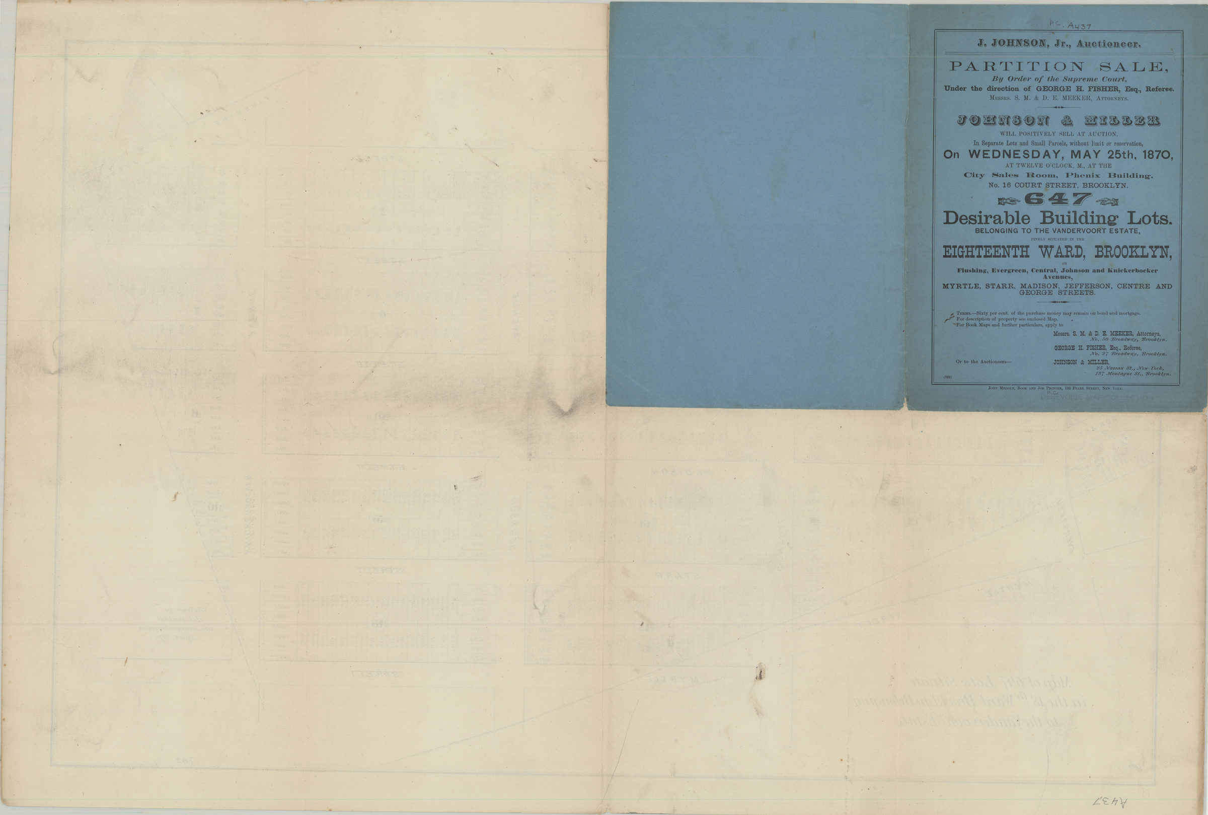
Map of 647 lots situate[d] in the 18th Ward, Brooklyn, belonging to the Vandervoord Estate: surveyed by L.L. Bartlett, city surveyor, Brooklyn, April 1870 [1870]
Map No. B P-[1870]d.Fl
Cadastral map covering area in modern-day Bushwick. Shows property (including lot numbers and dimensions). Oriented with north to the right. On cover: Text. Includes location map (oriented with north to the upper left). “762”–Lower right corner. Stamped on cover of BHS copy: DeBevoise Map Collection.
Map area shown
Genre
Cadastral mapsRelation
Full catalog recordSize
46 × 70 cmDownload
Low Resolution Image
Creator
Bartlett, L. L.,Publisher
Brooklyn Historical SocietyCitation
Map of 647 lots situate[d] in the 18th Ward, Brooklyn, belonging to the Vandervoord Estate: surveyed by L.L. Bartlett, city surveyor, Brooklyn, April 1870; [1870], Map Collection, B P-[1870]d.Fl; Brooklyn Historical Society.Scale
Scale not givenLoading zoom image...