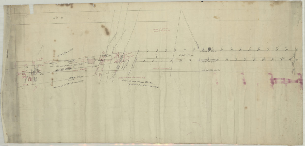
[Map of 71st St. and Narrows Ave.]. [189?]
Map No. Bergen-[189-?]d.Fl
Survey and cadastral map covering area in modern-day Bay Ridge. Shows property (including buildings and acreages), and names of landowners. Title devised by cataloger. Likely attributed to Van Brunt Bergen, based on handwriting on piece. Oriented with north to the lower right. Includes calculations.
Map area shown
Relation
Full catalog recordSize
38 × 82 cmDownload
Low Resolution Image
Creator
Bergen, Van Brunt,Publisher
Brooklyn Historical SocietyCitation
[Map of 71st St. and Narrows Ave.].; [189?], Map Collection, Bergen-[189-?]d.Fl; Brooklyn Historical Society.Scale
Scale not givenLoading zoom image...