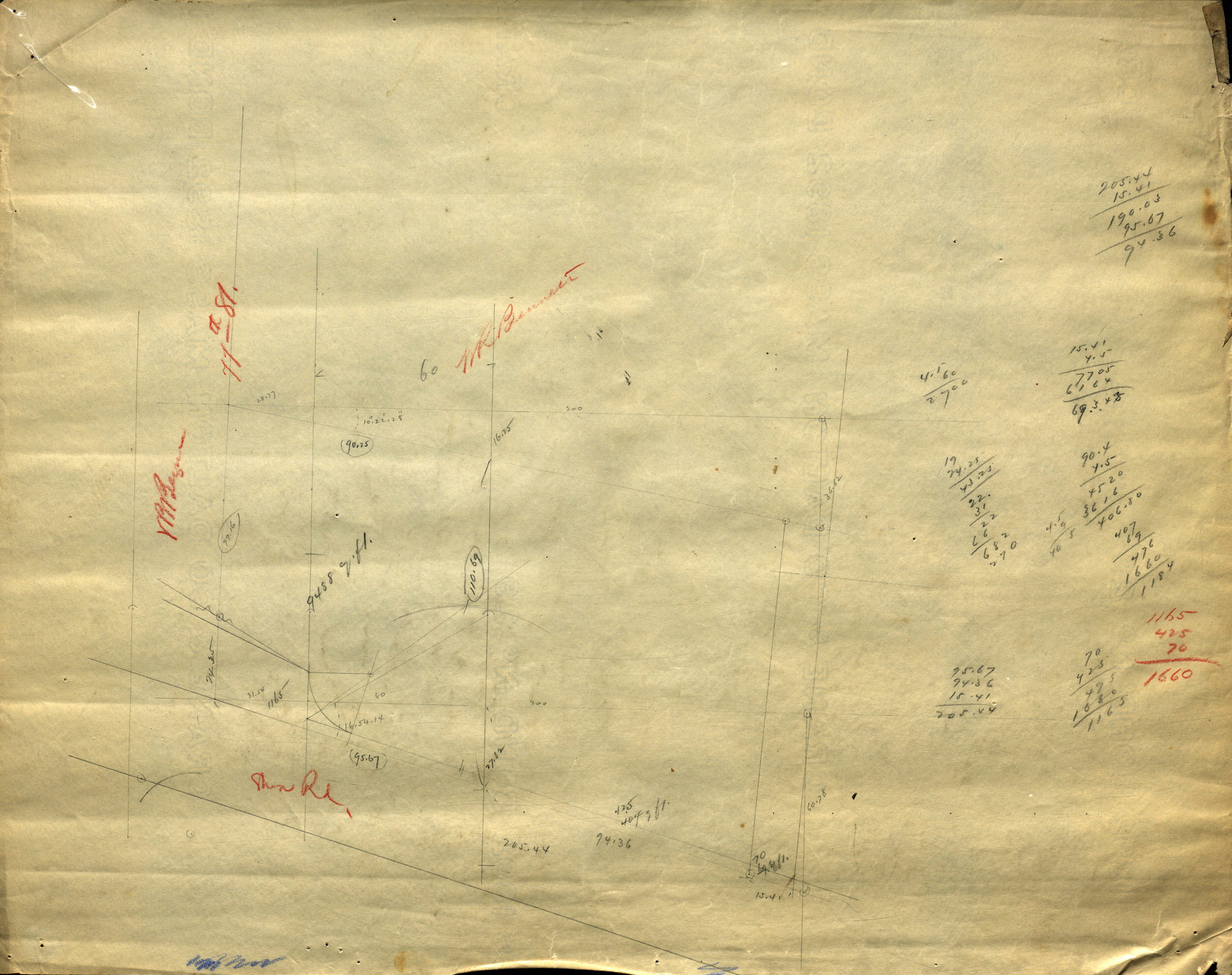
[Map of 77th St. and Shore Rd.]. [1892]
Map No. Bergen-[1892?]c.Fl
Cadastral map covering area in modern-day Bay Ridge. Shows property measurements and names of landowners. Title devised by cataloger. Likely attributed to Van Brunt Bergen, based on handwriting on piece. Oriented with north to the lower left. Date of publication conjectured from watermark. Watermark: Crane & Co Dalton Mass 1892 Bond No 29.
Map area shown
Relation
Full catalog recordSize
42 × 54 cmDownload
Low Resolution Image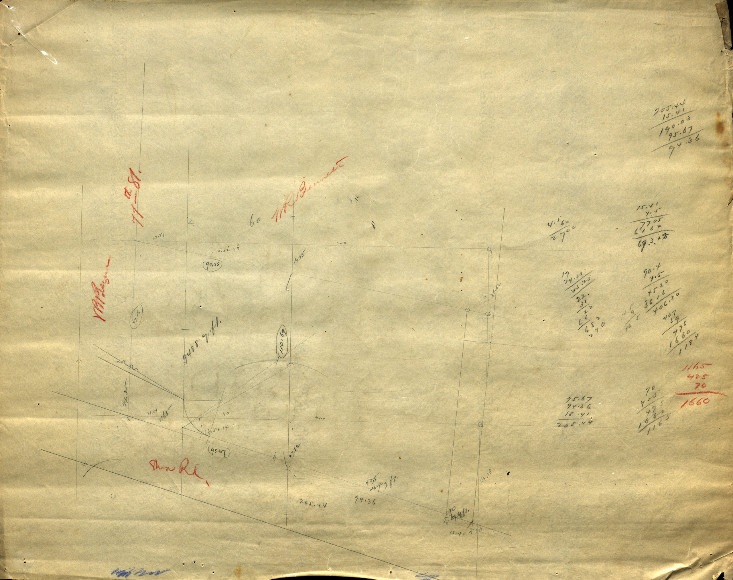
Creator
Bergen, Van Brunt,Publisher
Brooklyn Historical SocietyCitation
[Map of 77th St. and Shore Rd.].; [1892], Map Collection, Bergen-[1892?]c.Fl; Brooklyn Historical Society.Scale
Scale not givenLoading zoom image... 