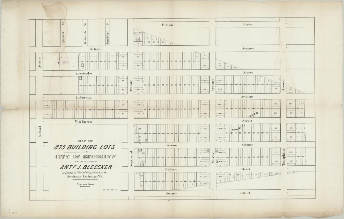
Map of 875 building lots in the city of Brooklyn to be sold at auction by Anty. J. Bleecker on Tuesday, 23rd Octr., 1849, at 12 o’clock at the Merchants’ Exchange, N.Y. 1849
Map No. B P-[1849].Fl.Folio
Cadastral map covering area north from Quincy St. to Pulaski St. and east from Bedford Ave to Tompkins Ave. (modern-day Bedford-Stuyvesant). Shows property (including lot numbers, dimensions, and buildings). “1458”–Lower center margin.
Map area shown
Genre
Cadastral mapsRelation
Full catalog recordSize
51 × 81 cmDownload
Low Resolution Image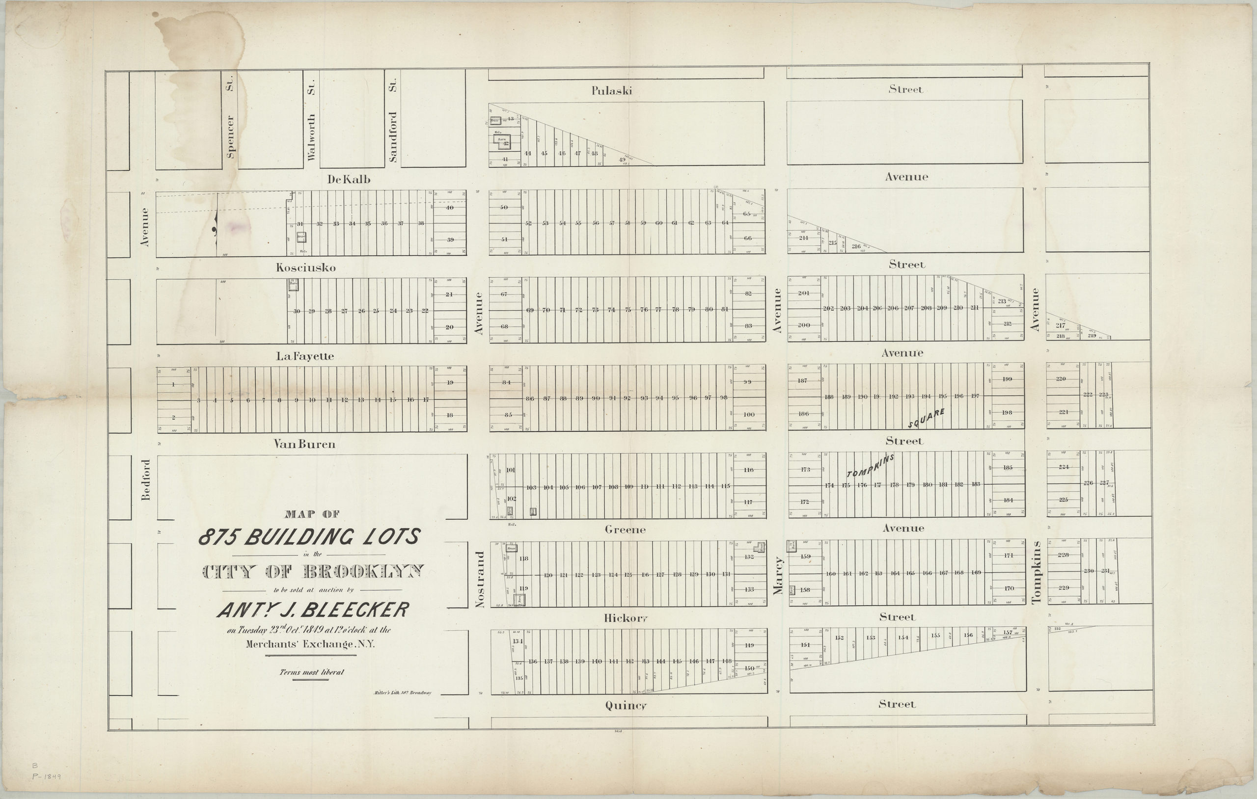
Creator
Miller & Co.,Publisher
Brooklyn Historical SocietyCitation
Map of 875 building lots in the city of Brooklyn to be sold at auction by Anty. J. Bleecker on Tuesday, 23rd Octr., 1849, at 12 o’clock at the Merchants’ Exchange, N.Y.; 1849, Map Collection, B P-[1849].Fl.Folio; Brooklyn Historical Society.Scale
Scale not givenLoading zoom image...