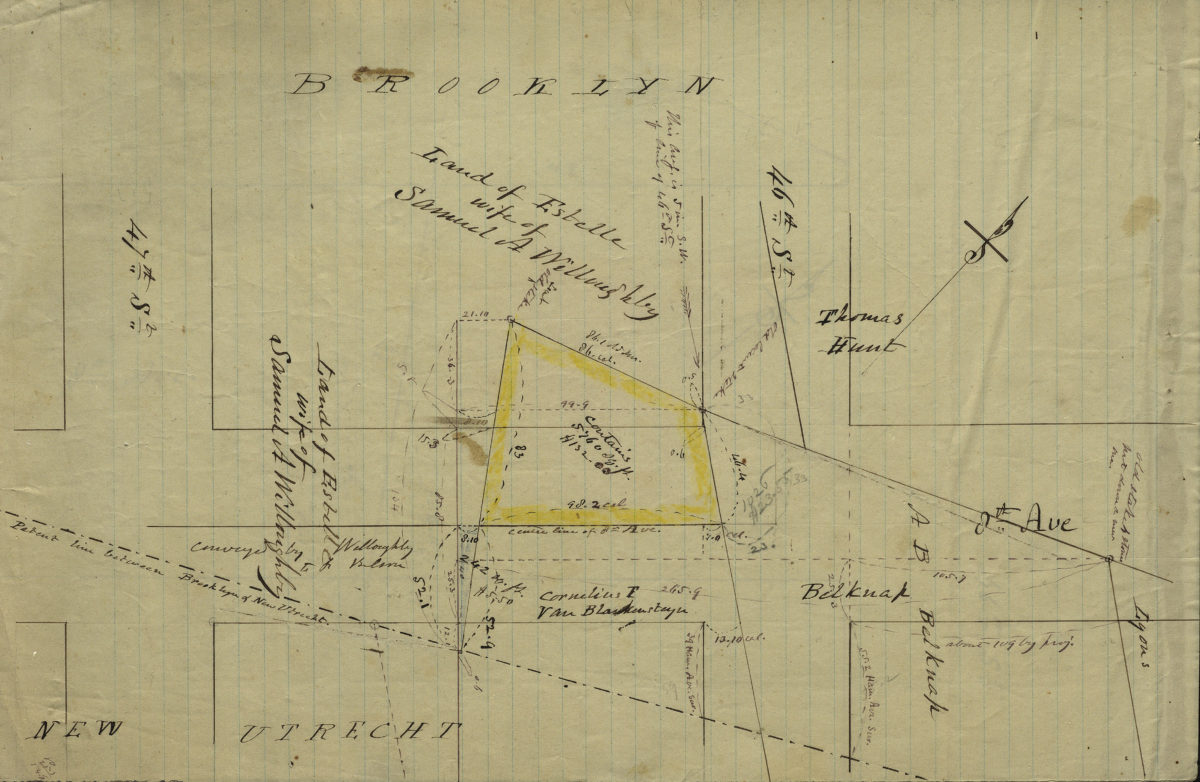
[Map of 8th Ave. at 46th St.]. [185?]
Map No. Bergen-[185-?]k.Fl
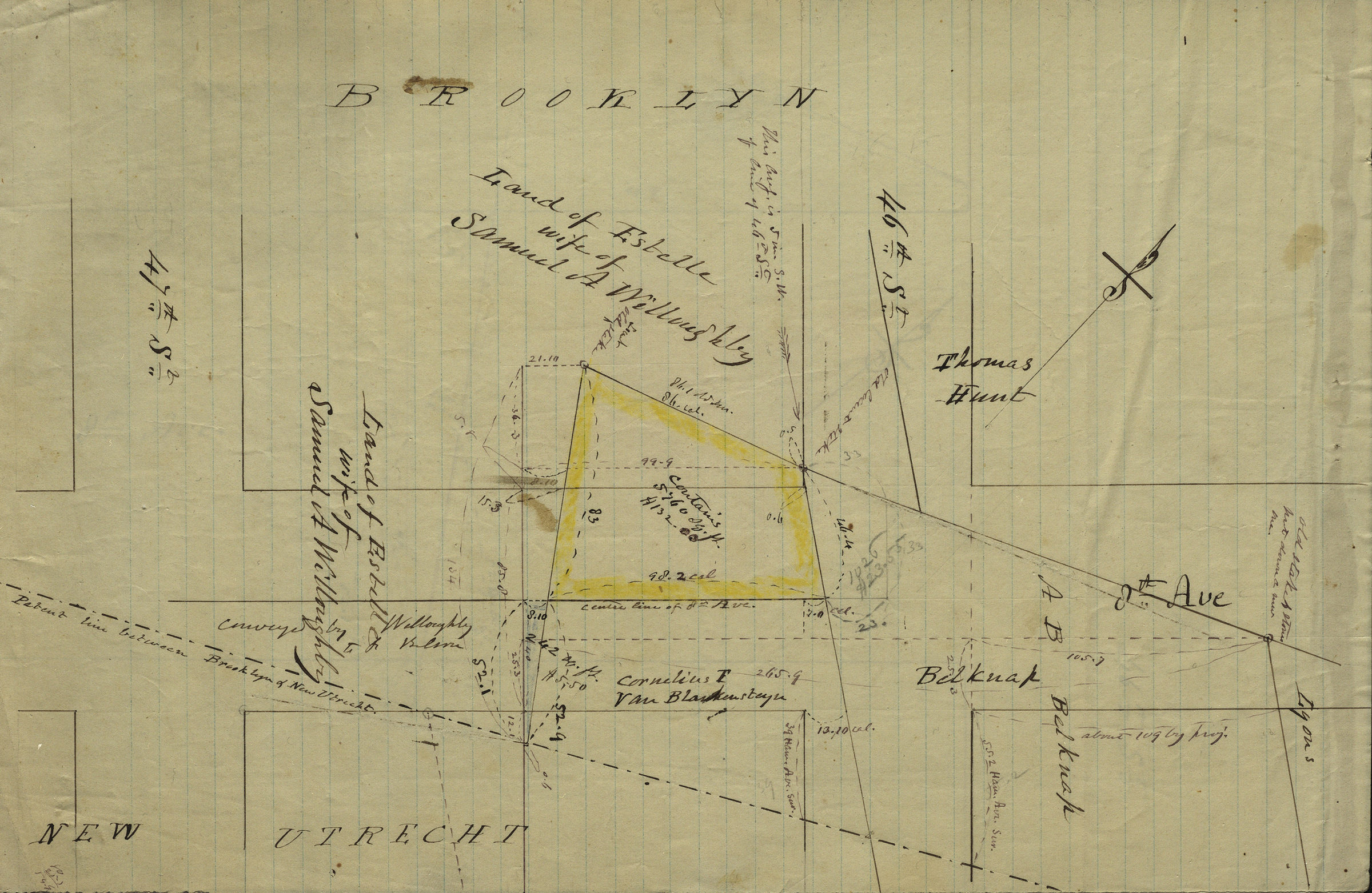
Cadastral map covering area in modern-day Sunset Park. Shows property (including dimensions and prices), and names of landowners. Title devised by cataloger. Likely attributed to T.G. Bergen, based on handwriting on piece. Oriented with north to the upper right. Includes notes and calculations. Accompanying map is draft of main map.
Map area shown
Relation
Full catalog recordSize
21 × 32 cmDownload
Low Resolution Image
Creator
Bergen, Teunis G.,Publisher
Brooklyn Historical SocietyCitation
[Map of 8th Ave. at 46th St.].; [185?], Map Collection, Bergen-[185-?]k.Fl; Brooklyn Historical Society.Scale
Scale not givenLoading zoom image...