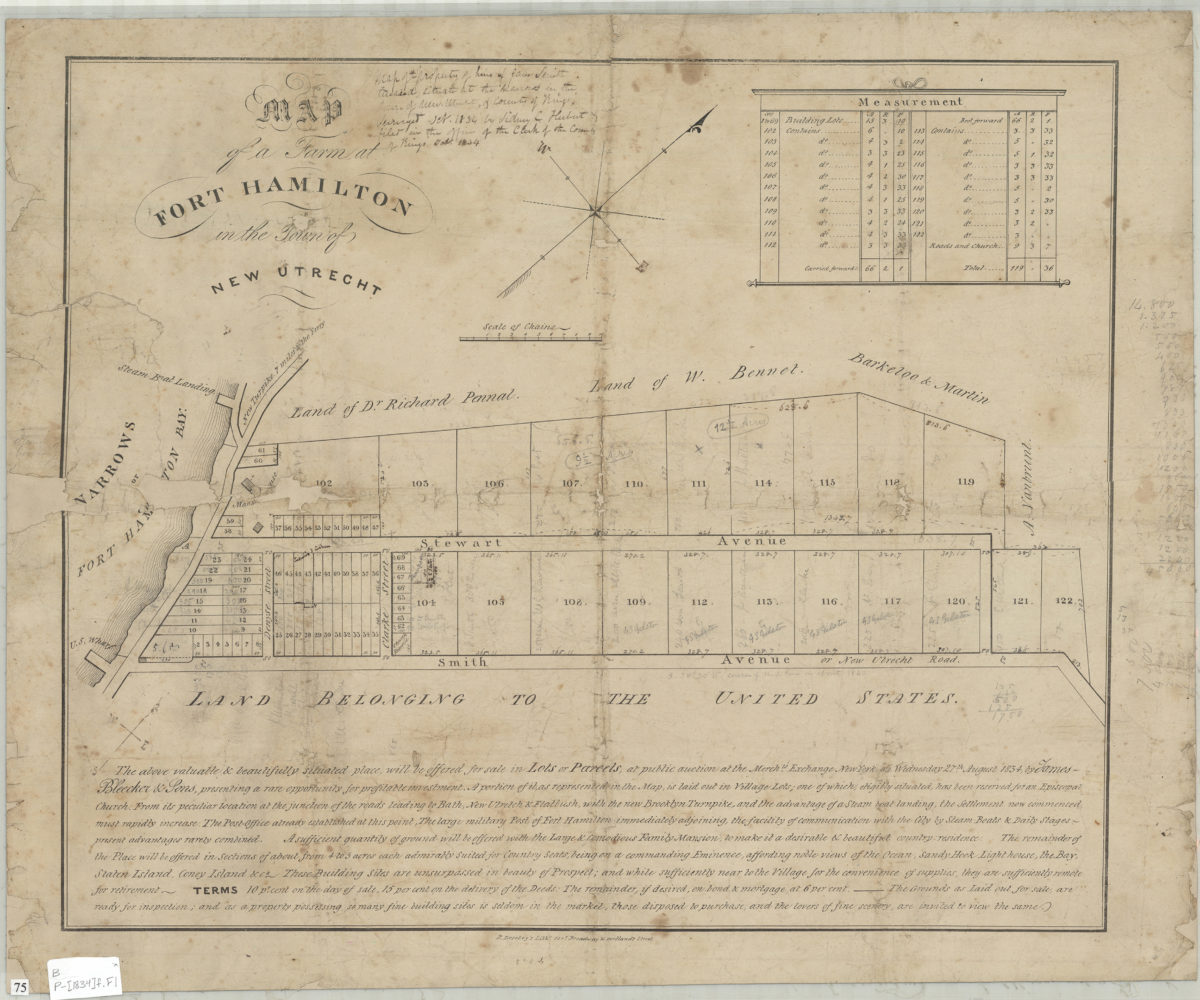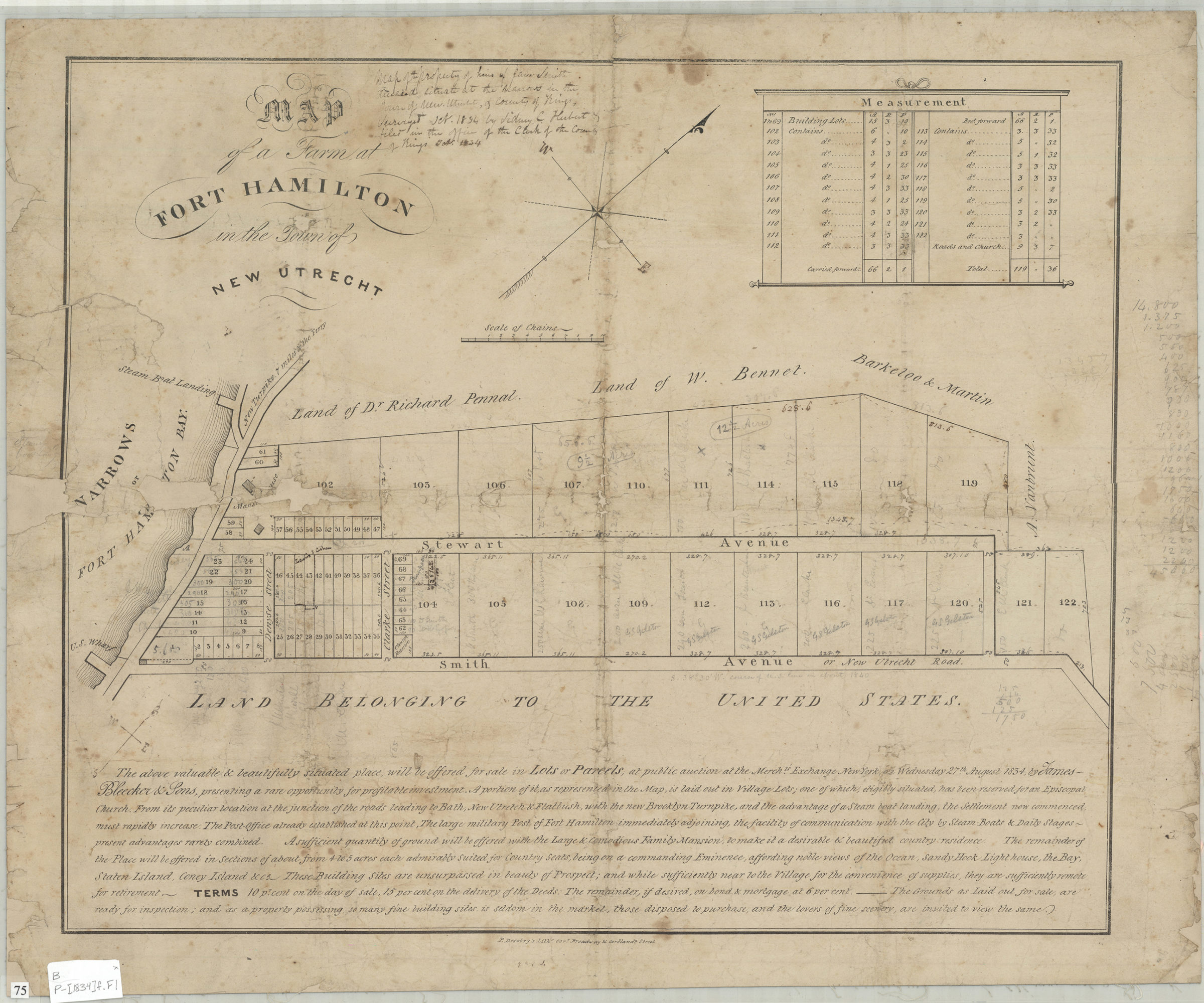

Map of a farm at Fort Hamilton in the town of New Utrecht [1834]
Map No. B P-[1834]f.Fl
Cadastral map covering Stewart Ave. and Smith Ave. at Clarke St. (modern-day Fort Hamilton). Shows property (including lot numbers, dimensions, and buildings), and names of landowners. Oriented with north to the upper right. Handwritten on recto: Surveyed Oct. 1834 by Sidney C. Herbert & filed in the office of the Clerk of the County of Kings, Oct. 1834. Includes text and measurement chart. BHS copy annotated in black ink and gray pencil.
Map area shown
Genre
Cadastral mapsRelation
Full catalog recordSize
43 × 51 cmDownload
Low Resolution Image
Creator
Herbert, S. C.; Desobry, Prosper, Herbert, S. C.; Desobry, Prosper,Publisher
Brooklyn Historical Society, Brooklyn Historical SocietyCitation
Map of a farm at Fort Hamilton in the town of New Utrecht; [1834], Map Collection, B P-[1834]f.Fl; Brooklyn Historical Society.Scale
Scale [ca. 1:3,168]Loading zoom image...