
Map of a farm belonging to the heirs of John Meserole, dec’d. (17th Ward, city of Brooklyn), Share H [18??]
Map No. B P-[18--?]o.Fl
Cadastral map covering area bounded by Nassau Ave., Dobbin St., Meserole Ave., and Smith St. (modern-day Greenpoint). Shows property (including lot numbers and dimensions). “Pease & Murphy (Jacob Meserole) share of the Capt. John Meserole Farm”–Verso. Oriented with north to the upper right.
Map area shown
Relation
Full catalog recordSize
63 × 84 cmDownload
Low Resolution Image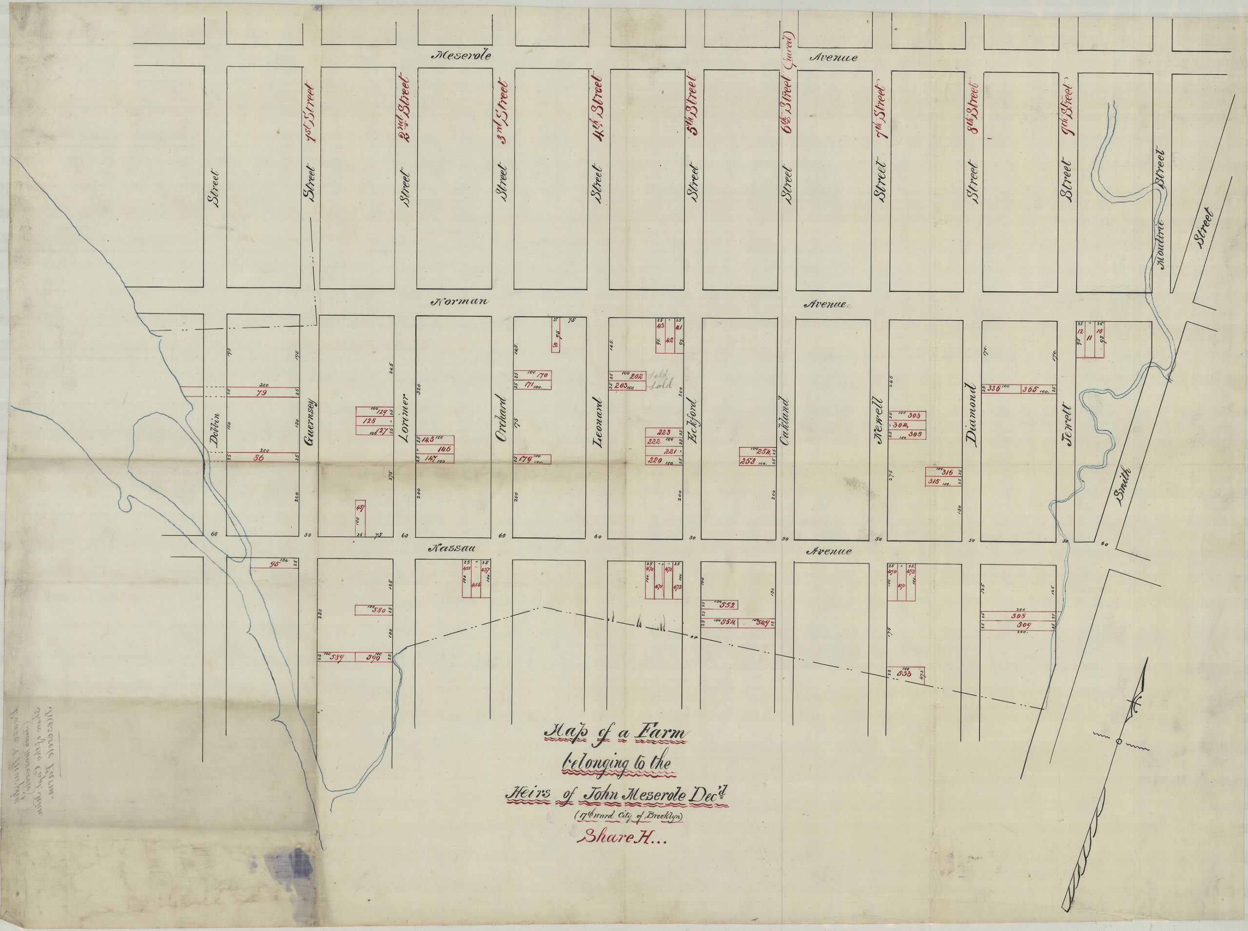
Creator
Publisher
Brooklyn Historical SocietyCitation
Map of a farm belonging to the heirs of John Meserole, dec’d. (17th Ward, city of Brooklyn), Share H; [18??], Map Collection, B P-[18--?]o.Fl; Brooklyn Historical Society.Scale
Scale not givenLoading zoom image... 