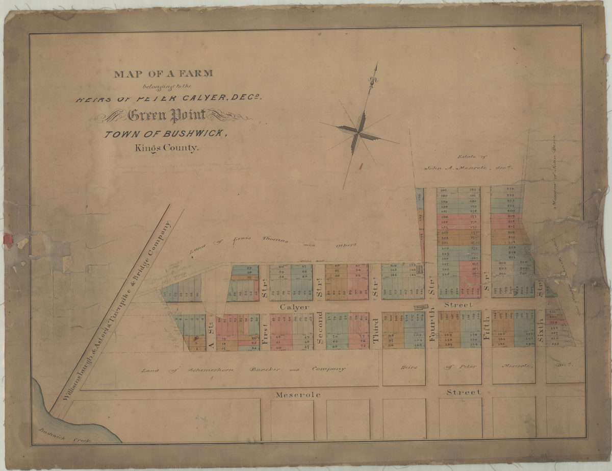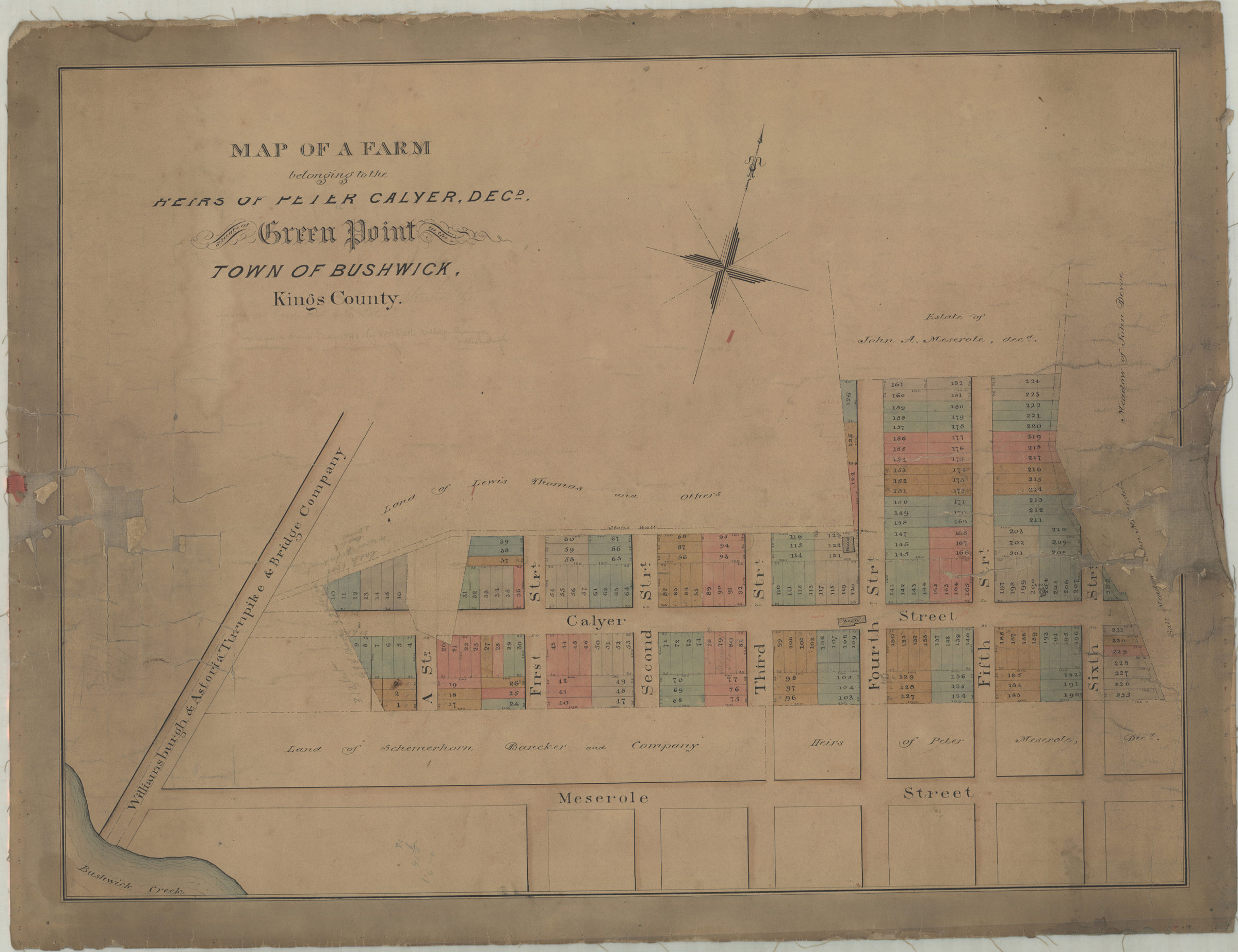
Map of a farm belonging to the heirs of Peter Calyer, decd., situate[d] at Green Point in the town of Bushwick, Kings County [1848]
Map No. B P-[1848?].Fl
Cadastral map covering area north from Bushwick Creek to approximately 2 blocks north of Calyer St. and east to 6th St. Shows property (including lot numbers and dimensions), names of property owners, buildings, and salt meadows. BHS copy annotated in gray pencil.
Map area shown
Genre
Cadastral mapsRelation
Full catalog recordSize
43 × 58 cmDownload
Low Resolution Image
Creator
Publisher
Brooklyn Historical SocietyCitation
Map of a farm belonging to the heirs of Peter Calyer, decd., situate[d] at Green Point in the town of Bushwick, Kings County; [1848], Map Collection, B P-[1848?].Fl; Brooklyn Historical Society.Scale
Scale not givenLoading zoom image...