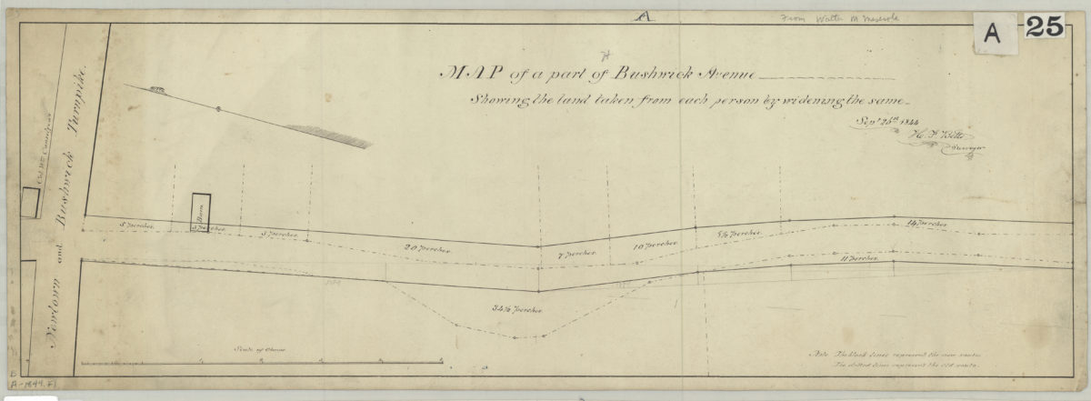
Map of a part of Bushwick Avenue, showing the land taken from each person by widening the same: [by] H.F. Betts, surveyor September 26, 1844
Map No. B A-1844.Fl
Shows Bushwick Ave. west of the Newtown and Bushwick Turnpike (likely modern-day Greenpoint). Oriented with north to the upper left. “The black lines represent the new route. The dotted lines represent the old route.”
Map area shown
Genre
Manuscript mapsRelation
Full catalog recordSize
23 × 68 cmDownload
Low Resolution Image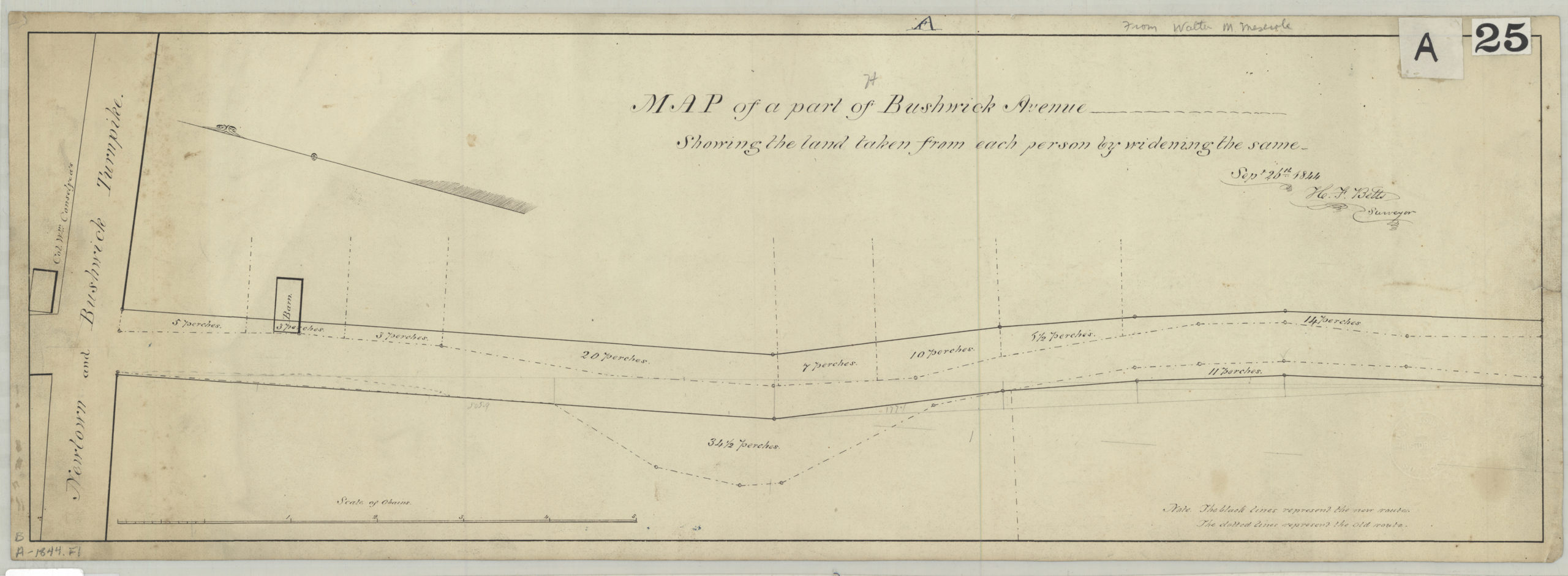
Creator
Betts, H. F.,Publisher
Brooklyn Historical SocietyCitation
Map of a part of Bushwick Avenue, showing the land taken from each person by widening the same: [by] H.F. Betts, surveyor; September 26, 1844, Map Collection, B A-1844.Fl; Brooklyn Historical Society.Scale
Scale [ca. 1:524]Loading zoom image...