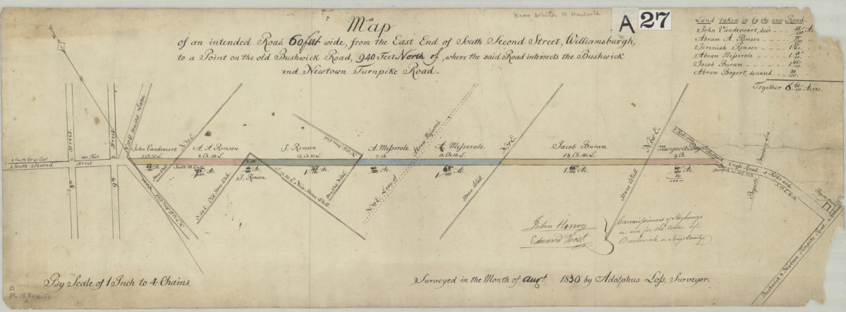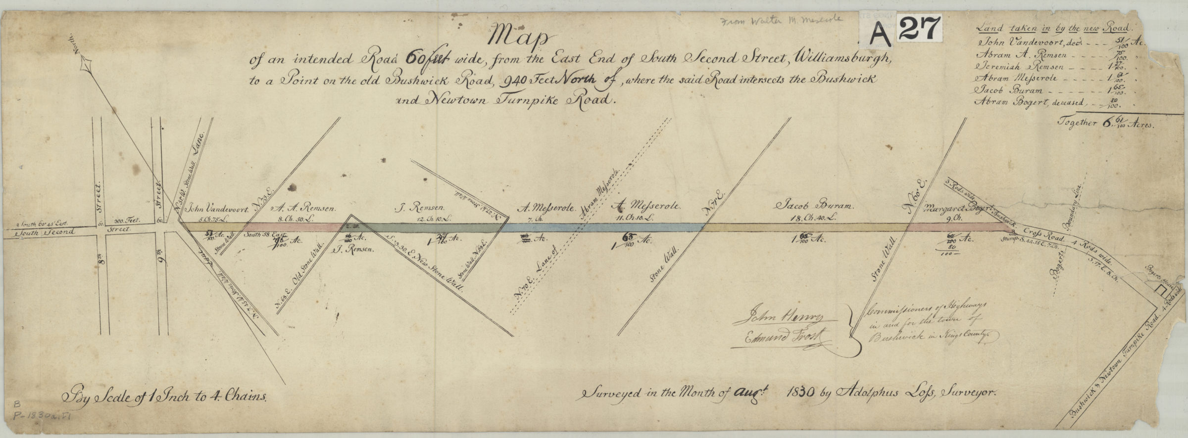
Map of an intended road 60 feet wide, from the east end of South Second Street, Williamsburgh, to a point on the old Bushwick Road, 940 feet north of where the said road interesects the Bushwick and Newtown Turnpike Road: surveyed by Adolphus Lofs August 1830
Map No. B P-1830a.Fl
Cadastral map covering area in modern-day Williamsburg. Shows the intended road and adjacent properties (including names of landowners). Oriented with north to the upper left. Includes chart of “land taken in by the new road” and signatures of Bushwick’s highway commissioners.
Map area shown
Relation
Full catalog recordSize
24 × 68 cmDownload
Low Resolution Image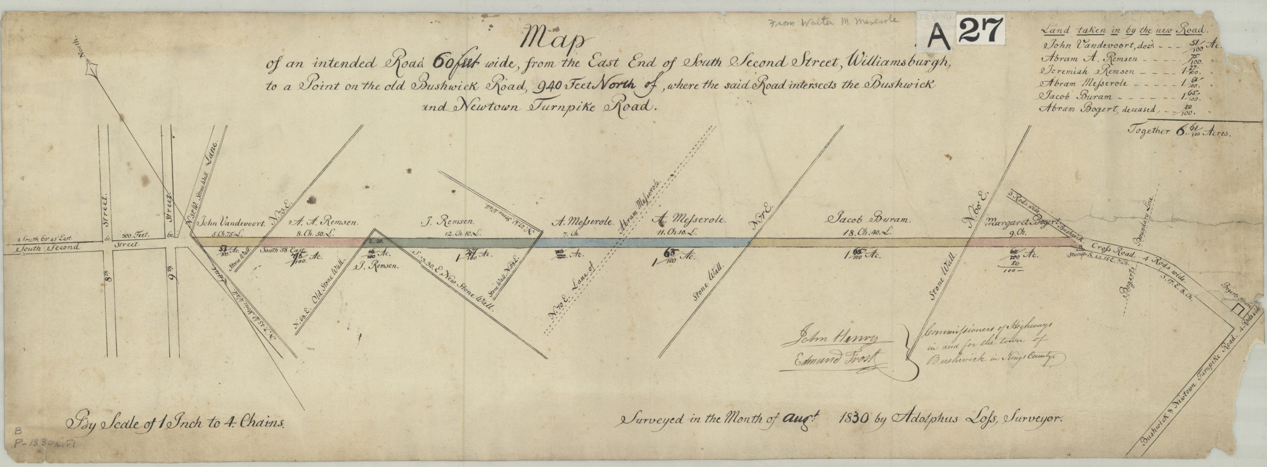
Creator
Lofs, Adolphus,Publisher
Brooklyn Historical SocietyCitation
Map of an intended road 60 feet wide, from the east end of South Second Street, Williamsburgh, to a point on the old Bushwick Road, 940 feet north of where the said road interesects the Bushwick and Newtown Turnpike Road: surveyed by Adolphus Lofs; August 1830, Map Collection, B P-1830a.Fl; Brooklyn Historical Society.Scale
Scale [1:3,168] 1 in to 4Loading zoom image...