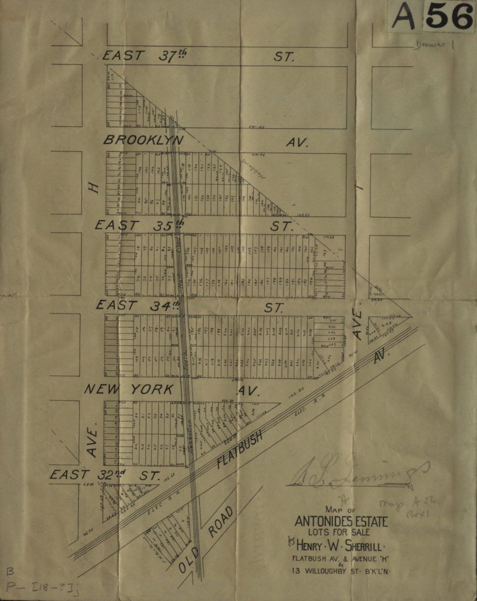
Map of Antonides Estate, lots for sale by Henry W. Sherrill, Flatbush Ave. & Avenue ‘H’ & 13 Willoughby St., B’K’L’N [189?]
Map No. B P-[189-?]c.Fl
Cadastral map covering area east from approximately E. 32nd St. to E. 37th St. and north from Ave. I to Ave. H (modern-day Flatlands). Shows property (including lot numbers and dimensions), and elevated railroads. Oriented with north to the left. On verso: Text.
Map area shown
Genre
Cadastral mapsRelation
Full catalog recordSize
31 × 25 cmDownload
Low Resolution Image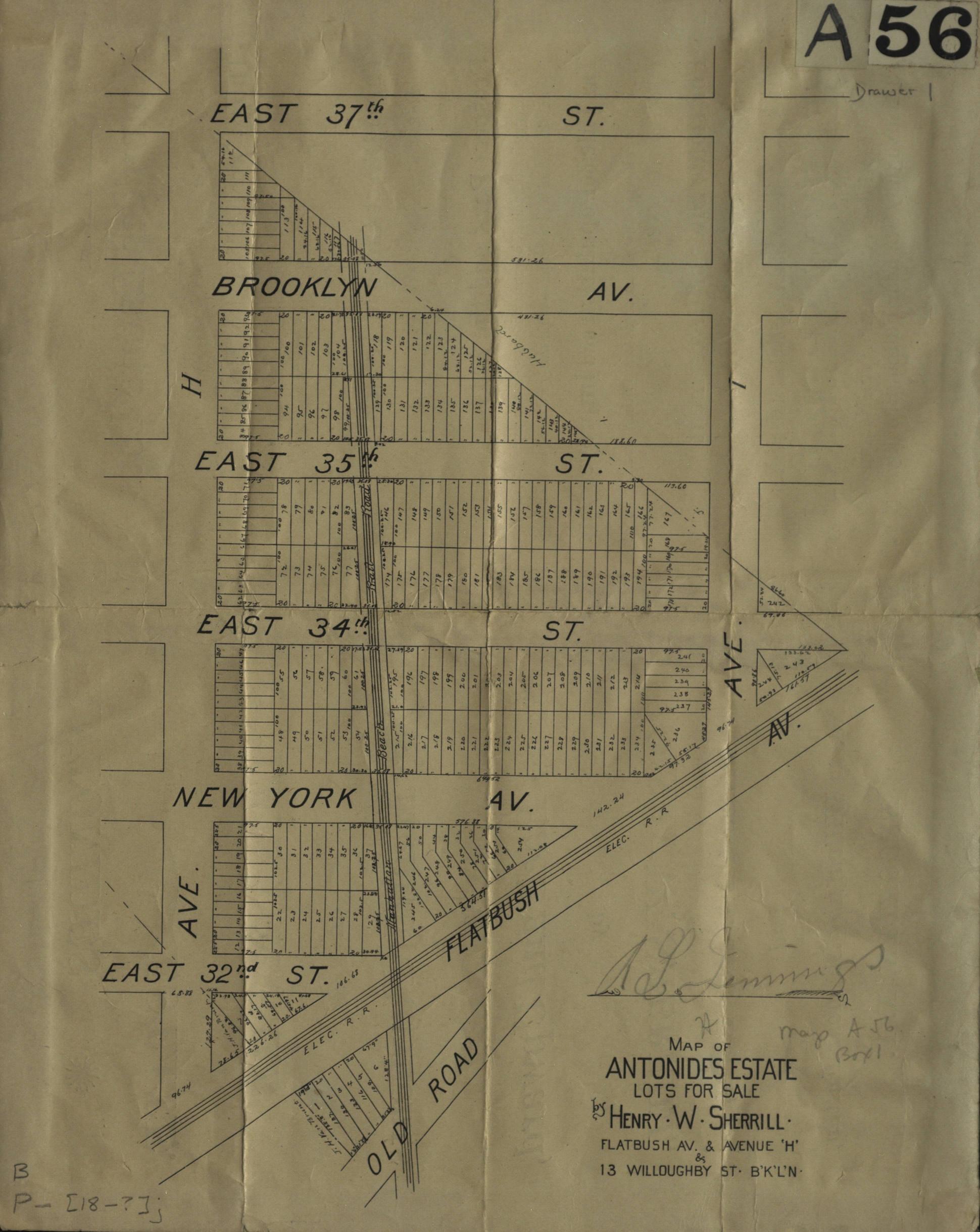
Creator
Scriven & Pagan (Firm),Publisher
Brooklyn Historical SocietyCitation
Map of Antonides Estate, lots for sale by Henry W. Sherrill, Flatbush Ave. & Avenue ‘H’ & 13 Willoughby St., B’K’L’N; [189?], Map Collection, B P-[189-?]c.Fl; Brooklyn Historical Society.Scale
Scale not givenLoading zoom image...