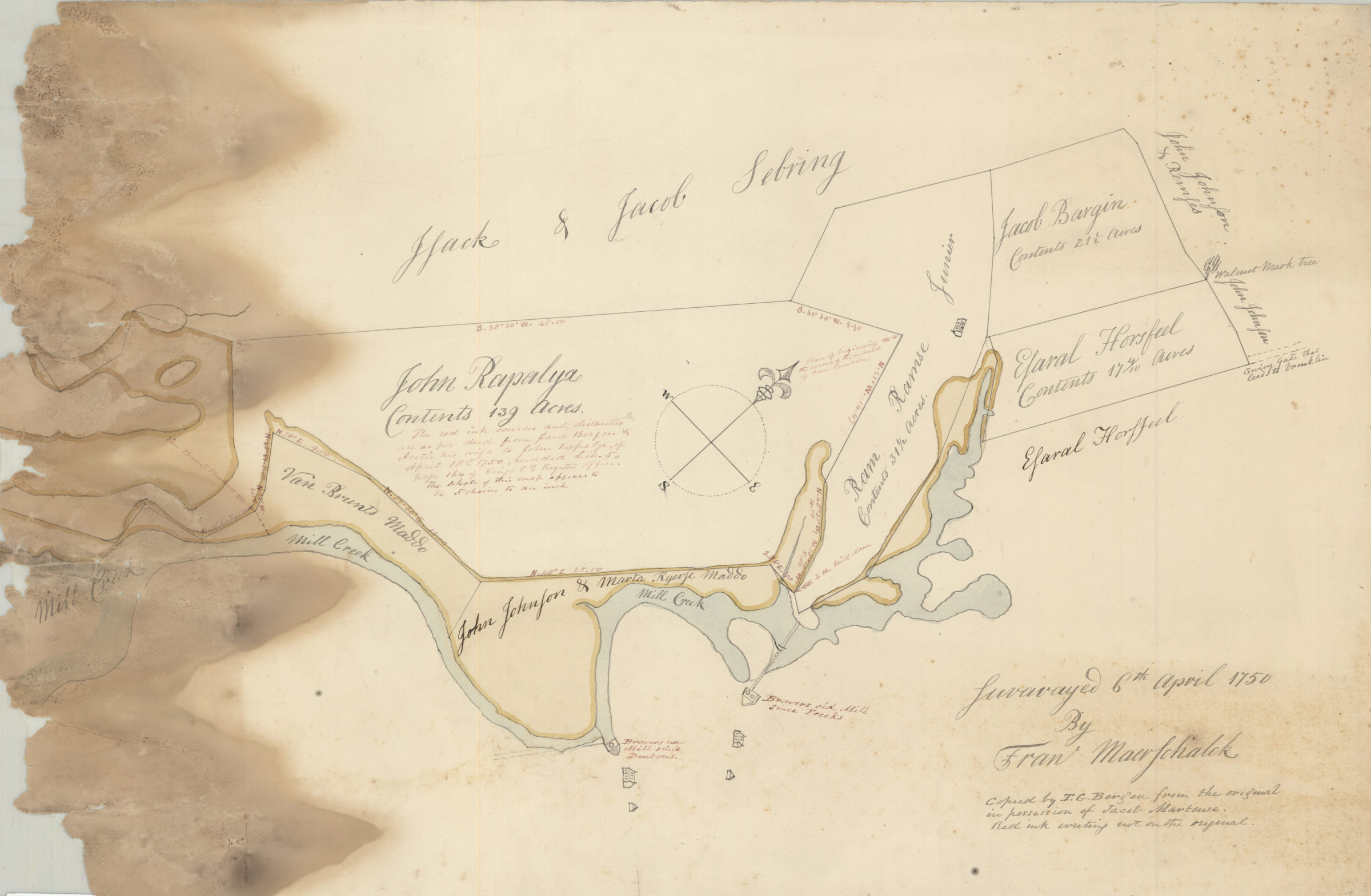
[Map of area around Gowanus Creek]: surveyed 6th April 1750 by Fran Maerschalck, copied by T. G. Bergen from the original in the possession of John Martense [18??]
Map No. Bergen-1750 (18--?).Fl
Cadastral map covering area surrounding part of creek identified as Mill Creek. Shows property, names of landowners, and structures. Title devised by cataloger. Includes notes by Teunis G. Bergen not on original map, in red ink. Identification of Mill Creek as Gowanus Creek based on text identifying sites of Freeks Mill and Dentons Mill. Oriented with north to the upper right.
Subjects
Places
Map area shown
Relation
Full catalog recordSize
39 × 60 cmDownload
Low Resolution Image
Creator
Maerschalck, Francis W.,Publisher
Brooklyn Historical SocietyCitation
[Map of area around Gowanus Creek]: surveyed 6th April 1750 by Fran Maerschalck, copied by T. G. Bergen from the original in the possession of John Martense; [18??], Map Collection, Bergen-1750 (18--?).Fl; Brooklyn Historical Society.Scale
Scale [1:3960] 1 in to 5Loading zoom image... 