
[Map of area bounded by 13th Ave., 64th St., 11th Ave., and 66th St.]. [189?]
Map No. Bergen-[189-?]b.Fl
Cadastral map covering area in modern-day Borough Park and Dyker Heights. Shows property (including lot numbers and dimensions). Titled devised by cataloger. Attibuted to Van Brunt Bergen, based on handwriting on piece. Oriented with north to the lower right.
Subjects
Places
Map area shown
Relation
Full catalog recordSize
33 × 60 cmDownload
Low Resolution Image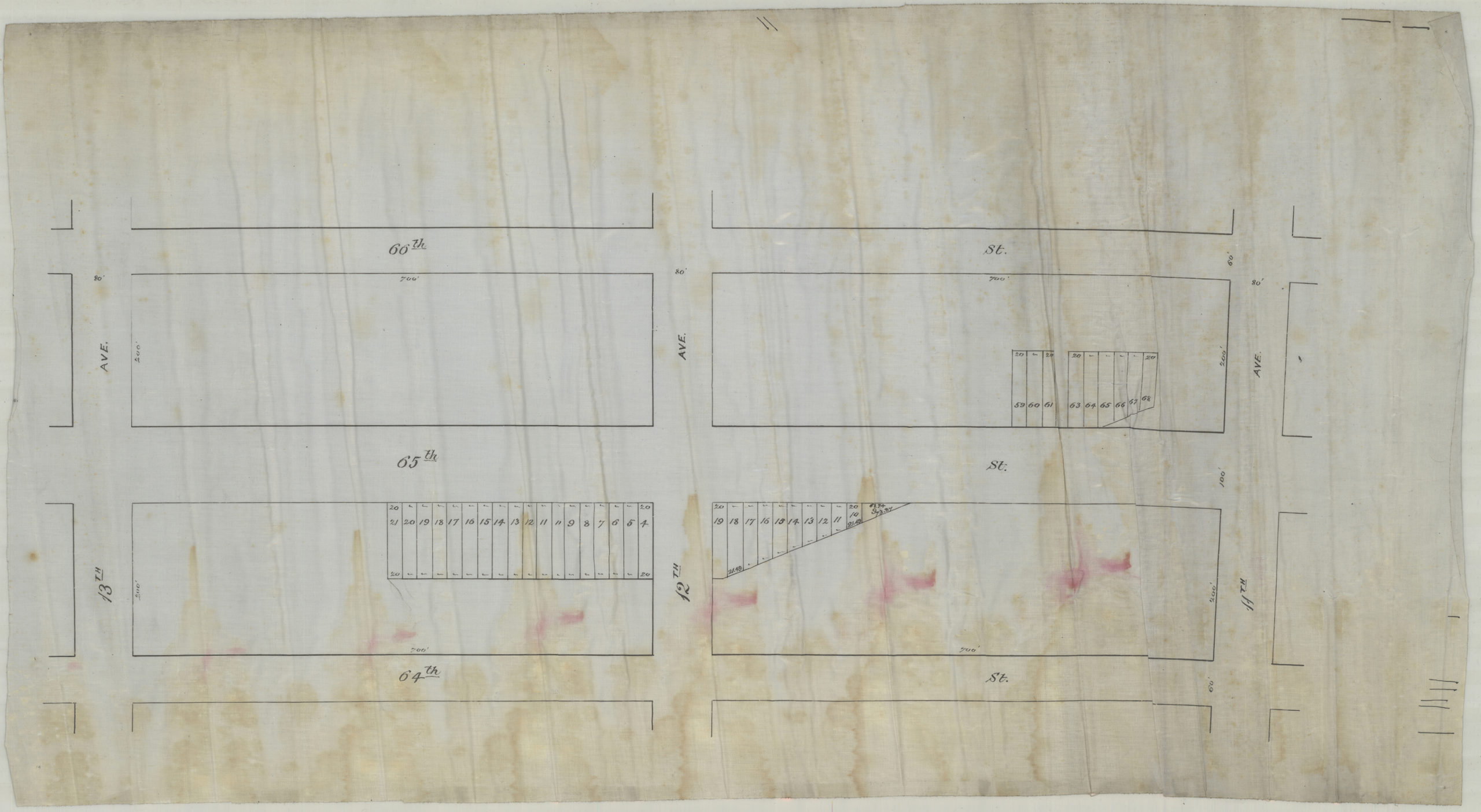
Creator
Bergen, Van Brunt,Publisher
Brooklyn Historical SocietyCitation
[Map of area bounded by 13th Ave., 64th St., 11th Ave., and 66th St.].; [189?], Map Collection, Bergen-[189-?]b.Fl; Brooklyn Historical Society.Scale
Scale not givenLoading zoom image... 