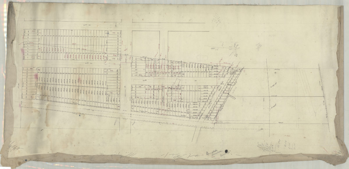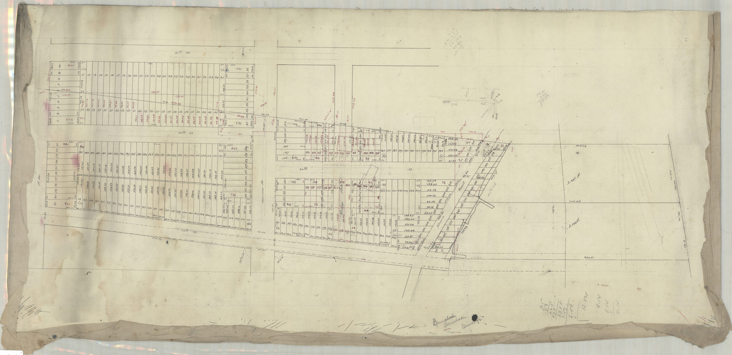
[Map of area bounded by 1st Ave., 79th St., Shore Rd., and 81st St.]. [189?]
Map No. Bergen-[189-?]e.Fl
Cadastral map covering area in modern-day Bay Ridge. Shows property (including lot numbers and dimensions). Title devised by cataloger. Oriented with north to the bottom. Likely attributed to Van Brunt Bergen, based on handwriting on piece. “J. Van Brunt”–Verso. Cataloger unable to determine J. Van Brunt’s relationship to map.
Map area shown
Relation
Full catalog recordSize
49 × 102 cmDownload
Low Resolution Image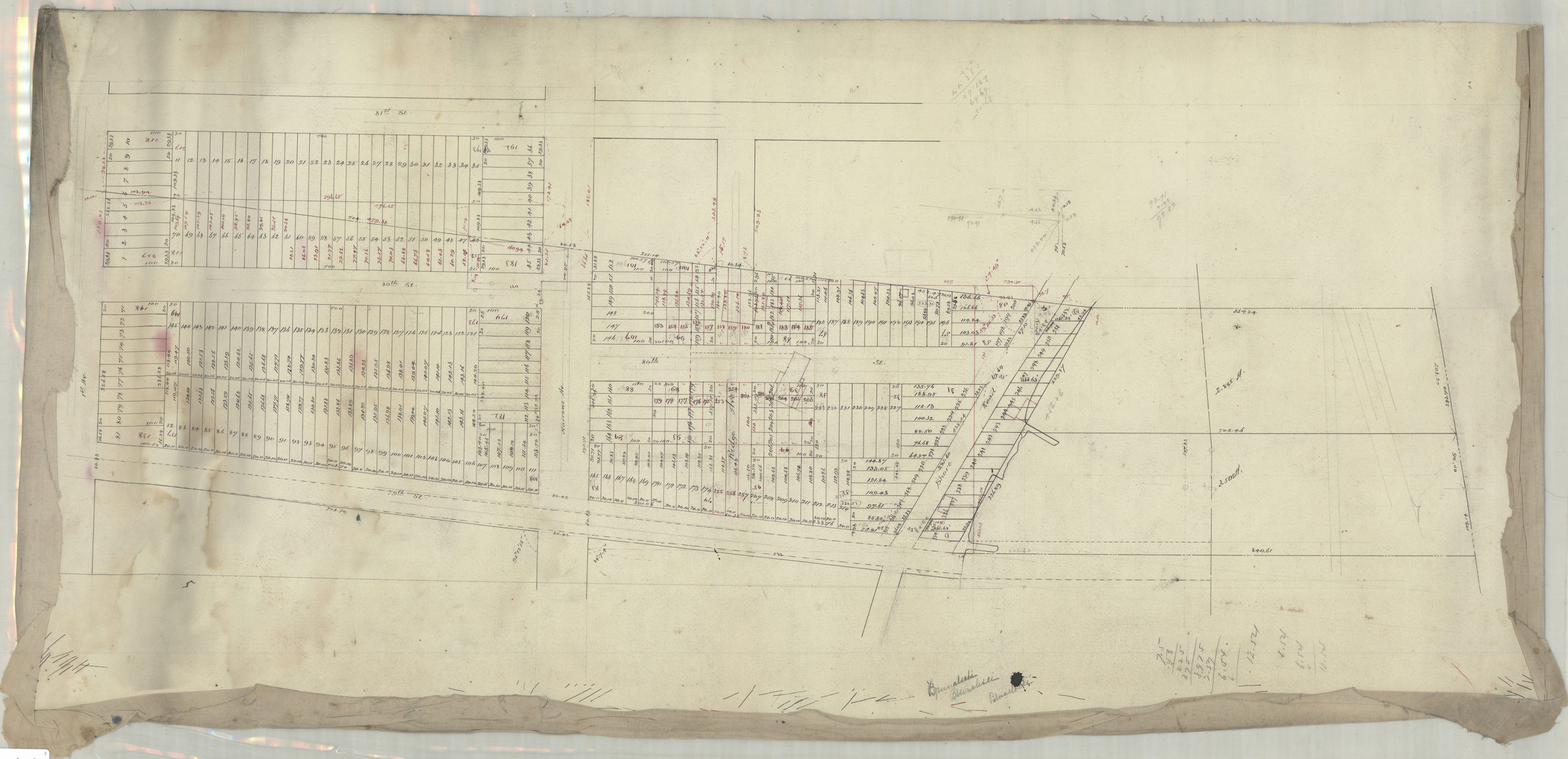
Creator
Bergen, Van Brunt,Publisher
Brooklyn Historical SocietyCitation
[Map of area bounded by 1st Ave., 79th St., Shore Rd., and 81st St.].; [189?], Map Collection, Bergen-[189-?]e.Fl; Brooklyn Historical Society.Scale
Scale not givenLoading zoom image...