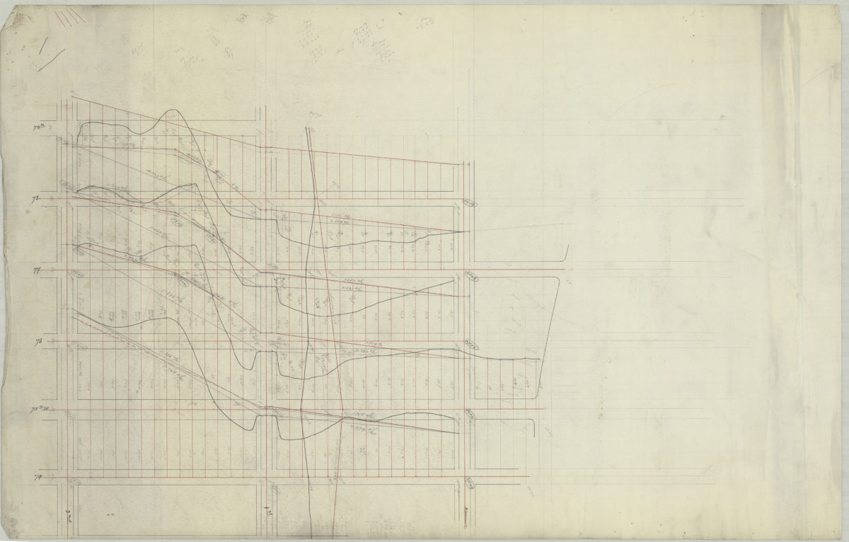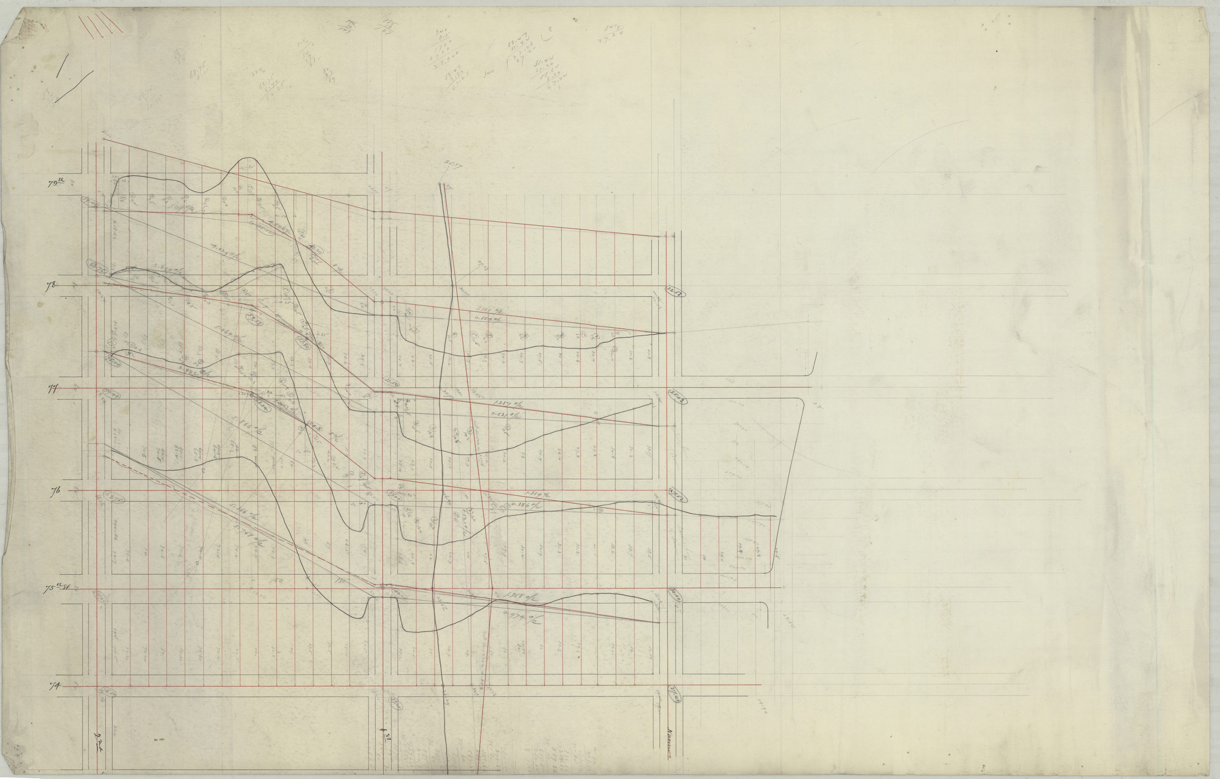
[Map of area bounded by 2nd Ave., 74th St., Narrows Ave, and 79th St.]. [1892]
Map No. Bergen-[1892?]d.Fl
Survey map covering area in modern-day Bay Ridge. Title devised by cataloger. Likely attributed to Van Brunt Bergen, based on handwriting on piece. Oriented with north to the bottom. Date of publication conjectured from watermark. Watermark: Crane & Co. Dalton Mass 1892 Bond No 29. Includes calculations.
Map area shown
Genre
Manuscript mapsRelation
Full catalog recordSize
54 × 84 cmDownload
Low Resolution Image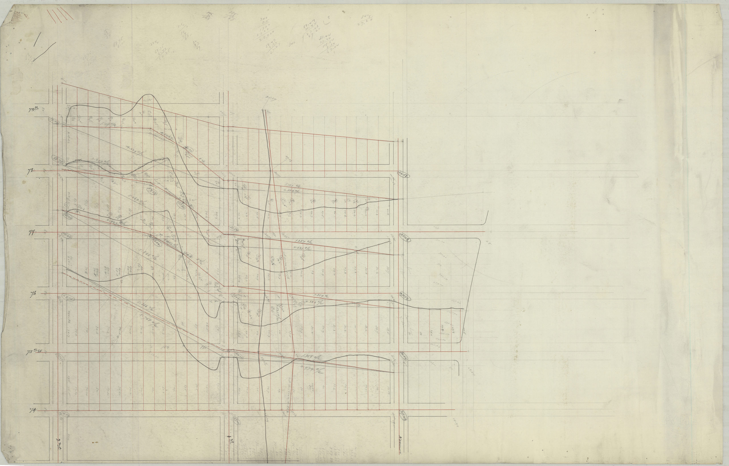
Creator
Bergen, Van Brunt,Publisher
Brooklyn Historical SocietyCitation
[Map of area bounded by 2nd Ave., 74th St., Narrows Ave, and 79th St.].; [1892], Map Collection, Bergen-[1892?]d.Fl; Brooklyn Historical Society.Scale
Scale not givenLoading zoom image...