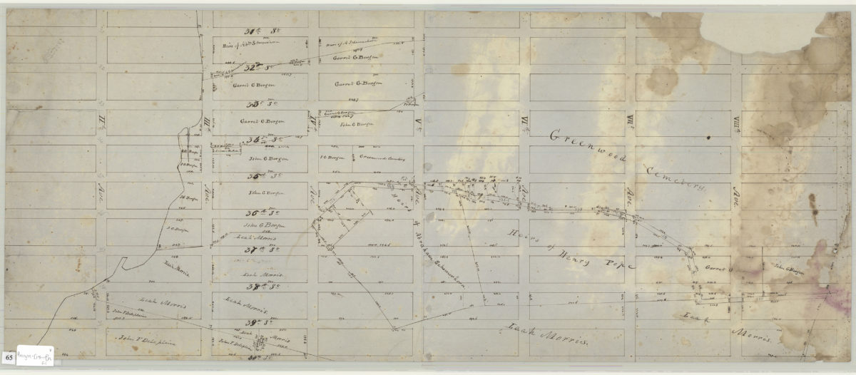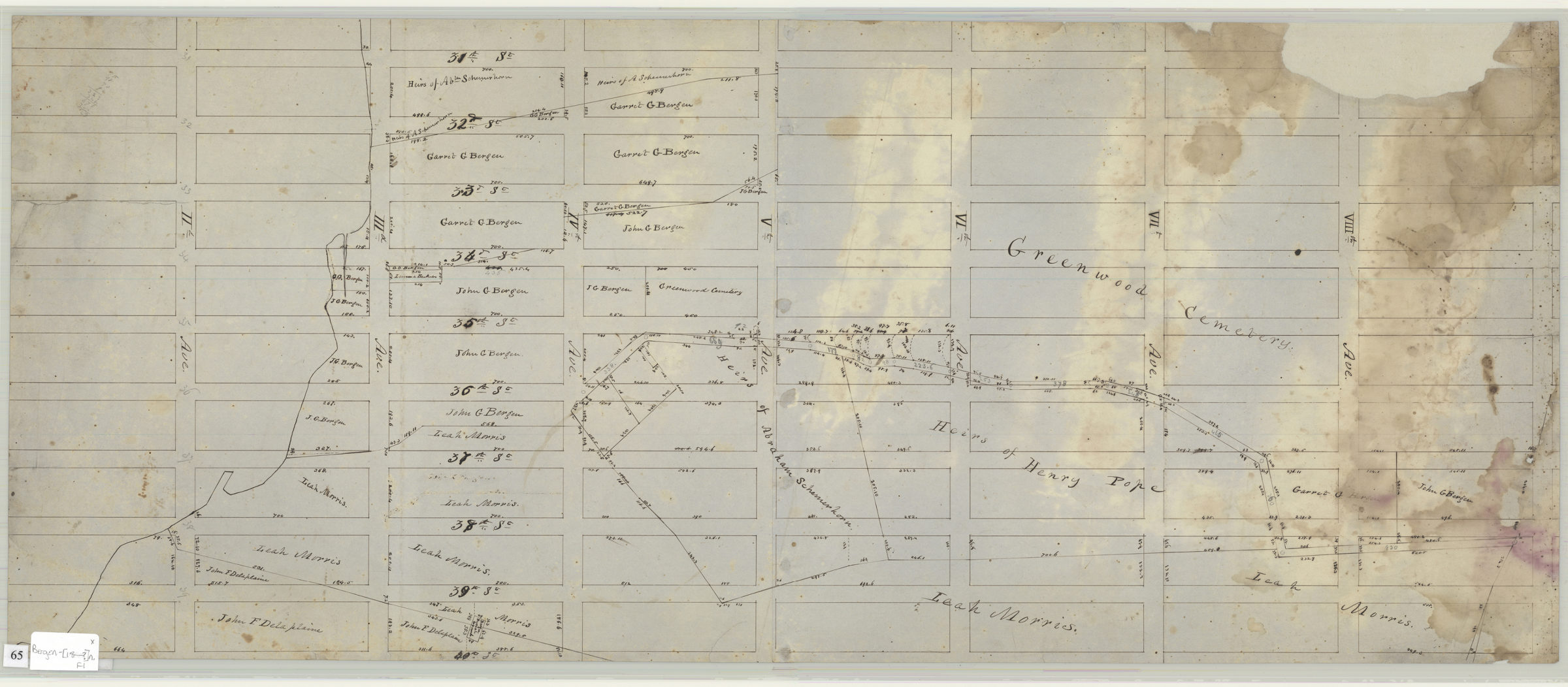
[Map of area bounded by 31st Street, 8th Avenue, 40th Street and 2nd Avenue] [18??]
Map No. Bergen-[18--?]n.Fl
Cadastral map covering a portion of modern-day Sunset Park. Shows property and names of landowners. Title devised by cataloger. Likely attributed to Teunis G. Bergen, based on handwriting on piece.
Map area shown
Relation
Full catalog recordSize
33 × 79 cmDownload
Low Resolution Image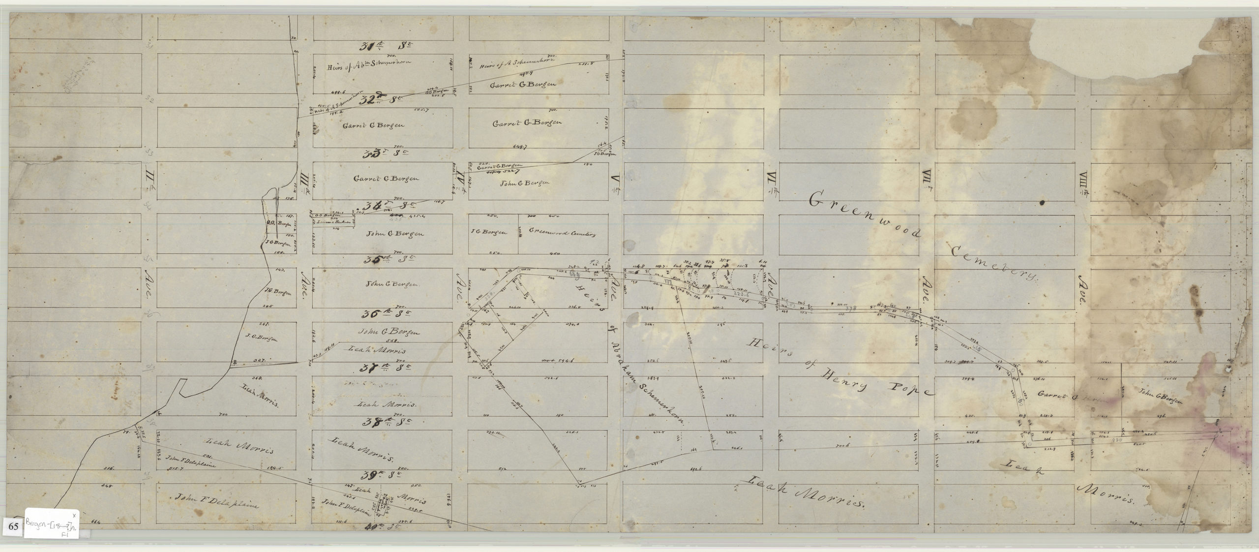
Creator
Bergen, Teunis G.,Publisher
Brooklyn Historical SocietyCitation
[Map of area bounded by 31st Street, 8th Avenue, 40th Street and 2nd Avenue]; [18??], Map Collection, Bergen-[18--?]n.Fl; Brooklyn Historical Society.Scale
Scale not givenLoading zoom image...