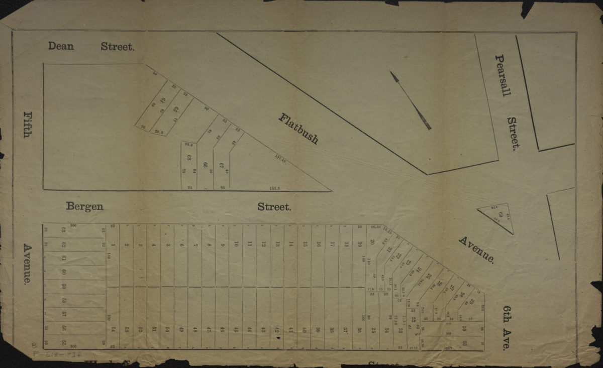
[Map of area bounded by 5th Ave., Dean St., Pearsall St., and Wyckoff St.]. [18??]
Map No. B P-[18--?]f.Fl
Cadastral map covering portions of modern-day Park Slope and Prospect Heights. Shows property (including lot numbers and dimensions). Extracted from a larger map? Title devised by cataloger. Oriented with north to the upper left.
Subjects
Places
Map area shown
Genre
Cadastral mapsRelation
Full catalog recordSize
30 × 49 cmDownload
Low Resolution Image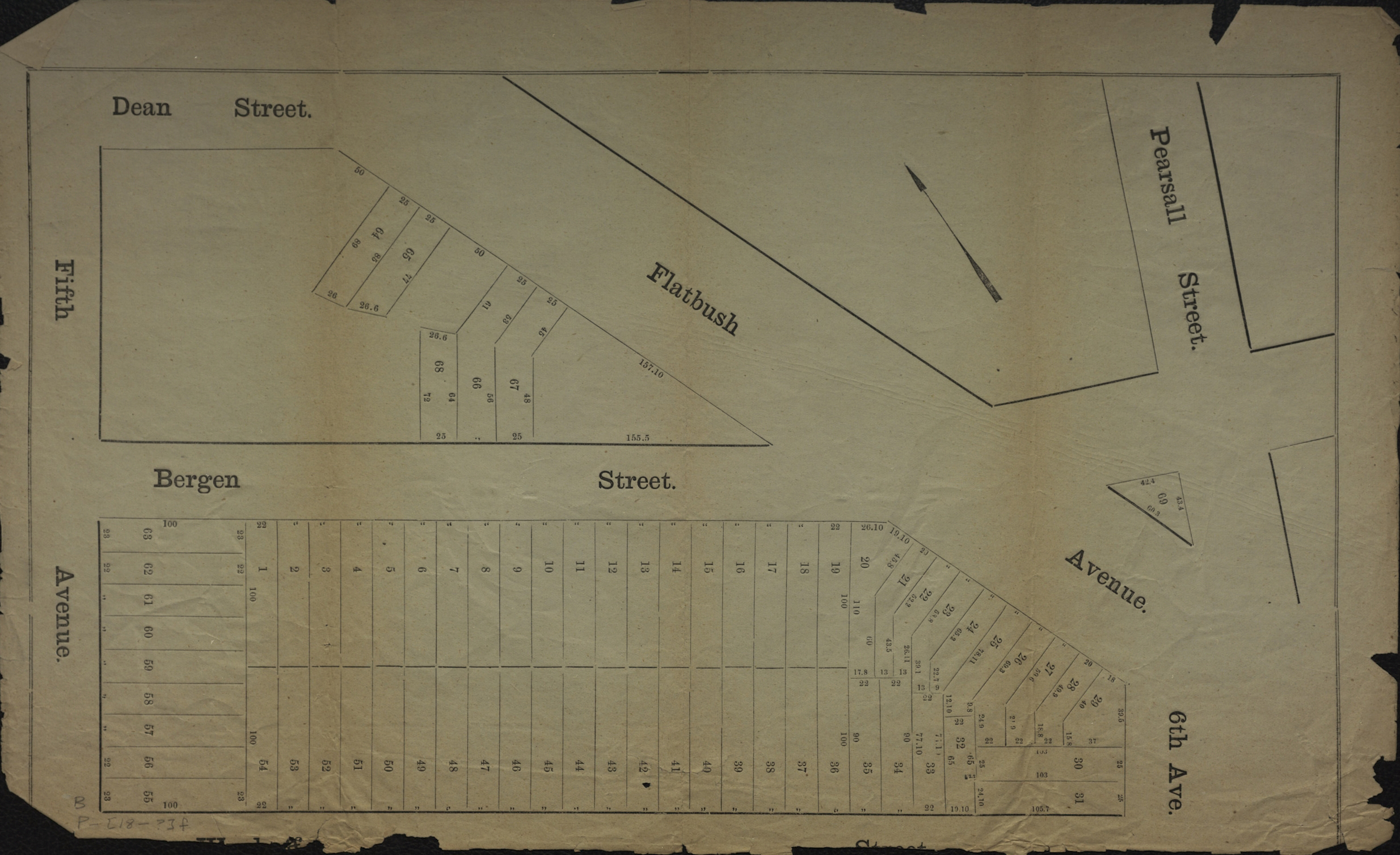
Creator
Publisher
Brooklyn Historical SocietyCitation
[Map of area bounded by 5th Ave., Dean St., Pearsall St., and Wyckoff St.].; [18??], Map Collection, B P-[18--?]f.Fl; Brooklyn Historical Society.Scale
Scale not givenLoading zoom image...