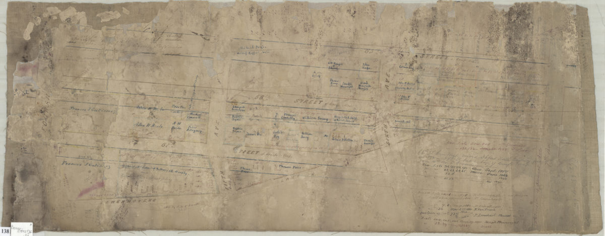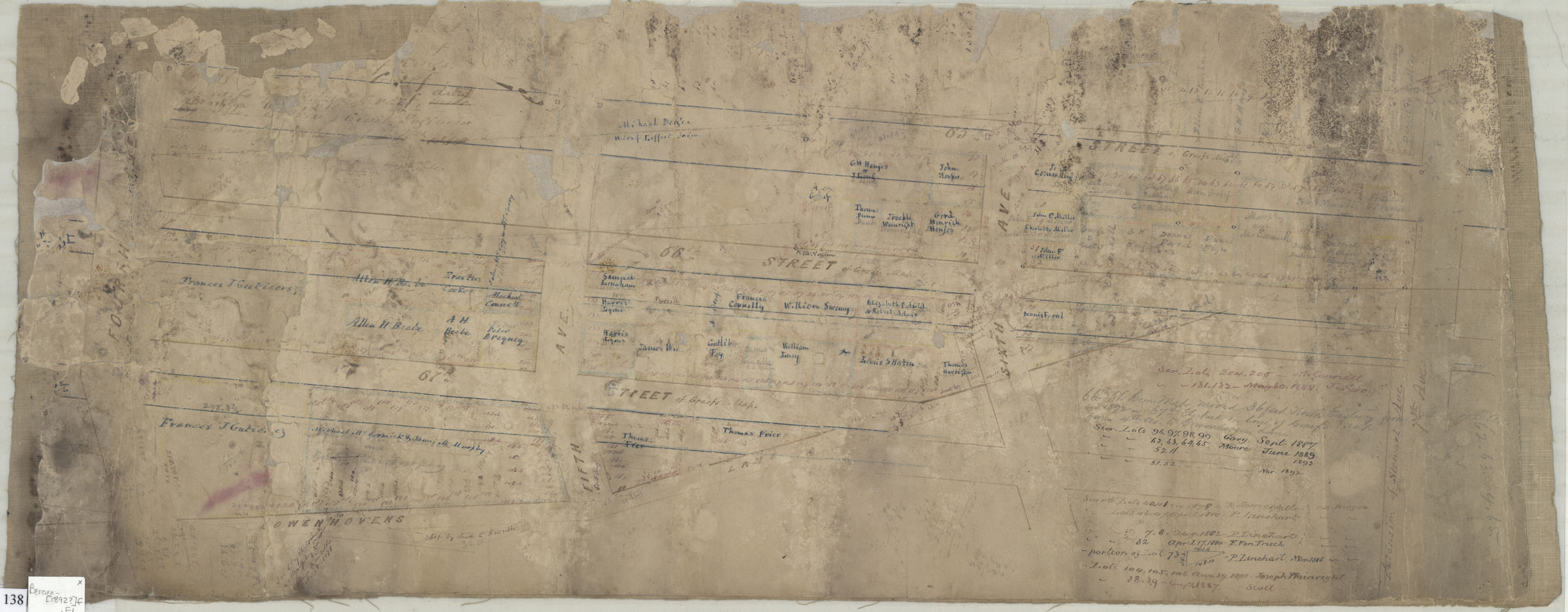
[Map of area bounded by 66th Street, 7th Avenue, Cowenhovens Lane, and 4th Avenue] [ca. 1892]
Map No. Bergen-[1892?]f.Fl
Cadastral map covering area bounded by in modern-day Bay Ridge. Shows streets, property and names of landowners. Title devised by cataloger. Attributed to Van Brunt Bergen, based on handwriting on piece. Includes notes and calculations.
Map area shown
Relation
Full catalog recordSize
27 × 69 cmDownload
Low Resolution Image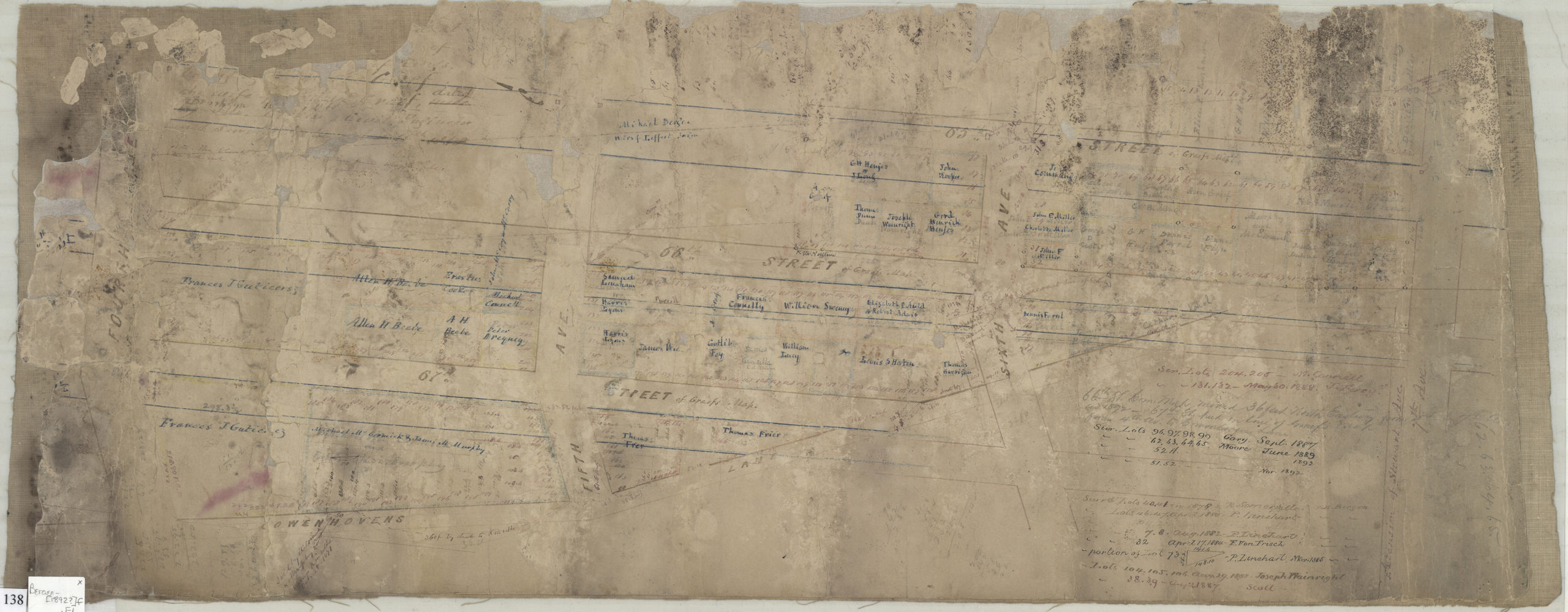
Creator
Bergen, Van Brunt,Publisher
Brooklyn Historical SocietyCitation
[Map of area bounded by 66th Street, 7th Avenue, Cowenhovens Lane, and 4th Avenue]; [ca. 1892], Map Collection, Bergen-[1892?]f.Fl; Brooklyn Historical Society.Scale
Scale not givenLoading zoom image...