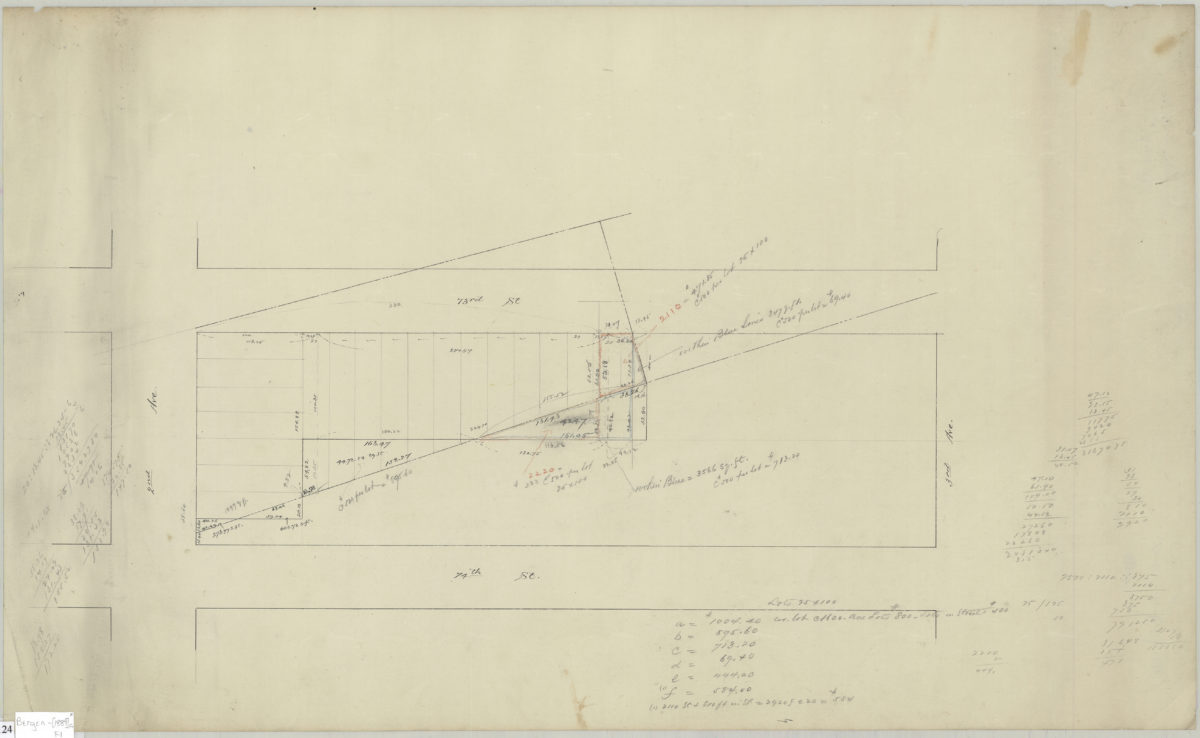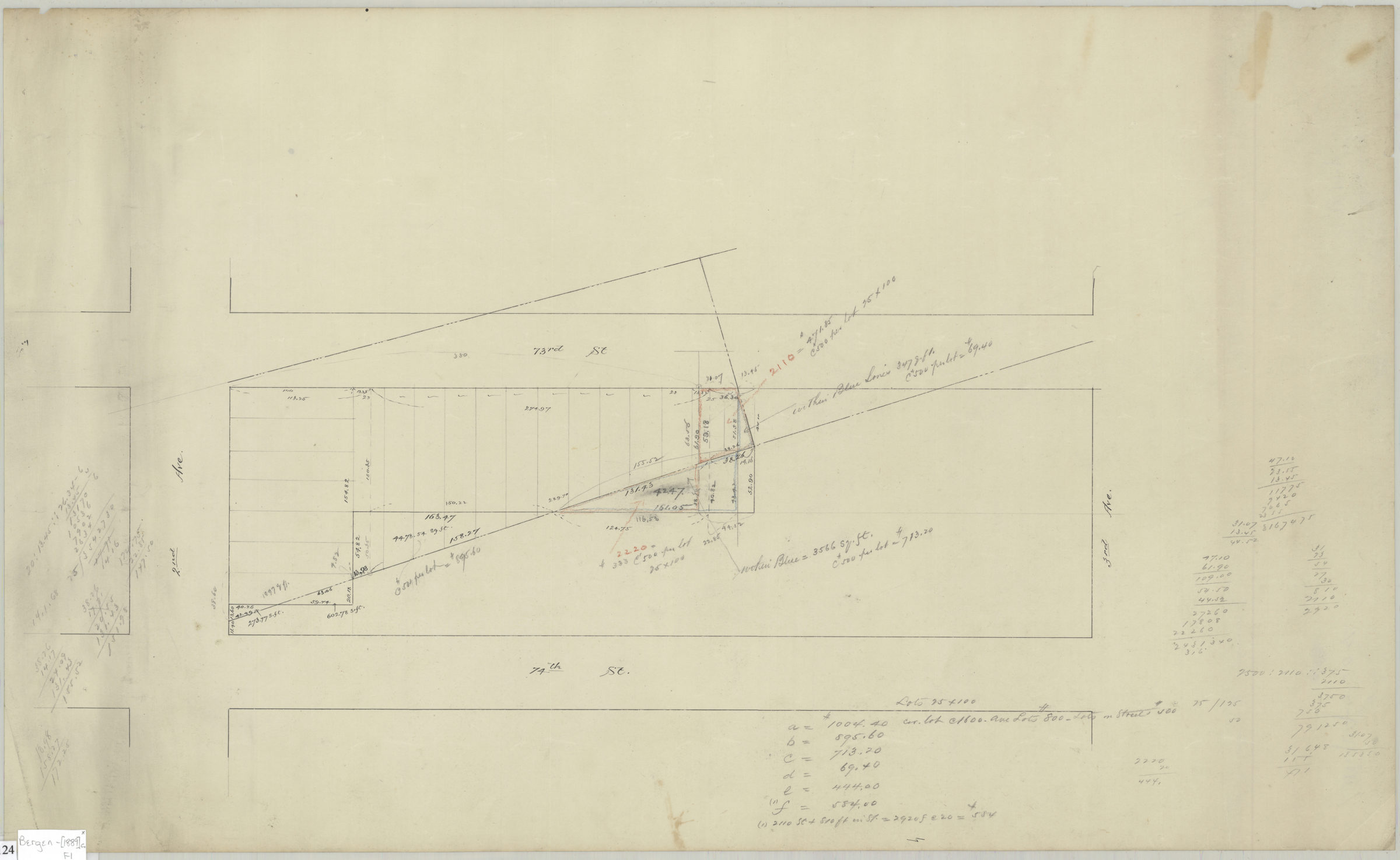
[Map of area bounded by 73rd Street, 3rd Avenue, 74th Street, and 2nd Avenue] [ca. 1889]
Map No. Bergen-[1889]c.Fl
Cadastral map covering area bounded by 73rd Street, 3rd Avenue, 74th Street, and 2nd Avenue in modern-day Bay Ridge. Shows streets, property and lots (including dimensions). Title devised by cataloger. Attributed to Van Brunt Bergen, based on handwriting on piece. Includes calculations. Watermark: Crane & Co., Dalton, Mass., 1889. Bond no. 29.
Map area shown
Relation
Full catalog recordSize
43 × 71 cmDownload
Low Resolution Image
Creator
Bergen, Van Brunt,Publisher
Brooklyn Historical SocietyCitation
[Map of area bounded by 73rd Street, 3rd Avenue, 74th Street, and 2nd Avenue]; [ca. 1889], Map Collection, Bergen-[1889]c.Fl; Brooklyn Historical Society.Scale
Scale not givenLoading zoom image...