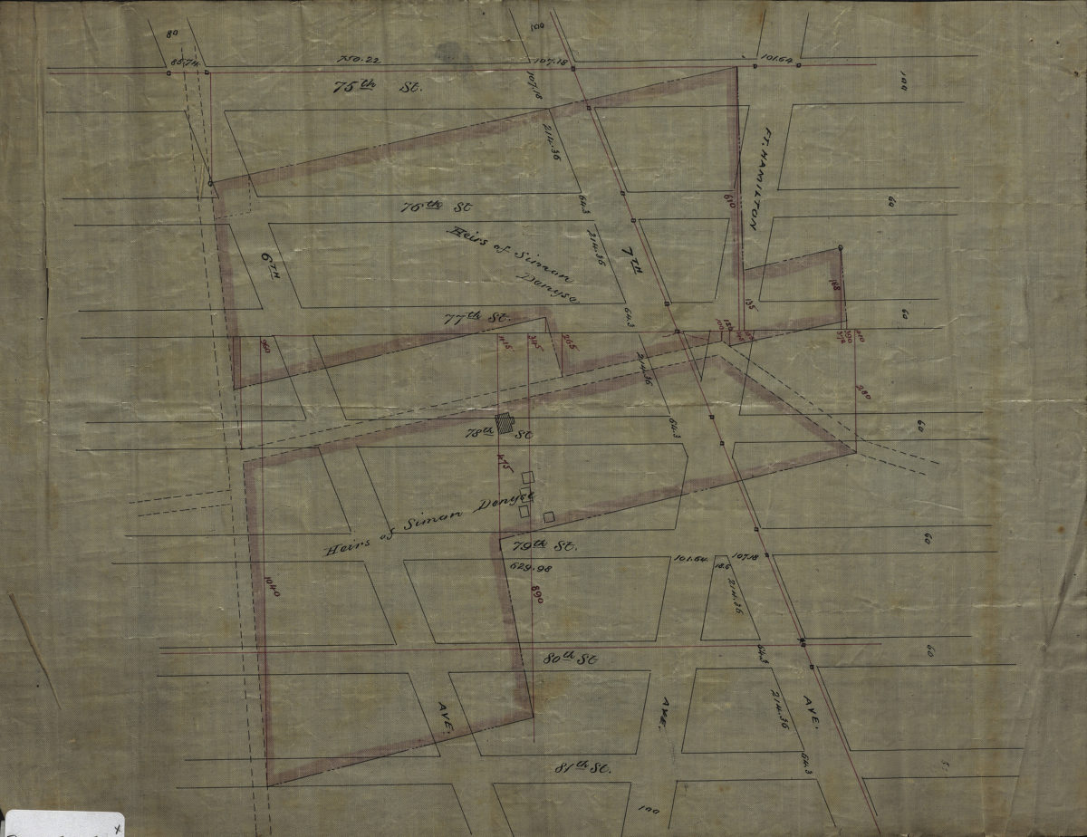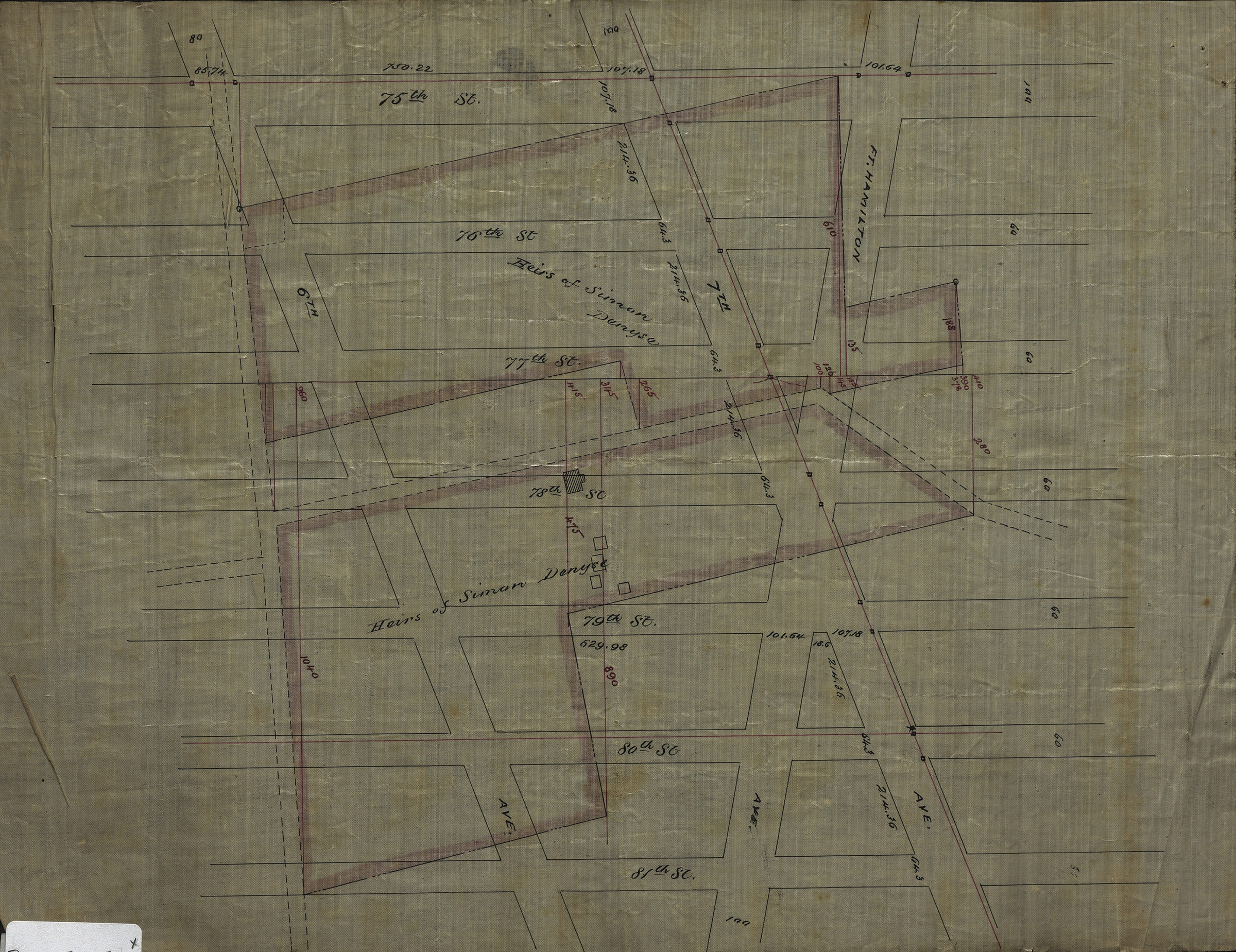
[Map of area bounded by 81st St., Fort Hamilton Ave., 75th St., and 6th Ave.]. [189?]
Map No. Bergen-[189-?]a.Fl
Cadastral map covering area in modern-day Bay Ridge and Dyker Heights. Shows property (including buildings and dimensions), and land of the heirs of Simon Denyse. Title devised by cataloger. Likely attributed to Van Brunt Bergen, based on handwriting.
Subjects
Places
Map area shown
Relation
Full catalog recordSize
25 × 32 cmDownload
Low Resolution Image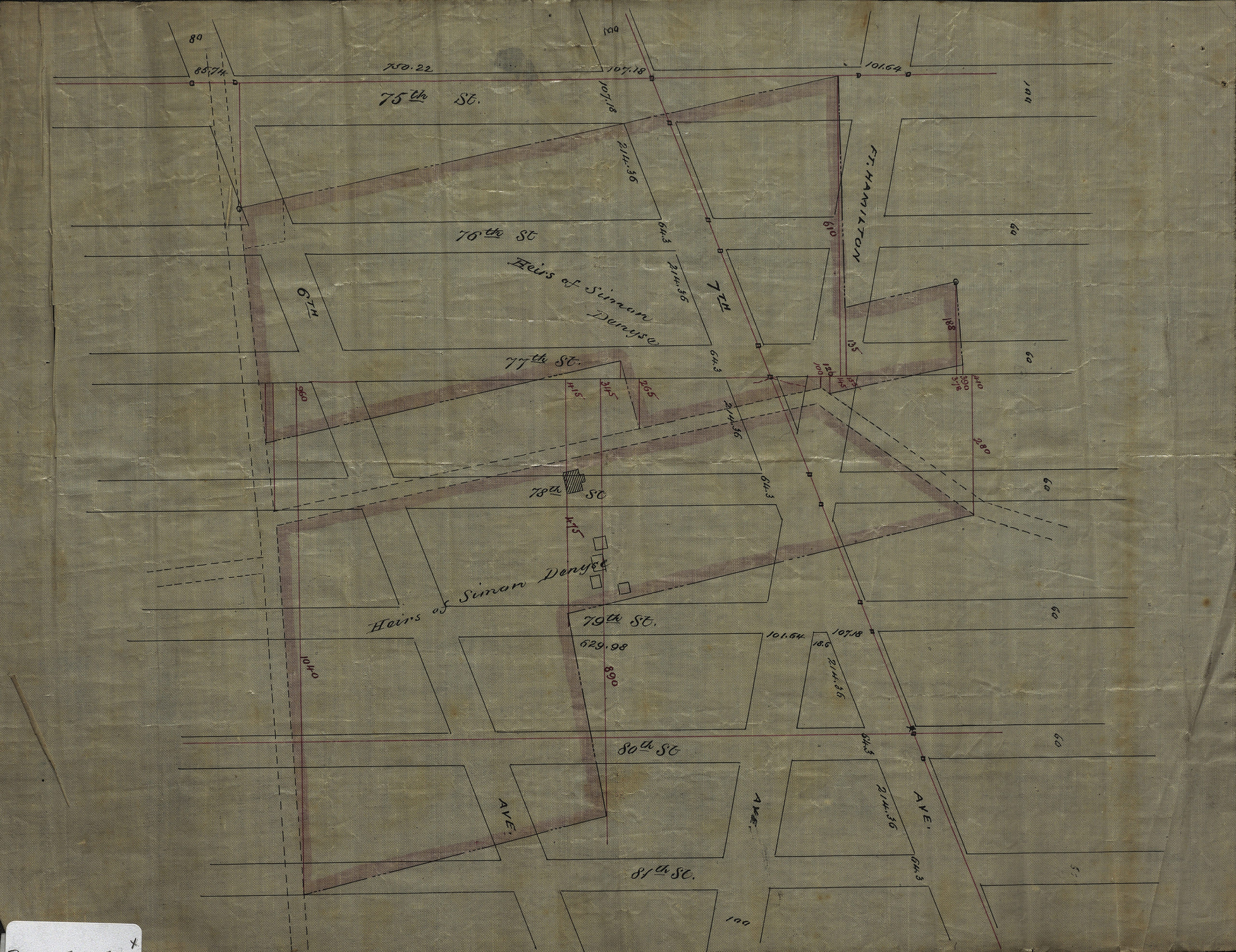
Creator
Bergen, Van Brunt,Publisher
Brooklyn Historical SocietyCitation
[Map of area bounded by 81st St., Fort Hamilton Ave., 75th St., and 6th Ave.].; [189?], Map Collection, Bergen-[189-?]a.Fl; Brooklyn Historical Society.Scale
Scale not givenLoading zoom image...