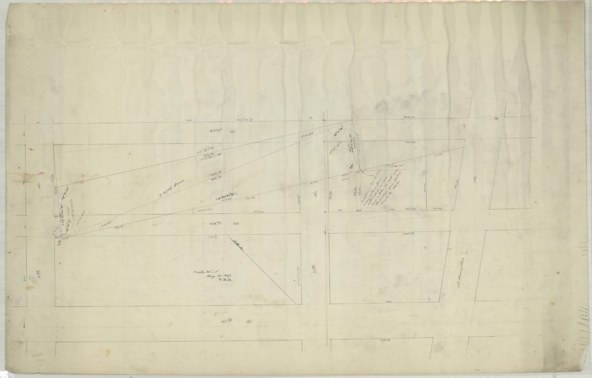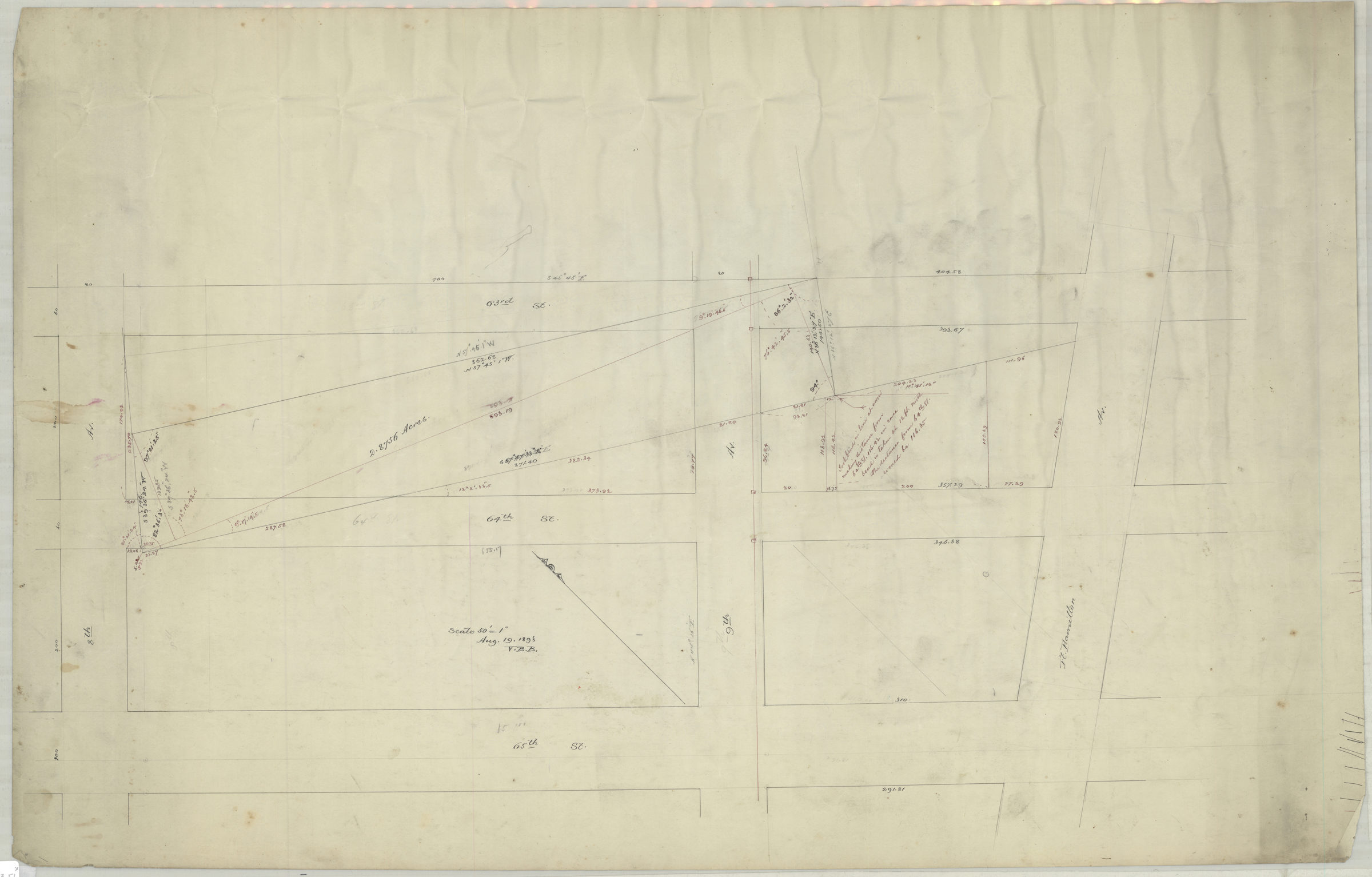
[Map of area bounded by 8th Ave., 65th St., Fort Hamilton Ave., and 63rd St.]: V.B.B. [Van Brunt Bergen] August 19, 1893
Map No. Bergen-1893.Fl
Survey map covering area in modern-day Bay Ridge and Sunset Park. Title devised by cataloger. Includes notes and calculations. Watermark: Crane & Co Dalton Mass 1892 Bond No 92.
Map area shown
Genre
Manuscript mapsRelation
Full catalog recordSize
54 × 83 cmDownload
Low Resolution Image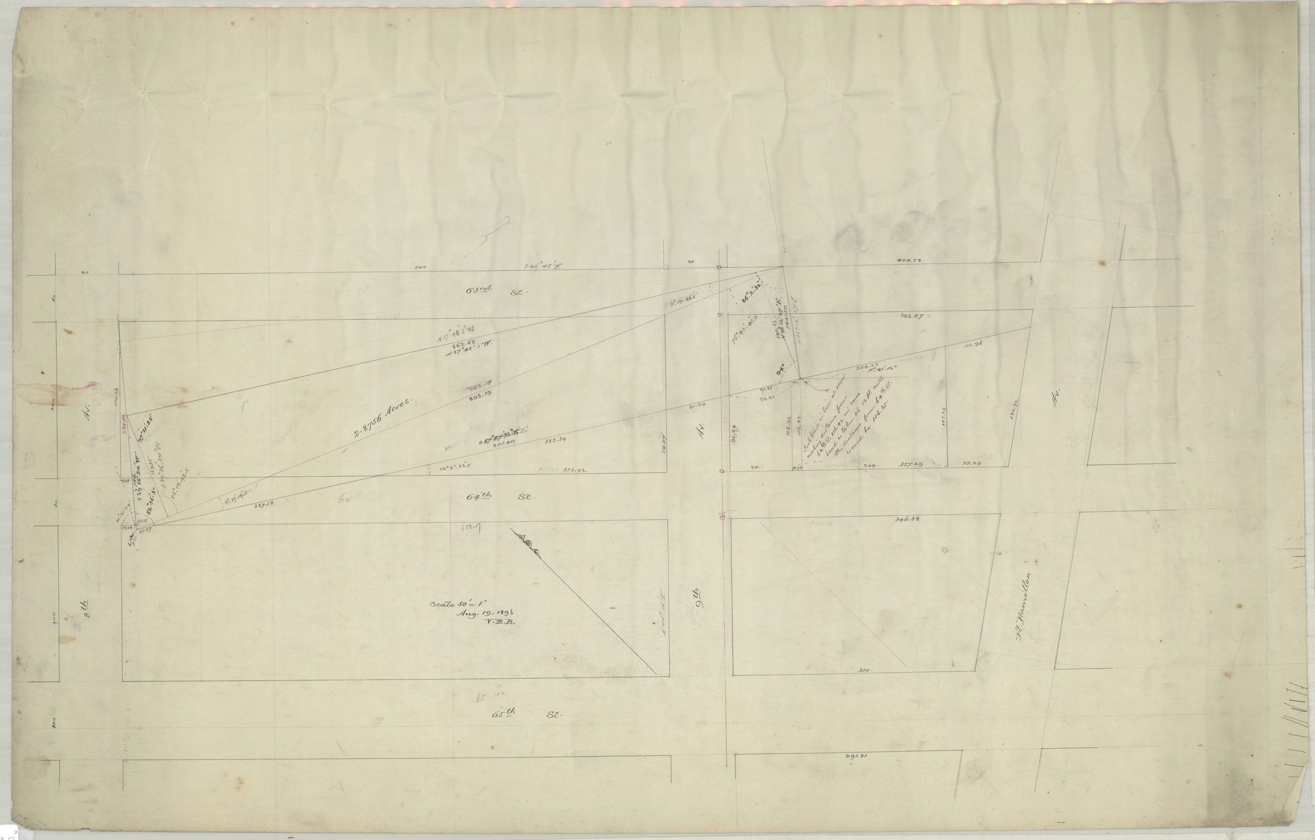
Creator
Bergen, Van Brunt,Publisher
Brooklyn Historical SocietyCitation
[Map of area bounded by 8th Ave., 65th St., Fort Hamilton Ave., and 63rd St.]: V.B.B. [Van Brunt Bergen]; August 19, 1893, Map Collection, Bergen-1893.Fl; Brooklyn Historical Society.Scale
Scale [1:600] 1 in to 50Loading zoom image...