[Map of area bounded by Bay 49th St., W. 28th St., Neptune Ave. and W. 18th St.]. [18??]
Map No. B P-[18--?]k.Fl
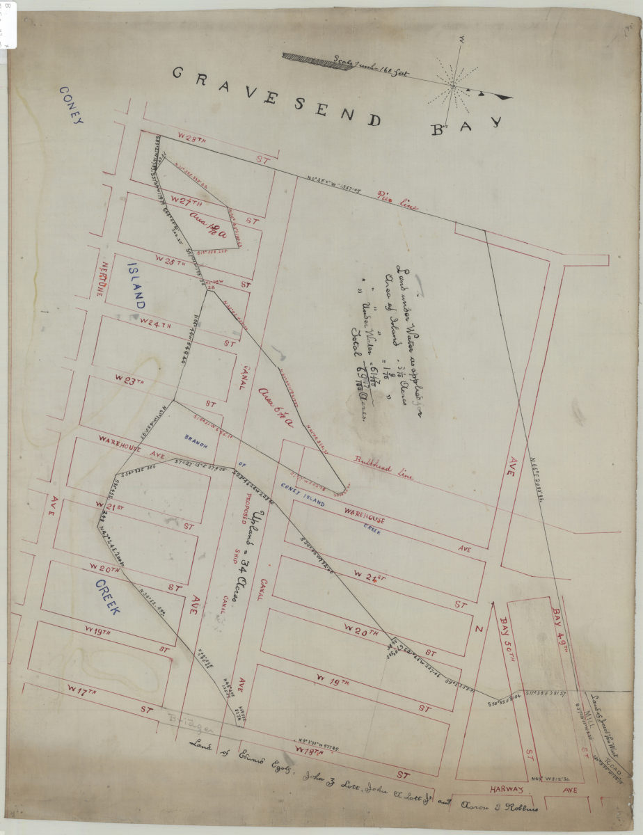
Cadastral map covering area in modern-day Coney Island. Shows property (including acreages and land under water), names of landowners, bulkhead and pier lines, Gravesend Bay, and a proposed ship canal. Title devised by cataloger.
Subjects
Places
Map area shown
Relation
Full catalog recordSize
47 × 61 cmDownload
Low Resolution Image
Creator
Publisher
Brooklyn Historical SocietyCitation
[Map of area bounded by Bay 49th St., W. 28th St., Neptune Ave. and W. 18th St.].; [18??], Map Collection, B P-[18--?]k.Fl; Brooklyn Historical Society.Scale
Scale not givenLoading zoom image...