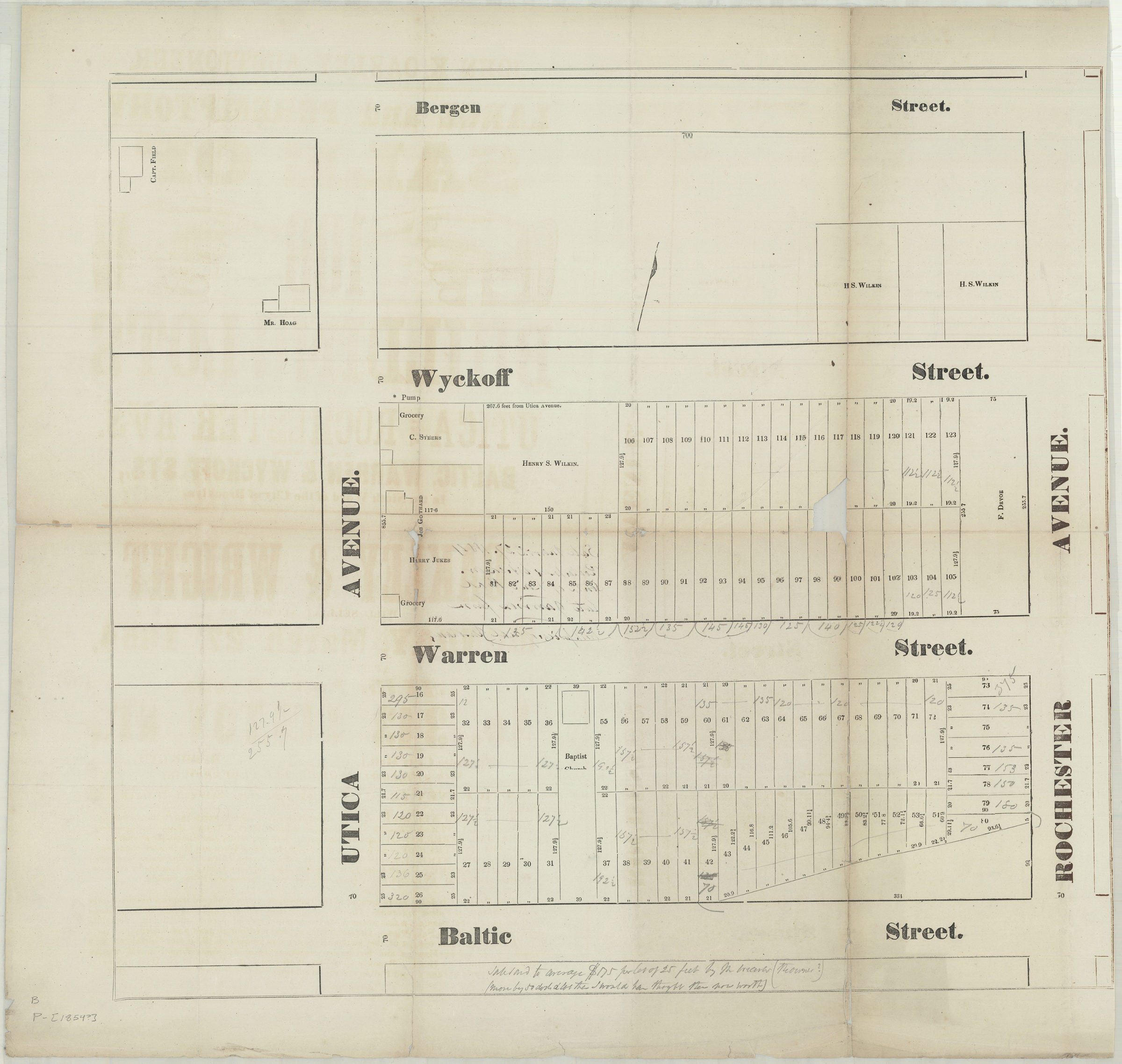
[Map of area bounded by Bergen St., Utica Ave., Baltic St. and Rochester Ave.]. [1854]
Map No. B P-[1854?].Fl
Cadastral map covering area in modern-day Bedford-Stuyvesant (formerly Weeksville). Shows property (including lot numbers, dimensions, and buildings), names of landowners, businesses, and a Baptist church. Title devised by cataloger. Extracted from a larger map? Oriented with north to the upper right. Date of publication conjectured from annotations on verso. BHS copy annotated in ink and gray pencil.
Subjects
Places
Map area shown
Genre
Cadastral mapsRelation
Full catalog recordSize
54 × 58 cmDownload
Low Resolution Image
Creator
Publisher
Brooklyn Historical SocietyCitation
[Map of area bounded by Bergen St., Utica Ave., Baltic St. and Rochester Ave.].; [1854], Map Collection, B P-[1854?].Fl; Brooklyn Historical Society.Scale
Scale not givenLoading zoom image... 