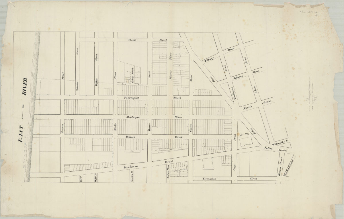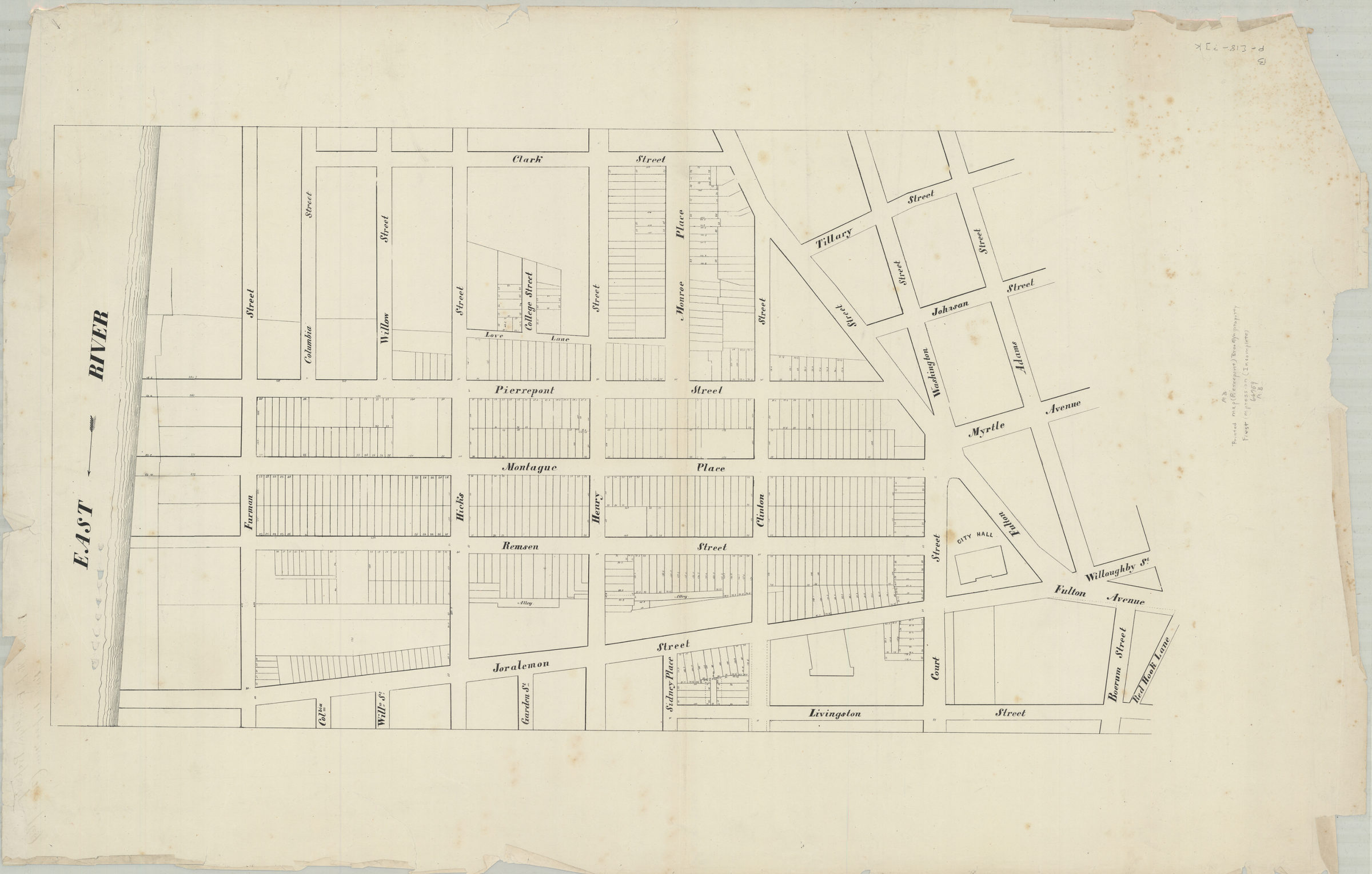
[Map of area bounded by Clark St., Adams St., Livingston St., and the East River] [18??]
Map No. B P-[18--?].Fl.Folio
Cadastral map covering area in modern-day Brooklyn Heights and Downtown Brooklyn. Shows property (including lot measurements). Title devised by cataloger. Oriented with north toward the bottom.
Subjects
Places
Map area shown
Genre
Cadastral mapsRelation
Full catalog recordSize
62 × 96 cmDownload
Low Resolution Image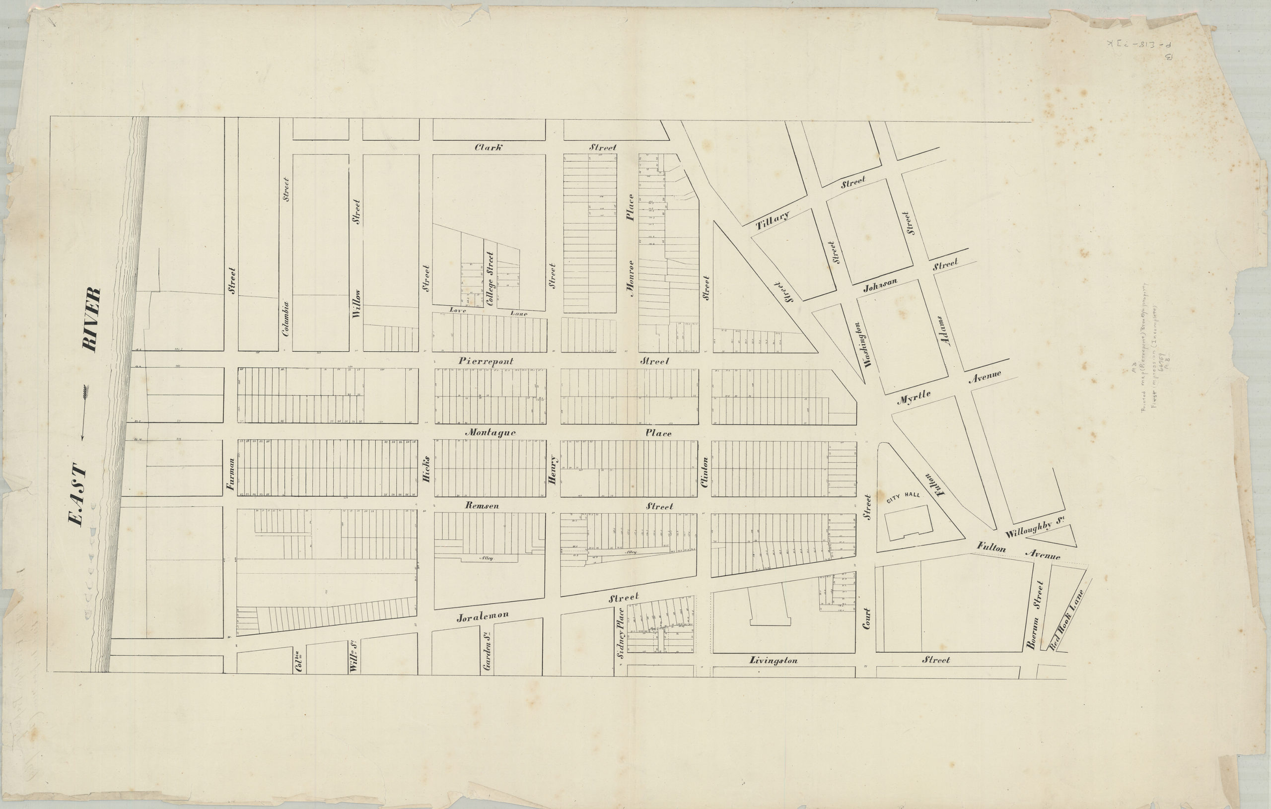
Creator
Publisher
Brooklyn Historical SocietyCitation
[Map of area bounded by Clark St., Adams St., Livingston St., and the East River]; [18??], Map Collection, B P-[18--?].Fl.Folio; Brooklyn Historical Society.Scale
Scale not givenLoading zoom image...