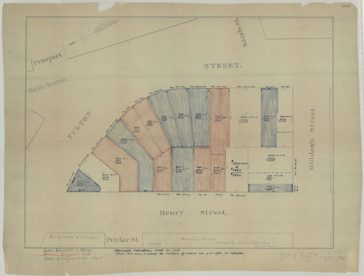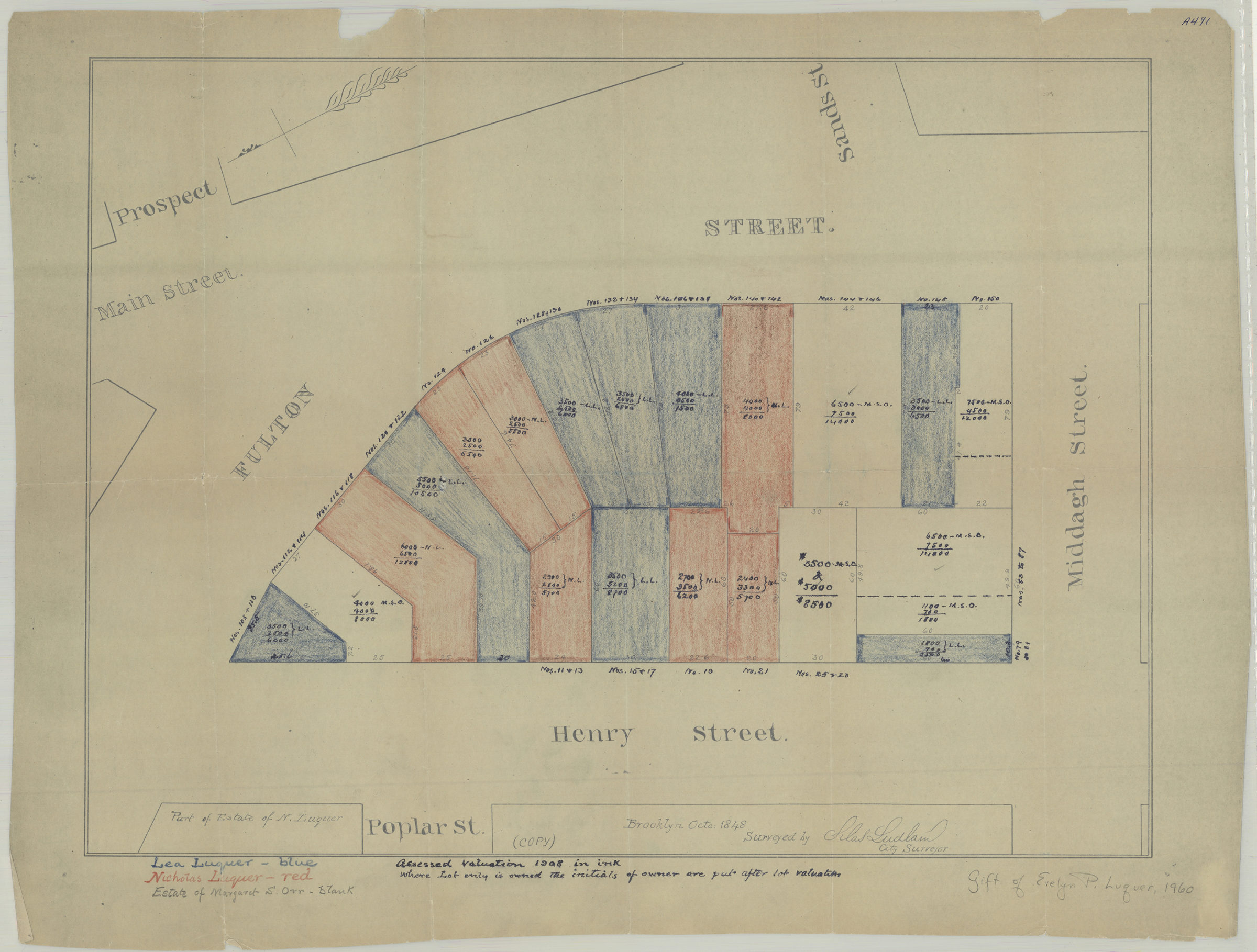
[Map of area bounded by Fulton St., Henry St., and Middagh St.]: surveyed by Silas Ludlam, city surveyor [19??]
Map No. Luquer-1848 (19--?).Fl;Luquer-1848 (19--?).Fl c.2
Cadastral map covering area in modern-day Brooklyn Heights. Annotated to show property of Lea Luquer, Nicholas Luquer, and the estate of Margaret S. Orr. Title devised by cataloger. Reproduction of an 1848 manuscript map. Oriented with north to the lower left. Includes notes. BHS has 2 copies c.2 is uncolored but annotated in gray pencil.
Map area shown
Genre
Cadastral mapsRelation
Full catalog recordSize
39 × 52 cmDownload
Low Resolution Image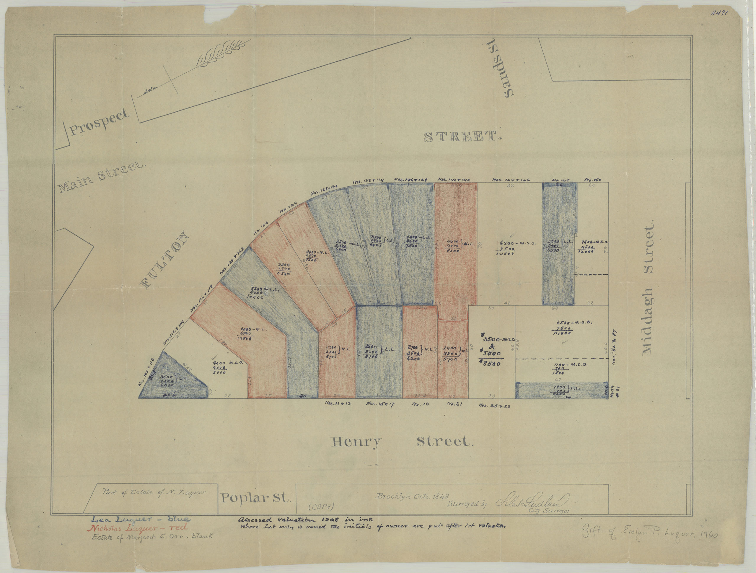
Creator
Ludlam, Silas,Publisher
Brooklyn Historical SocietyCitation
[Map of area bounded by Fulton St., Henry St., and Middagh St.]: surveyed by Silas Ludlam, city surveyor; [19??], Map Collection, Luquer-1848 (19--?).Fl;Luquer-1848 (19--?).Fl c.2; Brooklyn Historical Society.Scale
Scale not givenLoading zoom image...