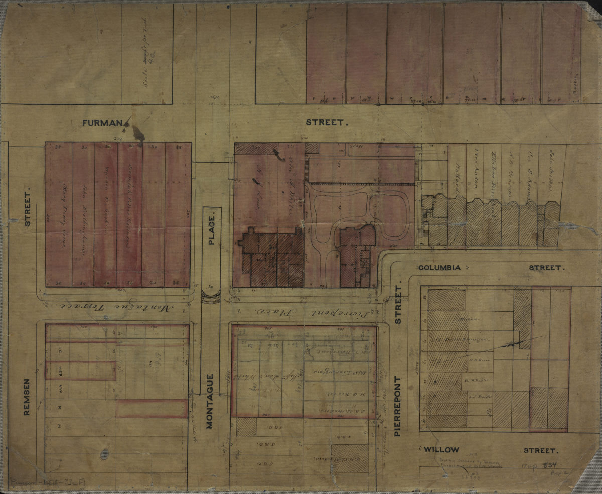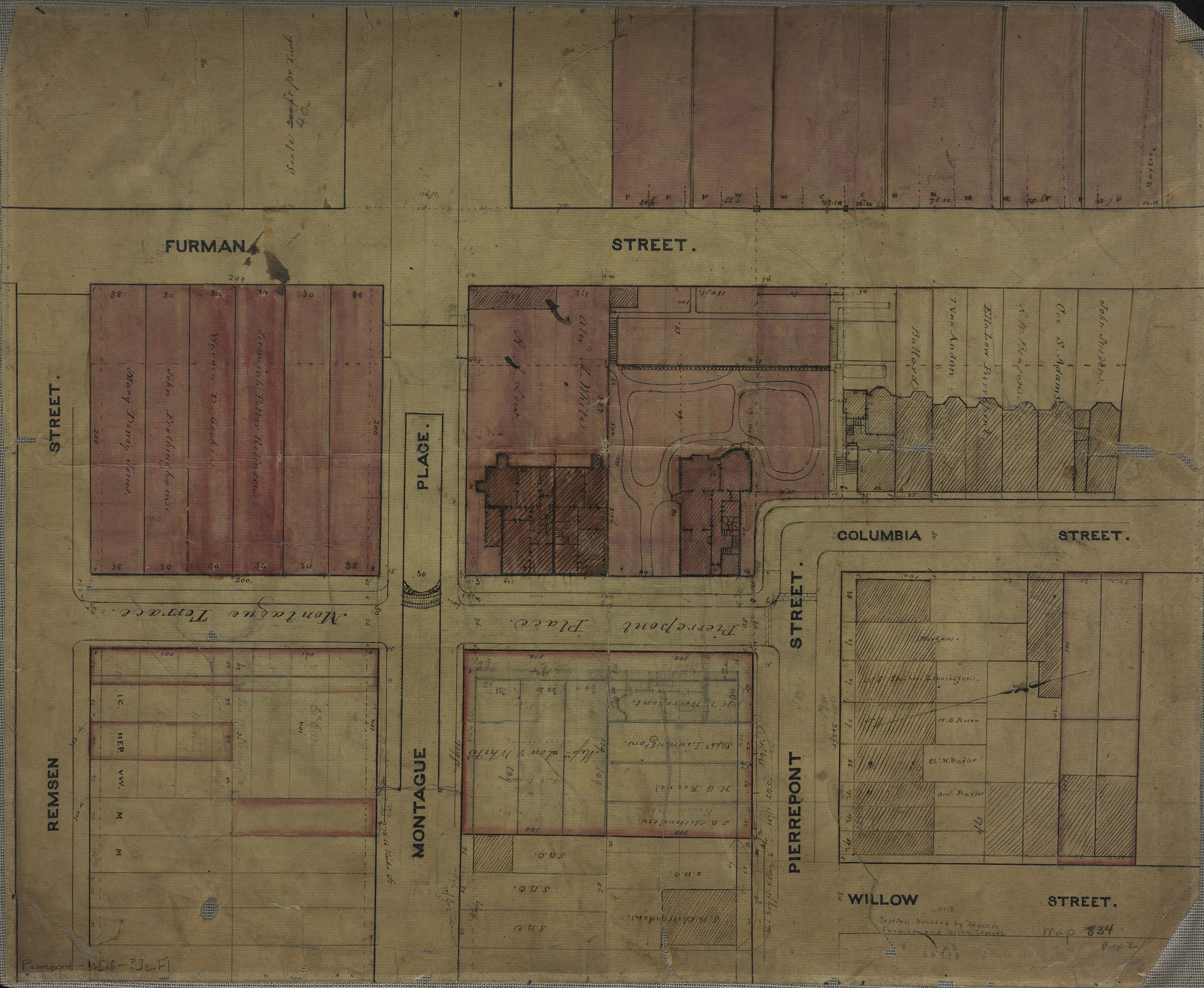
[Map of area bounded by Furman St., Remsen St., and Willow St.]. [18??]
Map No. Pierrepont-[18--?]e.Fl
Cadastral map covering area in modern-day Brooklyn Heights. Shows property (including lots and dimensions), and names of landowners. Also shows the Pierrepont family homes. Title devised by cataloger. Oriented with north to the upper right. Scale corrected originally “200 ft. per inch.”
Subjects
Places
Map area shown
Relation
Full catalog recordSize
43 × 53 cmDownload
Low Resolution Image
Creator
Publisher
Brooklyn Historical SocietyCitation
[Map of area bounded by Furman St., Remsen St., and Willow St.].; [18??], Map Collection, Pierrepont-[18--?]e.Fl; Brooklyn Historical Society.Scale
Scale [1:480] 1 in to 40Loading zoom image...