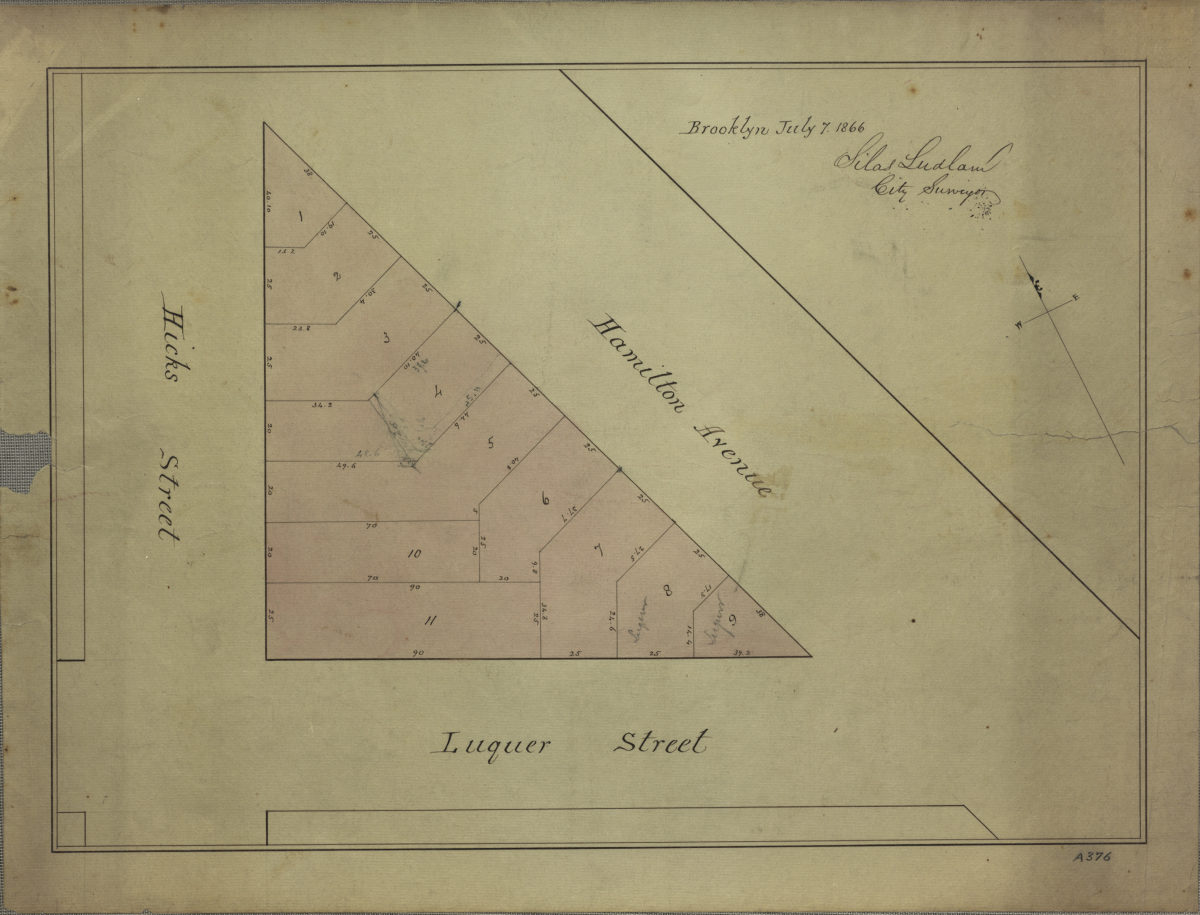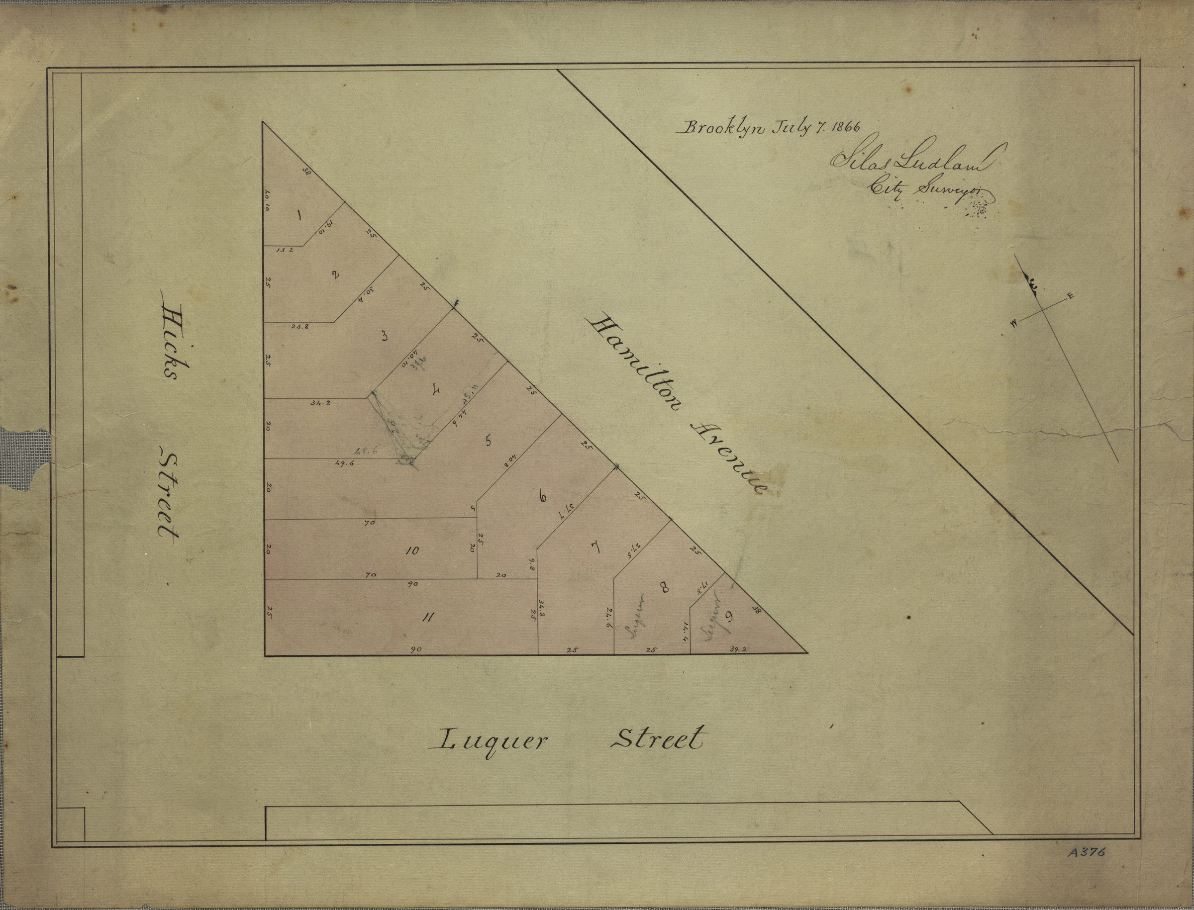
[Map of area bounded by Hicks St., Luquer St., and Hamilton Ave.]: surveyed by Silas Ludlam, city surveyor July 7, 1866
Map No. B P-1866.Fl
Cadastral map covering area in modern-day Carroll Gardens. Shows property (including lot numbers and dimensions), and names of landowners. Title devised by cataloger. Oriented with north to the upper left.
Map area shown
Relation
Full catalog recordSize
32 × 45 cmDownload
Low Resolution Image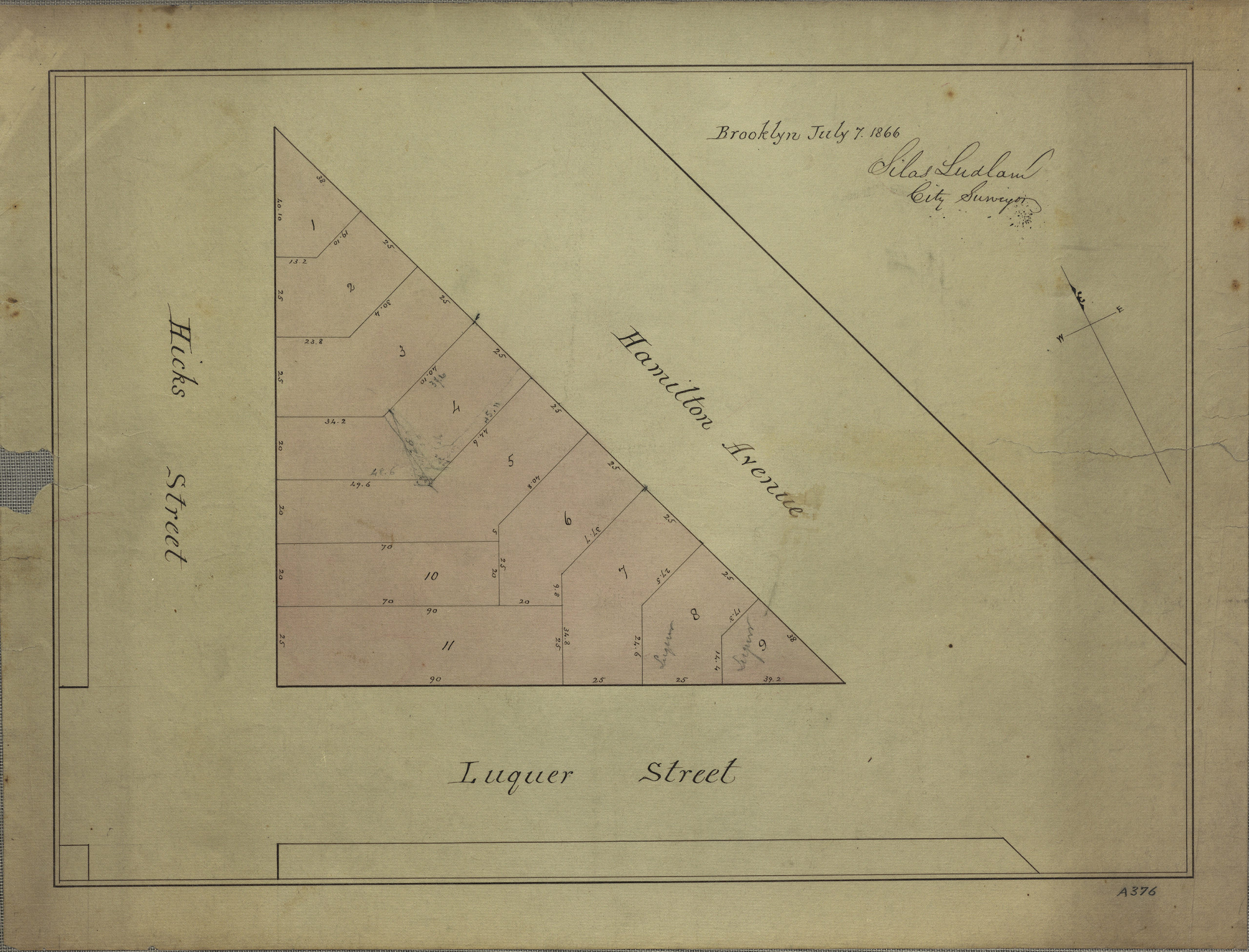
Creator
Ludlam, Silas,Publisher
Brooklyn Historical SocietyCitation
[Map of area bounded by Hicks St., Luquer St., and Hamilton Ave.]: surveyed by Silas Ludlam, city surveyor; July 7, 1866, Map Collection, B P-1866.Fl; Brooklyn Historical Society.Scale
Scale not givenLoading zoom image...