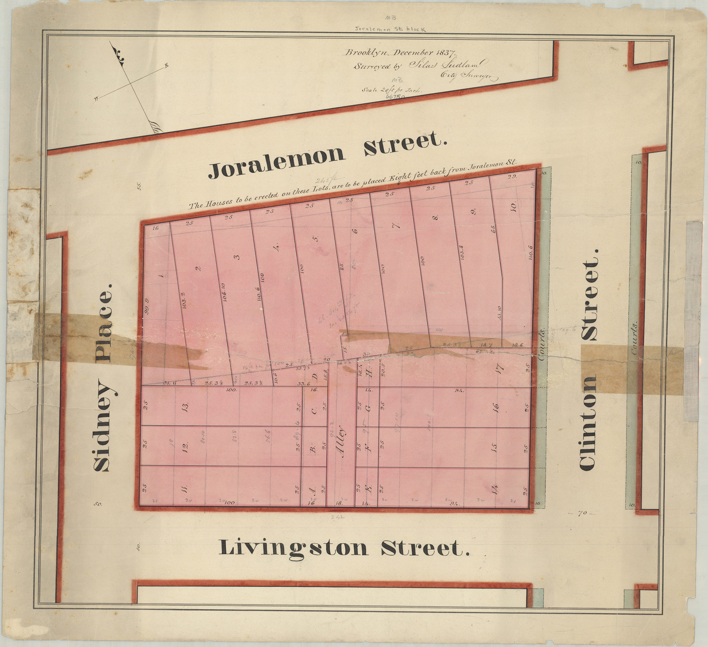
[Map of area bounded by Joralemon St., Clinton St., Livingston St., and Sidney Pl.]: surveyed by Silas Ludlam, city surveyor December 1837
Map No. B P-1837.Fl
Cadastral map covering area in modern-day Brooklyn Heights. Shows property (including lot numbers and dimensions). Title devised by cataloger. Oriented with north to the upper left. Watermark: J. Whatman, Turkey Mill … [text illegible].
Map area shown
Relation
Full catalog recordSize
45 × 49 cmDownload
Low Resolution Image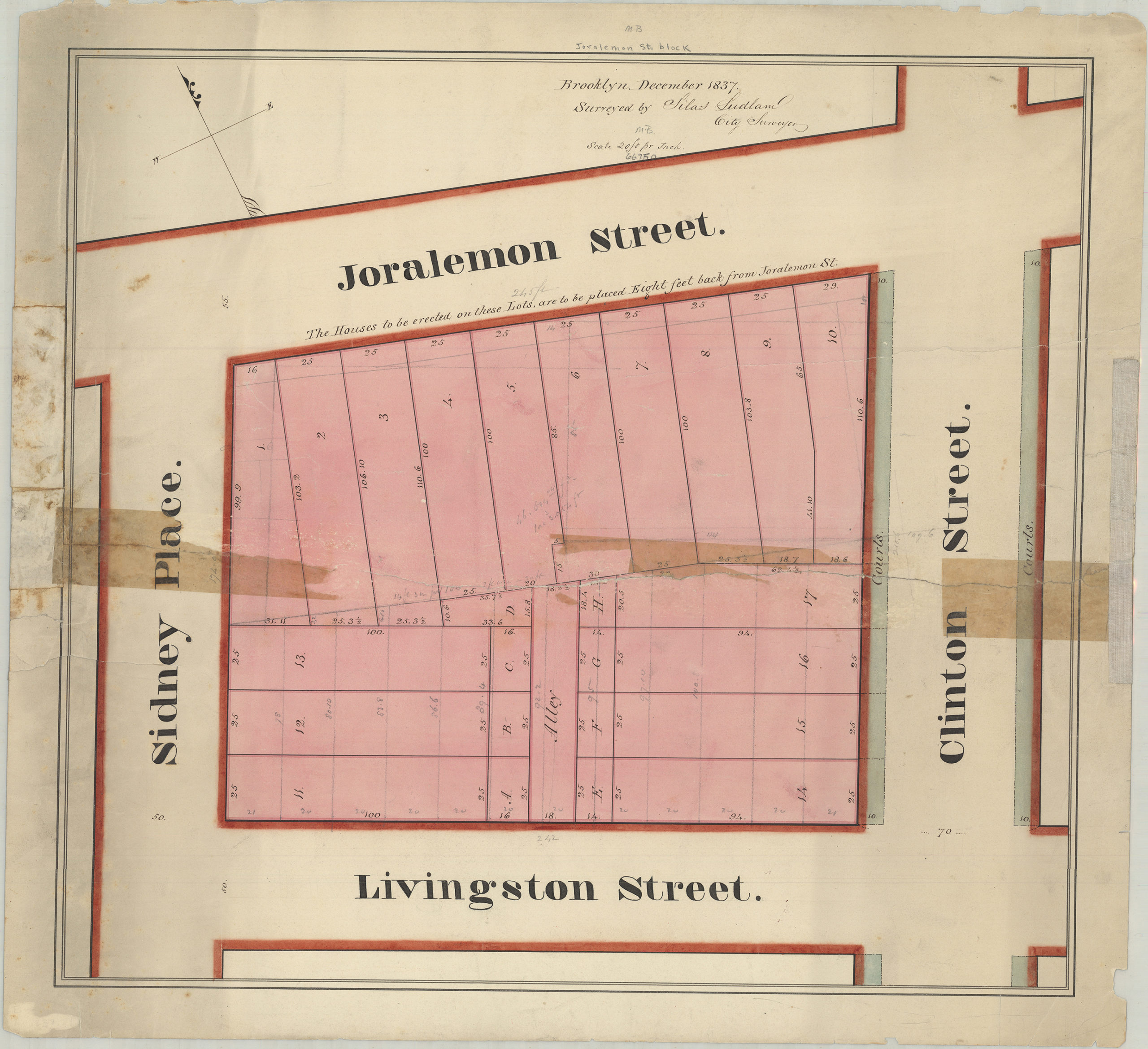
Creator
Ludlam, Silas,Publisher
Brooklyn Historical SocietyCitation
[Map of area bounded by Joralemon St., Clinton St., Livingston St., and Sidney Pl.]: surveyed by Silas Ludlam, city surveyor; December 1837, Map Collection, B P-1837.Fl; Brooklyn Historical Society.Scale
Scale [1:240] 1 in to 20Loading zoom image... 