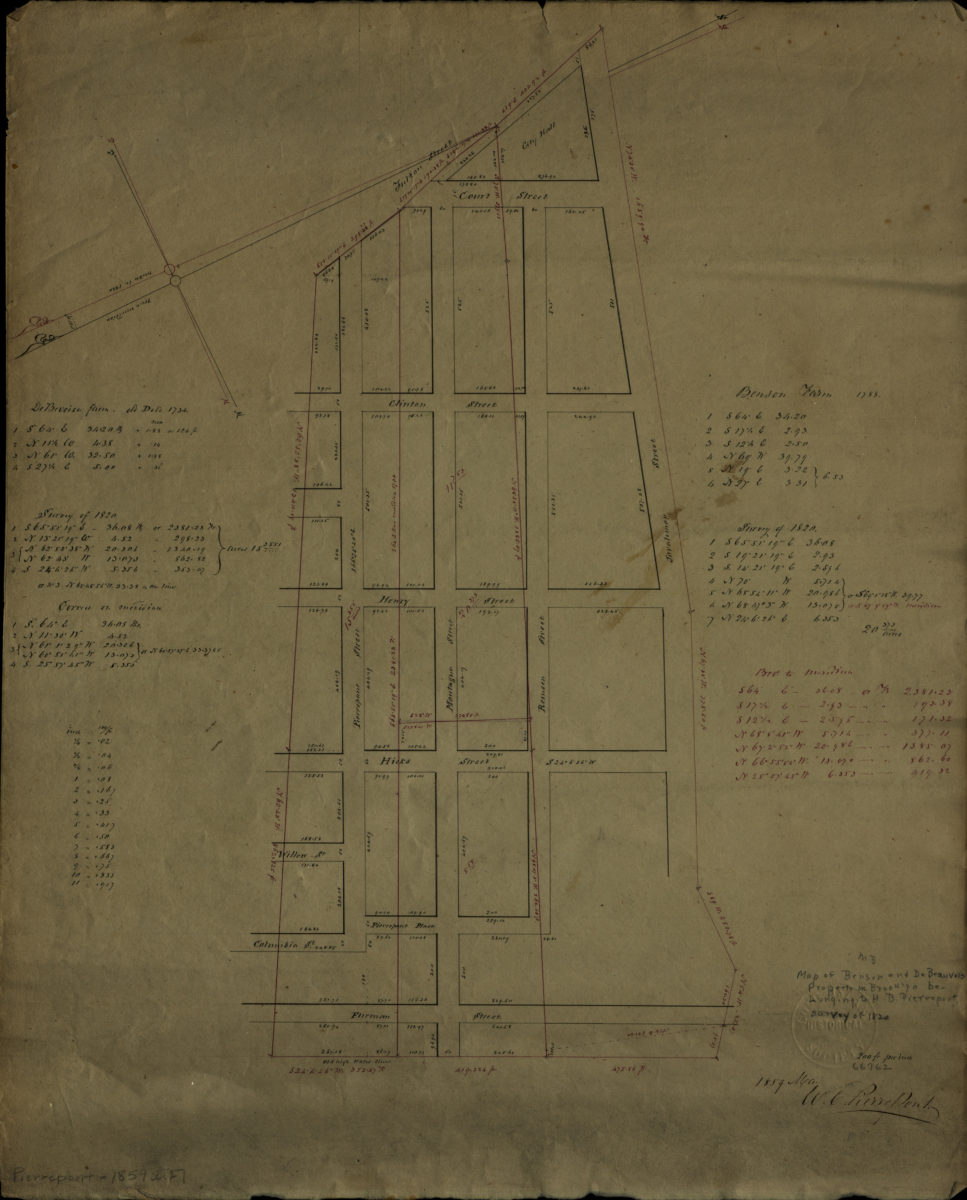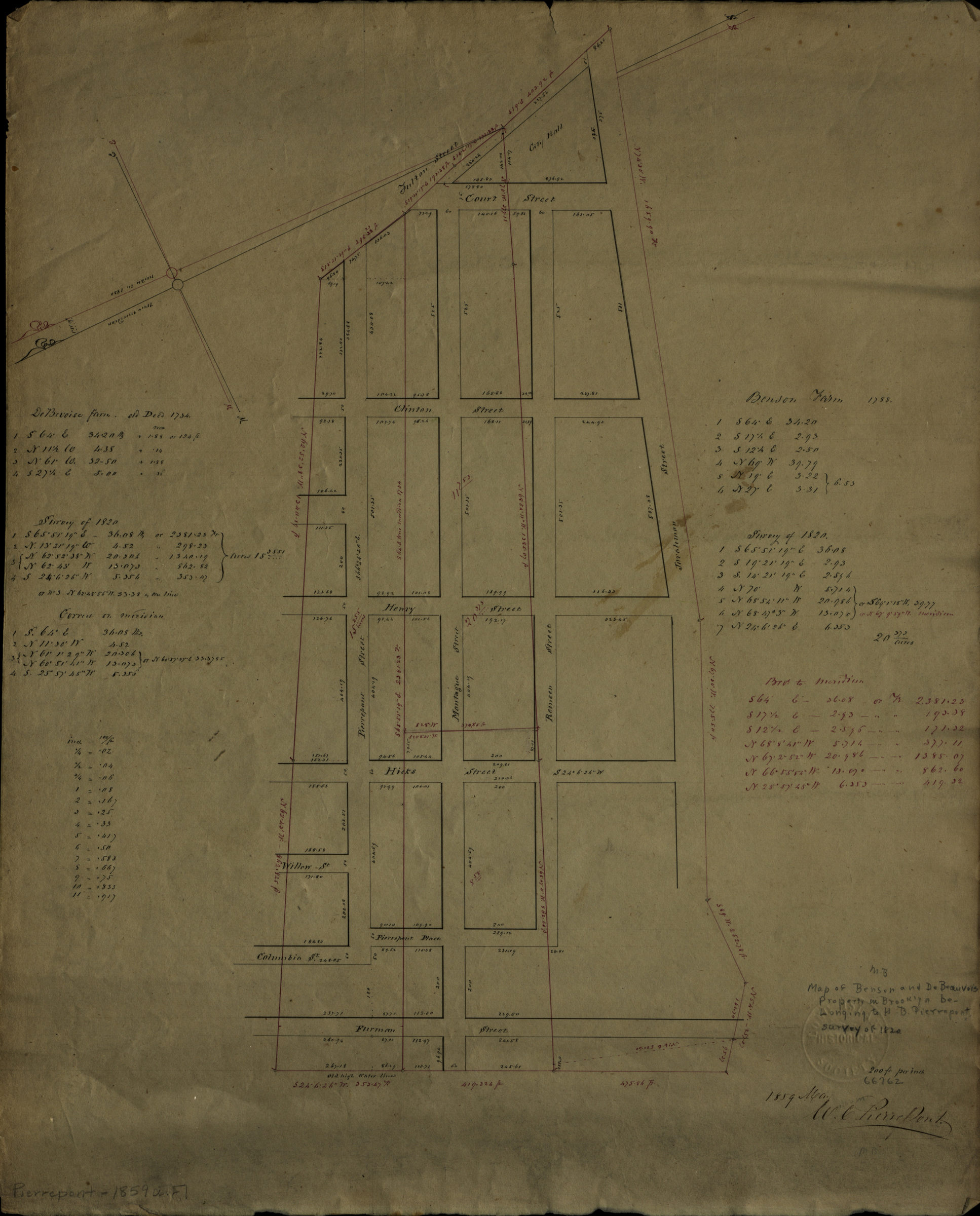
[Map of area bounded by Joralemon St., Fulton St., Pierrepont St., and Furman St.]: W.C. Pierrepont May 1859
Map No. Pierrepont-1859a.Fl
Cadastral map covering area in modern-day Brooklyn Heights. Shows farms of the Benson and DeBevoise families. Title devised by cataloger. Based on an 1820 survey. Oriented with north to the lower left. Includes measurements and notes.
Map area shown
Relation
Full catalog recordSize
43 × 35 cmDownload
Low Resolution Image
Creator
Pierrepont, W. C.,Publisher
Brooklyn Historical SocietyCitation
[Map of area bounded by Joralemon St., Fulton St., Pierrepont St., and Furman St.]: W.C. Pierrepont; May 1859, Map Collection, Pierrepont-1859a.Fl; Brooklyn Historical Society.Scale
Scale [1:2,400] 1 in to 2Loading zoom image...