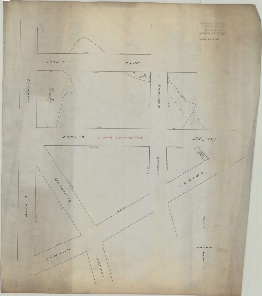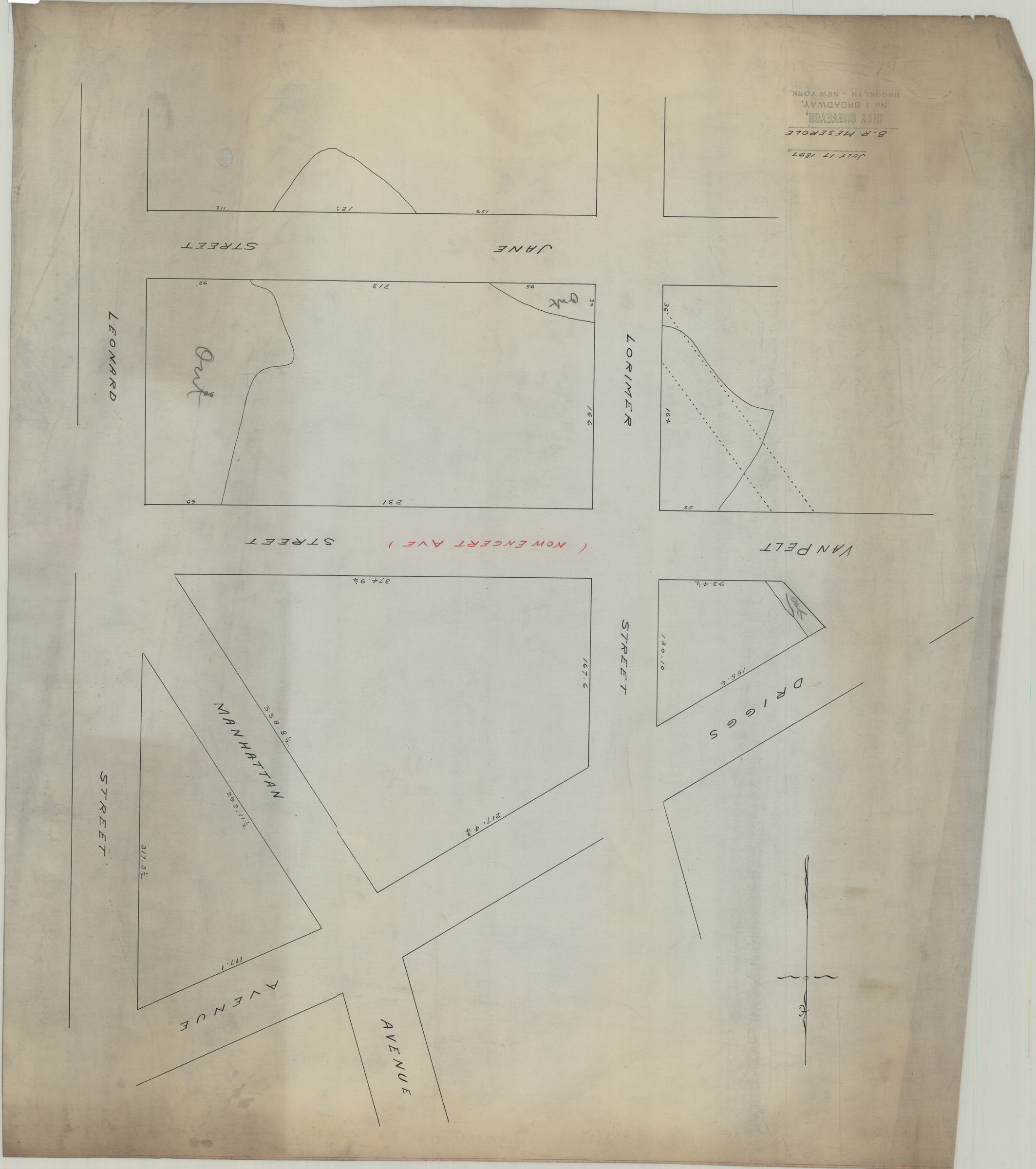
[Map of area bounded by Lorimer St., Jane St., Leonard St., and Driggs Ave.]: B.R. Meserole July 17, 1897
Map No. B A-1897a.Fl
Survey map covering area in modern-day Greenpoint and Williamsburg, on the site of what is now McCarren Park. Title devised by cataloger. Includes measurements.
Subjects
Places
Map area shown
Genre
Manuscript mapsRelation
Full catalog recordSize
65 × 58 cmDownload
Low Resolution Image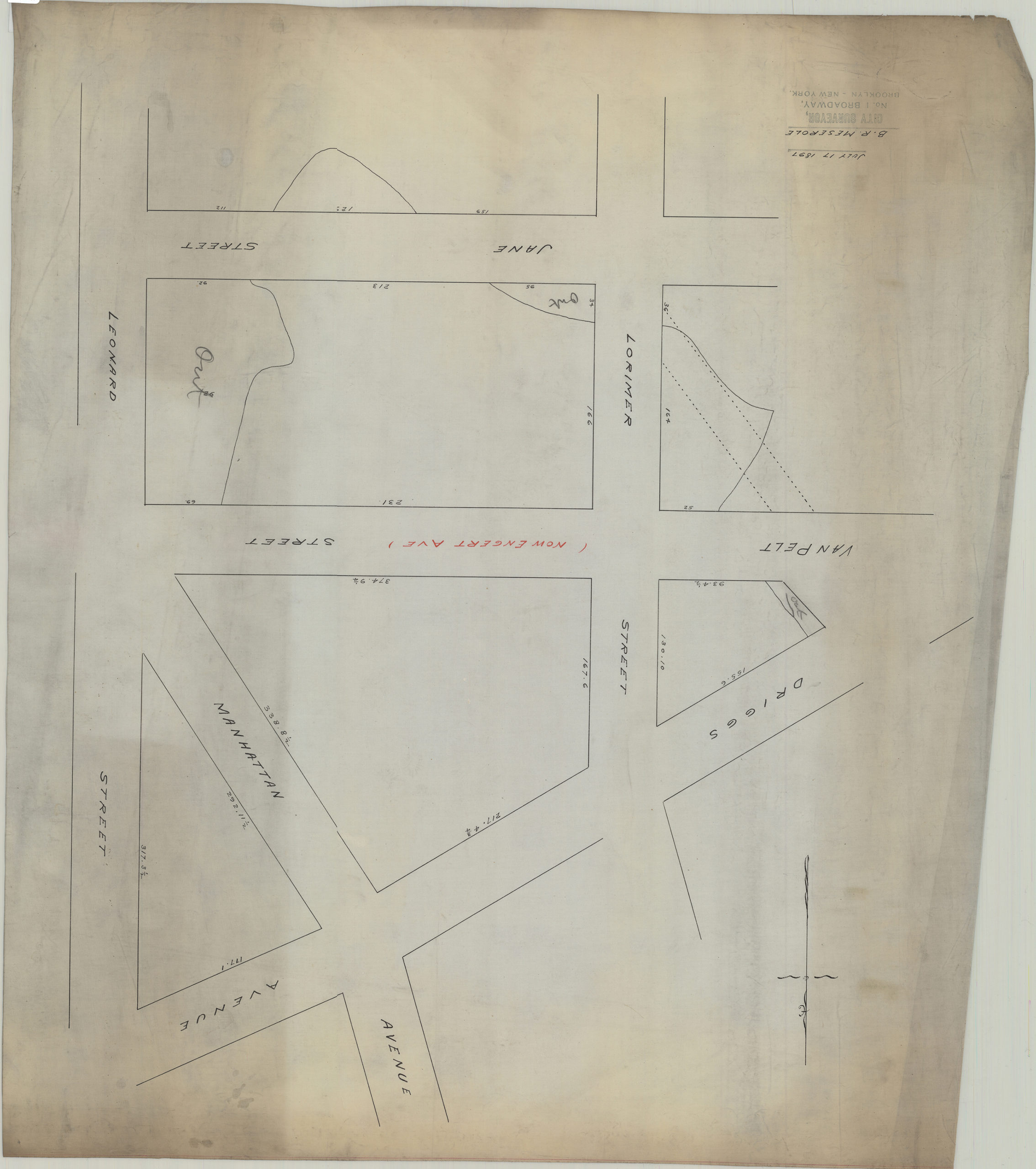
Creator
Meserole, B. R.,Publisher
Brooklyn Historical SocietyCitation
[Map of area bounded by Lorimer St., Jane St., Leonard St., and Driggs Ave.]: B.R. Meserole; July 17, 1897, Map Collection, B A-1897a.Fl; Brooklyn Historical Society.Scale
Scale not givenLoading zoom image...